Category:Easton, Suffolk
Jump to navigation
Jump to search
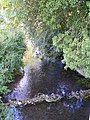
English: The former estate village of Easton in England is situated on the River Deben around three miles (5 km) south of Framlingham. The stately home, which was once the seat of the Duke of Hamilton, was demolished in the early part of the twentieth century. Easton is also the home of Easton Farm Park, a farming museum with a selection of rare breeds and other countryside related activities.
village and civil parish in Suffolk, UK  | |||||
| Upload media | |||||
| Instance of | |||||
|---|---|---|---|---|---|
| Location |
| ||||
| Population |
| ||||
| Different from | |||||
 | |||||
Subcategories
This category has the following 5 subcategories, out of 5 total.
A
E
- Easton, Suffolk "Wavy Wall" (10 F)
M
- The Maples, Easton (2 F)
V
- Easton Village Sign, Suffolk (7 F)
W
- White Horse, Easton, Suffolk (8 F)
Media in category "Easton, Suffolk"
The following 138 files are in this category, out of 138 total.
-

-
 A wet August day in Easton - geograph.org.uk - 2014659.jpg 640 × 480; 78 KB
-
 A wet village green at Easton - geograph.org.uk - 2014667.jpg 640 × 480; 72 KB
-
 Ash Grove, Easton - geograph.org.uk - 2766709.jpg 640 × 480; 226 KB
-
 Barn at Benries Farm - geograph.org.uk - 2591509.jpg 3,072 × 2,304; 1.37 MB
-
 Barn at Benries Farm - geograph.org.uk - 2591510.jpg 3,072 × 2,304; 1.34 MB
-
 Barthorp's Covert - geograph.org.uk - 249888.jpg 1,600 × 1,200; 301 KB
-
 Bentries Farm sign - geograph.org.uk - 2591504.jpg 3,072 × 2,304; 1.56 MB
-
 Bentries Farmhouse ^ Entrance - geograph.org.uk - 2591493.jpg 3,072 × 2,304; 1.31 MB
-
 Borretts Farm Lane - geograph.org.uk - 5377818.jpg 1,500 × 1,102; 411 KB
-
 Bridge on the road the Letheringham - geograph.org.uk - 2582139.jpg 3,072 × 2,304; 1.31 MB
-
 Building Plot For Sale - geograph.org.uk - 3908840.jpg 1,024 × 768; 258 KB
-
 Cemetery Lane - geograph.org.uk - 2591571.jpg 2,304 × 3,072; 1.51 MB
-
 Cemetery Lane - geograph.org.uk - 2591573.jpg 2,304 × 3,072; 1.39 MB
-
 Cemetery Lane, Easton - geograph.org.uk - 2591580.jpg 2,304 × 3,072; 1.46 MB
-
 Cooks Hill crosses the River Deben - geograph.org.uk - 3598456.jpg 3,253 × 2,409; 1.27 MB
-
 Cottage On Bend - geograph.org.uk - 3908854.jpg 1,024 × 768; 272 KB
-
 Cottages by Pound Corner, Easton - geograph.org.uk - 2766671.jpg 640 × 480; 221 KB
-
 Country lane to Kettleburgh - geograph.org.uk - 2766764.jpg 640 × 480; 170 KB
-
 Country Road - geograph.org.uk - 1756776.jpg 1,600 × 1,200; 653 KB
-
 Crinkle Crankle Wall - geograph.org.uk - 3908824.jpg 1,024 × 768; 298 KB
-

-

-
 Dark Lane - geograph.org.uk - 1960893.jpg 2,304 × 3,072; 1.46 MB
-
 Deer warning on Hacheston Road - geograph.org.uk - 4618186.jpg 1,240 × 930; 543 KB
-
 Development works at Home Farm, Glevering - geograph.org.uk - 6168392.jpg 6,000 × 4,000; 7.06 MB
-
 Easton Bowls Club ^ Bowling Green - geograph.org.uk - 2591548.jpg 3,072 × 2,304; 1.28 MB
-
 Easton Cemetery - geograph.org.uk - 2591566.jpg 3,072 × 2,304; 1.4 MB
-
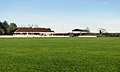
 Easton Cricket Club Match - geograph.org.uk - 2591483.jpg 3,072 × 2,304; 1.26 MB
-
 Easton Cricket Club pavilion - geograph.org.uk - 2766722.jpg 640 × 385; 123 KB
-
 Easton Farm Park - geograph.org.uk - 5373658.jpg 640 × 480; 245 KB
-
 Easton Farm Park - geograph.org.uk - 5373669.jpg 640 × 480; 251 KB
-
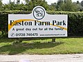 Easton Farm Park sign - geograph.org.uk - 2588225.jpg 3,072 × 2,304; 1.44 MB
-

-
 Easton Harriers Hunt Kennels - geograph.org.uk - 2766633.jpg 640 × 480; 161 KB
-
 Easton Telephone Box - geograph.org.uk - 2353513.jpg 3,072 × 2,304; 1.51 MB
-
 Easton village sign - geograph.org.uk - 6649278.jpg 4,608 × 3,072; 5.62 MB
-
 Easton, Houses in Framlingham Road - geograph.org.uk - 6468270.jpg 6,191 × 4,127; 6.25 MB
-
 Easton, Martley Hall Stud sign - geograph.org.uk - 6468269.jpg 6,200 × 4,134; 5.47 MB
-
 Entering Easton on Framlingham Road - geograph.org.uk - 2581844.jpg 3,072 × 2,304; 1.51 MB
-
 Entrance to Easton Park Farm - geograph.org.uk - 4618181.jpg 1,240 × 930; 414 KB
-
 Farm Buildings at Bentries Farm - geograph.org.uk - 2591497.jpg 3,072 × 2,304; 1.24 MB
-
 Footbridge of the footpath to Parham ^ Easton - geograph.org.uk - 2581819.jpg 2,304 × 3,072; 1.49 MB
-
 Footpath along Bentries Belt, Easton - geograph.org.uk - 2766682.jpg 640 × 480; 241 KB
-
 Footpath junction, Easton - geograph.org.uk - 2766714.jpg 640 × 480; 175 KB
-
 Footpath past the Skouldings, Easton - geograph.org.uk - 2766779.jpg 640 × 480; 253 KB
-
 Footpath Sign - geograph.org.uk - 3908835.jpg 1,024 × 768; 290 KB
-
 Footpath to Easton past the Skouldings - geograph.org.uk - 2766775.jpg 640 × 480; 263 KB
-
 Footpath to Kettleburgh New Hall - geograph.org.uk - 2581843.jpg 3,072 × 2,304; 1.65 MB
-
 Footpath to Letheringham Mill - geograph.org.uk - 2592132.jpg 2,304 × 3,072; 1.48 MB
-
 Footpath to Low Farm ^ Easton Hall - geograph.org.uk - 2588234.jpg 3,072 × 2,304; 1.62 MB
-
 Footpath to Parham - geograph.org.uk - 2591553.jpg 2,304 × 3,072; 1.47 MB
-
 Footpath to Parham ^ Easton - geograph.org.uk - 2581818.jpg 2,304 × 3,072; 1.5 MB
-
 Footpath to Parham ^ Easton - geograph.org.uk - 2581826.jpg 2,304 × 3,072; 1.36 MB
-
 Footpath to Park Wood, Easton - geograph.org.uk - 2766695.jpg 640 × 480; 201 KB
-
 Footpath to Sessions Wood, Easton - geograph.org.uk - 2766768.jpg 640 × 480; 212 KB
-
 Footpath to The Street, Easton - geograph.org.uk - 2582146.jpg 3,072 × 2,304; 1.59 MB
-
 Ford at Letheringham - geograph.org.uk - 3189271.jpg 3,872 × 2,592; 2.36 MB
-
 Framlingham Road - geograph.org.uk - 2581832.jpg 2,304 × 3,072; 1.46 MB
-
 Framlingham Road - geograph.org.uk - 2581836.jpg 2,304 × 3,072; 1.52 MB
-
 Framlingham Road - geograph.org.uk - 2581909.jpg 3,072 × 2,304; 1.52 MB
-
 Framlingham Road - geograph.org.uk - 2581926.jpg 3,072 × 2,304; 1.2 MB
-
 Framlingham Road Postbox - geograph.org.uk - 2581807.jpg 3,072 × 2,304; 1.37 MB
-
 Framlingham Road Postbox - geograph.org.uk - 2581808.jpg 2,304 × 3,072; 1.41 MB
-
 Framlingham Road Postbox - geograph.org.uk - 2581809.jpg 2,304 × 3,072; 1.49 MB
-
 Framlingham Road Postbox - geograph.org.uk - 2581822.jpg 3,072 × 2,304; 1.52 MB
-
 Framlingham Road ^ Framlingham Road Postbox - geograph.org.uk - 2581802.jpg 3,072 × 2,304; 1.64 MB
-
 Framlingham Road, Easton - geograph.org.uk - 2581855.jpg 3,072 × 2,304; 1.36 MB
-

-
 Hacheston Road, Easton - geograph.org.uk - 2591531.jpg 2,304 × 3,072; 1.35 MB
-
 Hacheston Road, Easton - geograph.org.uk - 2591535.jpg 3,072 × 2,304; 1.34 MB
-
 Hacheston Road, Easton - geograph.org.uk - 2591536.jpg 3,072 × 2,304; 1.31 MB
-
 Harriers Walk sign - geograph.org.uk - 2581862.jpg 3,072 × 2,304; 1.63 MB
-
 Harriers Walk, Easton - geograph.org.uk - 2581860.jpg 3,072 × 2,304; 1.25 MB
-
 Hatcheston Road - geograph.org.uk - 2591428.jpg 3,072 × 2,304; 1.34 MB
-
 Hatcheston Road near Verandah Cottages - geograph.org.uk - 2591434.jpg 3,072 × 2,304; 1.3 MB
-
 Hatcheston Road, Easton - geograph.org.uk - 2591439.jpg 3,072 × 2,304; 1.32 MB
-
 Hatcheston Road, Easton - geograph.org.uk - 2591533.jpg 3,072 × 2,304; 1.22 MB
-
 Hoo Road - geograph.org.uk - 2581947.jpg 3,072 × 2,304; 1.37 MB
-

-
 Mill Lane east of Low Farm - geograph.org.uk - 3598334.jpg 3,648 × 2,736; 1.13 MB
-
 Mill Lane junction with Framlingham Road - geograph.org.uk - 3599402.jpg 3,152 × 2,380; 993 KB
-
 Morris Minor, The Street, Easton, Suffolk - geograph.org.uk - 2930692.jpg 1,600 × 888; 397 KB
-
 Muddy Field Boundary - geograph.org.uk - 3911222.jpg 1,024 × 768; 224 KB
-
 Oilseed rape crop, Easton - geograph.org.uk - 2766690.jpg 640 × 480; 246 KB
-
 Old Tree - geograph.org.uk - 3908859.jpg 768 × 1,024; 216 KB
-

-
 Park Wood, Easton - geograph.org.uk - 2766711.jpg 640 × 480; 237 KB
-
 Postbox On Framlingham Road - geograph.org.uk - 3908849.jpg 1,024 × 768; 194 KB
-
 Pound Corner, Easton - geograph.org.uk - 2766663.jpg 640 × 453; 194 KB
-
 Private track into Park Wood, Easton - geograph.org.uk - 2766715.jpg 640 × 480; 283 KB
-

-
 River Deben - geograph.org.uk - 2583070.jpg 2,304 × 3,072; 1.68 MB
-
 River Deben - geograph.org.uk - 2583071.jpg 2,304 × 3,072; 1.64 MB
-
 Road sign at the Hacheston Road junction - geograph.org.uk - 2591524.jpg 2,304 × 3,072; 1.32 MB
-
 Road to Hoo ^ Letheringham - geograph.org.uk - 2581938.jpg 2,304 × 3,072; 1.36 MB
-
 Roadsign on Framlingham Road - geograph.org.uk - 2581927.jpg 2,304 × 3,072; 1.61 MB
-
 Roadsign on Hoo Road - geograph.org.uk - 2581949.jpg 2,304 × 3,072; 1.43 MB
-
 Roadsign to the Cemetery ^ Bowls Club - geograph.org.uk - 2591583.jpg 2,304 × 3,072; 1.49 MB
-
 School Lane Easton - geograph.org.uk - 2591450.jpg 2,304 × 3,072; 1.39 MB
-
 School Lane ^ Easton CC sign - geograph.org.uk - 2591447.jpg 2,304 × 3,072; 1.45 MB
-
 School Lane, Easton - geograph.org.uk - 2591458.jpg 2,304 × 3,072; 1.49 MB
-
 School Lane, Easton - geograph.org.uk - 2591466.jpg 2,304 × 3,072; 1.42 MB
-
 School Lane, Easton - geograph.org.uk - 2591514.jpg 3,072 × 2,304; 1.4 MB
-
 Sessions Wood, Easton - geograph.org.uk - 2766763.jpg 640 × 480; 215 KB
-
 Suffolk Punches - geograph.org.uk - 2713487.jpg 4,272 × 2,848; 4.37 MB
-
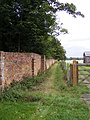
 The crinkle-crankle wall of Easton - geograph.org.uk - 5373688.jpg 640 × 480; 293 KB
-
 The crinkle-crankle wall of Easton - geograph.org.uk - 5373695.jpg 640 × 480; 343 KB
-
 The Entrance to Easton Cricket Club - geograph.org.uk - 2591474.jpg 3,072 × 2,304; 1.36 MB
-
 The Entrance to Easton Farm Park - geograph.org.uk - 2588224.jpg 3,072 × 2,304; 1.34 MB
-
 The Old Dairy, Easton Farm Park - geograph.org.uk - 2552807.jpg 3,264 × 2,448; 2.15 MB
-
 The Round House - geograph.org.uk - 2262605.jpg 700 × 525; 224 KB
-
 The Skouldings, Easton - geograph.org.uk - 2766773.jpg 640 × 480; 260 KB
-
 The Street junction with Cooks Hill - geograph.org.uk - 3598354.jpg 3,265 × 2,499; 1.09 MB
-
 The Street Postbox - geograph.org.uk - 2353507.jpg 2,304 × 3,072; 1.46 MB
-
 The Street ^ The Street Postbox - geograph.org.uk - 2353504.jpg 3,072 × 2,304; 1.44 MB
-
 The Street ^ The Street Postbox - geograph.org.uk - 2353509.jpg 3,072 × 2,304; 1.52 MB
-
 The Street, Easton - geograph.org.uk - 2591442.jpg 3,072 × 2,304; 1.39 MB
-
 The Street, Easton - geograph.org.uk - 2591517.jpg 3,072 × 2,304; 1.24 MB
-
 The Street, Easton - geograph.org.uk - 2591526.jpg 3,072 × 2,304; 1.35 MB
-
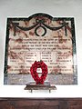
 The War Memorial at All Saints church Easton, Suffolk - geograph.org.uk - 6571948.jpg 3,456 × 2,592; 3.66 MB
-
 Track to the Church - geograph.org.uk - 2591549.jpg 2,304 × 3,072; 1.63 MB
-
 Training Nets at Easton Cricket Club - geograph.org.uk - 2591482.jpg 3,072 × 2,304; 1.5 MB
-
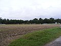
 Undulating fields west of Easton - geograph.org.uk - 2766769.jpg 640 × 480; 216 KB
-
 View towards the Skouldings, Easton - geograph.org.uk - 2766758.jpg 640 × 480; 203 KB
-
 Vincent Cross, Maverick American Festival, 2019.jpg 1,654 × 2,311; 981 KB
-
 War Memorial - geograph.org.uk - 3908790.jpg 768 × 1,024; 183 KB
-
 Welcome to the Barmy Barn^ - geograph.org.uk - 5373651.jpg 640 × 480; 259 KB
-
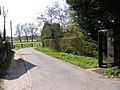
 Dark Lane, close to Easton Park - geograph.org.uk - 331747.jpg 640 × 480; 102 KB
-
 Easton, Suffolk - geograph.org.uk - 43625.jpg 640 × 480; 110 KB
-
 Farmhouse at Grove Farm - geograph.org.uk - 331736.jpg 640 × 423; 60 KB
-
 Gateway to Martley Hall - geograph.org.uk - 289710.jpg 640 × 479; 141 KB
-
 Great Wood - geograph.org.uk - 450550.jpg 640 × 480; 98 KB
-
 Green barley - geograph.org.uk - 450542.jpg 640 × 480; 82 KB
-
 Hidden pond - geograph.org.uk - 450545.jpg 640 × 480; 148 KB
-
 House opposite Martley Hall - geograph.org.uk - 289711.jpg 640 × 479; 151 KB
-
 Old oak - geograph.org.uk - 450551.jpg 640 × 480; 97 KB
-
 Woodland and wheat - geograph.org.uk - 450548.jpg 640 × 480; 93 KB


