Category:Eastburn, East Riding of Yorkshire
Jump to navigation
Jump to search
English: Eastburn is a hamlet in the East Riding of Yorkshire, England, it forms part of the civil parish of Kirkburn. It is situated in the Yorkshire Wolds on the A164 road, approximately 2.5 miles (4 km) south west of Driffield town centre and 3 miles (4.8 km) north west of the village of Hutton Cranswick.
village in United Kingdom | |||||
| Upload media | |||||
| Instance of | |||||
|---|---|---|---|---|---|
| Location | Kirkburn, East Riding of Yorkshire, Yorkshire and the Humber, England | ||||
 | |||||
Media in category "Eastburn, East Riding of Yorkshire"
The following 9 files are in this category, out of 9 total.
-
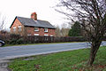 A cottage near Eastburn.jpg 640 × 427; 382 KB
-
 A driveway to Eastburn Farm - geograph.org.uk - 1052839.jpg 640 × 427; 524 KB
-
 A614 towards Market Weighton - geograph.org.uk - 1351268.jpg 640 × 480; 77 KB
-
 Farmland East of Eastburn - geograph.org.uk - 1351274.jpg 640 × 480; 103 KB
-
 Field Boundary near Eastburn.jpg 640 × 480; 103 KB
-
 Keep Out - geograph.org.uk - 454337.jpg 640 × 480; 83 KB
-
 Road^ to Elmswell - geograph.org.uk - 110620.jpg 640 × 480; 202 KB
-
 Site of village of Eastburn.jpg 640 × 480; 155 KB
-
 Toilets - geograph.org.uk - 454298.jpg 640 × 480; 109 KB


