Category:East and West Buckland
Jump to navigation
Jump to search
civil parish in Devon, UK | |||||
| Upload media | |||||
| Instance of |
| ||||
|---|---|---|---|---|---|
| Location | North Devon, Devon, South West England, England | ||||
| Population |
| ||||
 | |||||
Subcategories
This category has the following 3 subcategories, out of 3 total.
Media in category "East and West Buckland"
The following 200 files are in this category, out of 262 total.
(previous page) (next page)-
 A bridge near Clockhay Wood as seen from downstream - geograph.org.uk - 3302562.jpg 1,600 × 1,063; 741 KB
-
 A bridge on a stream near Clockhay wood - geograph.org.uk - 3301095.jpg 1,600 × 1,063; 764 KB
-

-

-
 A bridge over Venn Stream on Yeoland Lane - geograph.org.uk - 3267777.jpg 1,600 × 1,063; 708 KB
-
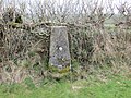 A hedge-side Triangulation Pillar on Brayley Hill - geograph.org.uk - 4740053.jpg 4,000 × 3,000; 5.03 MB
-
 A hen near Home Barton Farm, West Buckland - geograph.org.uk - 3334169.jpg 4,288 × 2,848; 4.05 MB
-
 A view down Venn Stream from a bridge on Yeoland Lane - geograph.org.uk - 3267771.jpg 1,600 × 1,063; 717 KB
-
 A361 east bound - geograph.org.uk - 3335907.jpg 640 × 480; 49 KB
-
 A361 eastbound - geograph.org.uk - 3335906.jpg 640 × 461; 56 KB
-
 A361 northwest bound - geograph.org.uk - 3126901.jpg 640 × 480; 48 KB
-
 A361 northwest bound - geograph.org.uk - 3126903.jpg 640 × 442; 52 KB
-
 Approaching Buckingham’s Leary - geograph.org.uk - 6432908.jpg 4,288 × 2,848; 2.04 MB
-
 Approaching East Buckland Cross - geograph.org.uk - 5988114.jpg 1,024 × 768; 233 KB
-
 Approaching Home Barton - geograph.org.uk - 6287032.jpg 1,024 × 787; 243 KB
-
 Approaching Hudley Mill Bridge - geograph.org.uk - 6436270.jpg 2,831 × 3,741; 1.71 MB
-

-
 Approaching West Buckland from the north - geograph.org.uk - 3333633.jpg 1,600 × 1,063; 553 KB
-
 Ashen Copse - geograph.org.uk - 3287375.jpg 640 × 480; 119 KB
-
 Ashen Copse - geograph.org.uk - 618838.jpg 640 × 480; 112 KB
-
 Ashen Copse - geograph.org.uk - 621721.jpg 484 × 640; 138 KB
-
 Barn at Crossbury - geograph.org.uk - 621091.jpg 640 × 480; 105 KB
-
 Barn, Middle Stoodleigh - geograph.org.uk - 6436831.jpg 4,002 × 2,565; 1.47 MB
-
 Bray valley - geograph.org.uk - 618626.jpg 640 × 480; 90 KB
-
 Bray valley - geograph.org.uk - 620909.jpg 640 × 480; 75 KB
-
 Bray valley - geograph.org.uk - 620959.jpg 640 × 480; 108 KB
-
 Bray valley - geograph.org.uk - 620965.jpg 640 × 480; 96 KB
-
 Brayley Bridge - geograph.org.uk - 5987432.jpg 1,024 × 768; 265 KB
-
 Brayley Bridge - geograph.org.uk - 620939.jpg 640 × 502; 147 KB
-
 Brayley Bridge on the river Bray - geograph.org.uk - 3916128.jpg 6,000 × 4,000; 4.99 MB
-
 Brayley Bridge on the river Bray - geograph.org.uk - 3916129.jpg 6,000 × 4,000; 4.35 MB
-
 Brayley Cross - geograph.org.uk - 5988106.jpg 1,024 × 768; 227 KB
-
 Bridge and junction, Charles Bottom - geograph.org.uk - 6435353.jpg 2,848 × 4,288; 1.88 MB
-
 Bridge at Charles Bottom - geograph.org.uk - 5988372.jpg 1,024 × 768; 252 KB
-
 Bridge over the Venn - geograph.org.uk - 621142.jpg 640 × 480; 130 KB
-
 Bridleway to Yarde Cottages - geograph.org.uk - 6437245.jpg 4,288 × 2,848; 1.98 MB
-
 Buckingham's Leary farmhouse (geograph 6433405).jpg 4,282 × 2,645; 914 KB
-
 Bungalow, Middle Stoodleigh - geograph.org.uk - 6436837.jpg 3,891 × 2,232; 1.53 MB
-
 Cattle pasture, Illers Leary - geograph.org.uk - 6191128.jpg 4,288 × 2,848; 2.32 MB
-
 Church Cottages, East Buckland (geograph 6435267).jpg 3,264 × 1,832; 2.43 MB
-
 Churchyard, East Buckland - geograph.org.uk - 6199363.jpg 4,288 × 2,848; 2.14 MB
-
 Churchyard, East Buckland - geograph.org.uk - 6435259.jpg 4,288 × 2,742; 2.02 MB
-
 Clockhay - geograph.org.uk - 6206626.jpg 1,024 × 824; 251 KB
-
 Collapsed barn, North Barton - geograph.org.uk - 6207028.jpg 1,024 × 768; 261 KB
-
 Corner cottage, West Buckland - geograph.org.uk - 6206918.jpg 1,024 × 812; 159 KB
-
 Cottage, East Buckland Cross - geograph.org.uk - 6199321.jpg 1,671 × 1,967; 442 KB
-
 Cottages at Buckingham's Leary - geograph.org.uk - 6286533.jpg 1,024 × 751; 160 KB
-
 Cottages, West Buckland - geograph.org.uk - 6206916.jpg 1,024 × 768; 139 KB
-
 Countryside near Buckingham’s Leary - geograph.org.uk - 6433547.jpg 3,679 × 2,418; 1.6 MB
-
 Countryside near Stone - geograph.org.uk - 6437331.jpg 4,288 × 2,848; 2.2 MB
-
 Crossbury Farm - geograph.org.uk - 6286335.jpg 1,024 × 772; 222 KB
-
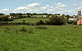
 East and West Buckland, Bray valley - geograph.org.uk - 90034.jpg 640 × 421; 121 KB
-
 East Buckland Cross - geograph.org.uk - 6207249.jpg 1,024 × 768; 200 KB
-
 East Buckland Cross - geograph.org.uk - 6435169.jpg 2,840 × 3,985; 2.08 MB
-
 Entering West Buckland from the north - geograph.org.uk - 3334163.jpg 1,600 × 1,063; 469 KB
-
 Entering West Buckland from the south - geograph.org.uk - 3334165.jpg 1,600 × 1,063; 583 KB
-
 Farm buildings at Buckingham's Leary - geograph.org.uk - 6286413.jpg 1,024 × 722; 155 KB
-
 Farm buildings tucked below Brayley Hill - geograph.org.uk - 5987600.jpg 1,024 × 768; 172 KB
-
 Farm lane to Furze - geograph.org.uk - 6437311.jpg 4,288 × 2,848; 2.39 MB
-
 Farm storage at Middle Stoodleigh - geograph.org.uk - 6206892.jpg 1,024 × 800; 266 KB
-
 Farm track on Brayley Hill - geograph.org.uk - 5987588.jpg 1,024 × 768; 174 KB
-
 Farmland near Brights Leary - geograph.org.uk - 6433551.jpg 3,567 × 2,136; 1.47 MB
-
 Farmland near Brights Leary - geograph.org.uk - 6433775.jpg 4,288 × 2,848; 2.69 MB
-
 Farmland near Buckingham’s Leary - geograph.org.uk - 6433042.jpg 2,876 × 1,758; 856 KB
-
 Farmland near Buckingham’s Leary - geograph.org.uk - 6433068.jpg 4,288 × 2,848; 1.94 MB
-
 Farmyard at Middle Stoodleigh - geograph.org.uk - 6206889.jpg 1,024 × 775; 156 KB
-
 Field access track near Brights Leary - geograph.org.uk - 6433716.jpg 2,848 × 4,288; 2.43 MB
-
 Field by Leary Cross - geograph.org.uk - 6433076.jpg 4,284 × 2,532; 1.68 MB
-
 Field by Upcott Cross - geograph.org.uk - 6436579.jpg 3,774 × 2,356; 1.26 MB
-
 Field by Wistford Cross - Goodwells Head Cross - geograph.org.uk - 6436418.jpg 3,203 × 1,605; 491 KB
-
 Field near Elwell - geograph.org.uk - 6436654.jpg 4,288 × 2,848; 2.11 MB
-
 Field near Elwell - geograph.org.uk - 6436743.jpg 4,288 × 2,848; 2.31 MB
-
 Field near Elwell - geograph.org.uk - 6436793.jpg 3,941 × 2,438; 1.46 MB
-
 Field near Stoodleigh - geograph.org.uk - 6191216.jpg 4,267 × 2,720; 1.22 MB
-
 Field north of Elwell - geograph.org.uk - 6436805.jpg 4,288 × 2,848; 1.97 MB
-
 Field on Brayley Hill - geograph.org.uk - 621015.jpg 640 × 480; 93 KB
-
 Field opposite West Buckland School - geograph.org.uk - 6434733.jpg 4,288 × 2,848; 1.84 MB
-
 Field opposite West Buckland School - geograph.org.uk - 6434742.jpg 4,288 × 2,848; 2.27 MB
-
 Fields near Brights Leary - geograph.org.uk - 6198782.jpg 3,350 × 2,323; 1.3 MB
-
 Fields near Stone - geograph.org.uk - 6437335.jpg 3,947 × 2,725; 2.07 MB
-
 Footpath near West Buckland - geograph.org.uk - 6434235.jpg 4,288 × 2,848; 1.57 MB
-
 Gate and track near Westacott - geograph.org.uk - 621025.jpg 461 × 640; 92 KB
-
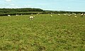
 Gate, sheep and field - geograph.org.uk - 621746.jpg 640 × 482; 120 KB
-
 Grass field on Middlecott Hill - geograph.org.uk - 6436277.jpg 4,288 × 2,848; 2.27 MB
-
 Grass field on Middlecott Hill - geograph.org.uk - 6436304.jpg 4,025 × 2,641; 1.67 MB
-
 Grass field on Middlecott Hill - geograph.org.uk - 6436310.jpg 4,288 × 2,848; 2.35 MB
-
 Grass field on Middlecott Hill - geograph.org.uk - 6436315.jpg 4,014 × 2,523; 1.95 MB
-
 Gubbs Wood - geograph.org.uk - 621316.jpg 480 × 640; 130 KB
-
 Headstone, West Buckland - geograph.org.uk - 6198991.jpg 4,288 × 2,848; 2.49 MB
-
 Headstones, West Buckland - geograph.org.uk - 6434051.jpg 4,288 × 2,848; 1.96 MB
-
 Hillside above Leary Barton - geograph.org.uk - 6286582.jpg 1,024 × 768; 170 KB
-
 Home Barton Plantation - geograph.org.uk - 621330.jpg 480 × 640; 108 KB
-
 Home Barton Plantation - geograph.org.uk - 621335.jpg 480 × 640; 134 KB
-
 Hoops Cottage (geograph 6199569).jpg 3,722 × 2,689; 1.71 MB
-
 Houses, West Buckland - geograph.org.uk - 6207042.jpg 1,024 × 807; 174 KB
-
 Hudley Mill Bridge - geograph.org.uk - 6207796.jpg 1,024 × 768; 281 KB
-
 Huxtable Copse - geograph.org.uk - 6434298.jpg 3,264 × 1,832; 1.46 MB
-
 Illers Cross - geograph.org.uk - 3287364.jpg 640 × 480; 113 KB
-
 Illers Cross - geograph.org.uk - 3334170.jpg 1,600 × 1,063; 728 KB
-
 Illers Cross - geograph.org.uk - 6286557.jpg 1,024 × 773; 326 KB
-
 Illers Cross - geograph.org.uk - 6433928.jpg 4,288 × 2,848; 2.1 MB
-
 Indicombe - geograph.org.uk - 6191154.jpg 3,264 × 1,832; 844 KB
-
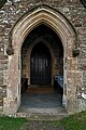
 Interior, St Michael's Church, East Buckland - geograph.org.uk - 5987628.jpg 1,024 × 768; 178 KB
-
 Interior, St Peter's Church, West Buckland - geograph.org.uk - 6207039.jpg 1,024 × 768; 149 KB
-

-
 Junction with the A361 - geograph.org.uk - 6287047.jpg 1,024 × 781; 191 KB
-
 Lane above Leary Cross - geograph.org.uk - 618736.jpg 640 × 480; 83 KB
-
 Lane at Stoodleigh Barton - geograph.org.uk - 6437115.jpg 4,165 × 2,590; 1.25 MB
-
 Lane from Stoodleigh Cross - geograph.org.uk - 6191284.jpg 4,288 × 2,848; 2.69 MB
-
 Lane from Wistford Cross - geograph.org.uk - 6436516.jpg 4,288 × 2,848; 1.49 MB
-
 Lane into Stoodleigh Barton Plantation - geograph.org.uk - 6436851.jpg 2,843 × 3,667; 1.88 MB
-
 Lane near Illers Leary - geograph.org.uk - 6433902.jpg 4,288 × 2,848; 2.52 MB
-
 Lane on Brayley Hill - geograph.org.uk - 5987608.jpg 1,024 × 768; 252 KB
-
 Lane past Brights Leary - geograph.org.uk - 6433567.jpg 2,848 × 4,288; 1.96 MB
-
 Lane past West Buckland School - geograph.org.uk - 6434676.jpg 1,826 × 2,943; 853 KB
-
 Lane to Buckingham’s Leary - geograph.org.uk - 6433565.jpg 3,721 × 2,544; 1.5 MB
-
 Lane to East Heddon - geograph.org.uk - 6287052.jpg 1,024 × 768; 292 KB
-
 Lane to Stone Cross - geograph.org.uk - 6437258.jpg 4,288 × 2,848; 2.15 MB
-
 Lane to Stoodleigh Barton - geograph.org.uk - 6436868.jpg 4,288 × 2,848; 2.19 MB
-
 Lane to Stoodleigh Cross - geograph.org.uk - 6436648.jpg 2,823 × 3,665; 2.08 MB
-
 Lane to Stoodleigh Cross - geograph.org.uk - 6436714.jpg 4,288 × 2,848; 2.68 MB
-
 Lane to Stoodleigh Cross - geograph.org.uk - 6436810.jpg 2,799 × 3,966; 1.44 MB
-
 Lane to Taddiport - geograph.org.uk - 6287040.jpg 1,024 × 739; 277 KB
-
 Lane to Taddiport - geograph.org.uk - 6287045.jpg 1,024 × 768; 368 KB
-
 Lane to Upcott Cross - geograph.org.uk - 6436587.jpg 2,848 × 4,288; 1.92 MB
-
 Lane to Upcott Cross - geograph.org.uk - 6436701.jpg 4,288 × 2,848; 2.4 MB
-
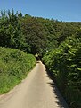
 Lane to West Buckland - geograph.org.uk - 6287000.jpg 1,024 × 768; 209 KB
-
 Lane to West Buckland - geograph.org.uk - 6433477.jpg 3,691 × 2,089; 1.05 MB
-
 Lane to Whitsford - geograph.org.uk - 6437125.jpg 4,288 × 2,848; 2.2 MB
-
 Lane to Whitsford - geograph.org.uk - 6437304.jpg 3,924 × 2,596; 1.5 MB
-
 Leary Barton - geograph.org.uk - 6286564.jpg 1,024 × 768; 172 KB
-
 Leary Moors - geograph.org.uk - 6432943.jpg 4,288 × 2,848; 2.58 MB
-
 Looking down the river Bray from Brayley Bridge - geograph.org.uk - 3916130.jpg 6,000 × 4,000; 4.16 MB
-

-
-
 Looking downstream from a bridge near Clockhay Wood - geograph.org.uk - 3302565.jpg 1,600 × 1,063; 752 KB
-
 Looking up the river Bray from Brayley Bridge - geograph.org.uk - 3916132.jpg 6,000 × 4,000; 4.69 MB
-

-
 Looking upstream from a bridge near Clockhay Wood - geograph.org.uk - 3302552.jpg 1,600 × 1,063; 627 KB
-
 Lower Rapscott Cross - geograph.org.uk - 5987431.jpg 1,024 × 796; 154 KB
-
 Lower Rapscott Cross - geograph.org.uk - 620932.jpg 640 × 432; 77 KB
-
 May's Leary Cottages - geograph.org.uk - 6286410.jpg 1,024 × 768; 210 KB
-
 Middlecott - geograph.org.uk - 6199561.jpg 3,212 × 1,704; 848 KB
-
 Middlecott Cross - Goodwells Head Cross - geograph.org.uk - 6436528.jpg 4,288 × 2,469; 1.03 MB
-
 Middlecott Farm, west of Charles, Devon.jpg 4,000 × 3,000; 2.88 MB
-
 Middlecott Farmhouse, west of Charles, Devon.jpg 4,000 × 3,000; 3.74 MB
-
 Middlecott Hill - geograph.org.uk - 6436325.jpg 4,282 × 2,736; 1.64 MB
-
 Mill Lane - geograph.org.uk - 5988360.jpg 1,024 × 767; 174 KB
-
 Mill Lane - geograph.org.uk - 6435304.jpg 4,288 × 2,848; 2.52 MB
-
 Mill Lane - geograph.org.uk - 6435312.jpg 4,288 × 2,697; 2.22 MB
-
 Mill Lane, Charles Bottom - geograph.org.uk - 6435352.jpg 2,848 × 4,288; 2.24 MB
-
 Mill Lane, East Buckland - geograph.org.uk - 6434787.jpg 4,258 × 2,619; 1.18 MB
-
 Minor road to East Buckland - geograph.org.uk - 6207102.jpg 1,024 × 774; 257 KB
-
 Minor road to Kimbland Cross - geograph.org.uk - 6207273.jpg 1,024 × 749; 292 KB
-
 Minor road to Kimbland Cross - geograph.org.uk - 6207743.jpg 1,024 × 769; 242 KB
-
 Minor road to West Buckland - geograph.org.uk - 6207030.jpg 1,024 × 756; 236 KB
-
 North Devon , Cattle Grazing - geograph.org.uk - 4233085.jpg 4,288 × 2,848; 5.48 MB
-
 North Devon , Countryside Scenery - geograph.org.uk - 3359341.jpg 4,288 × 2,848; 4.54 MB
-
 North Devon , Grassy Field ^ Cattle - geograph.org.uk - 4233084.jpg 4,288 × 2,848; 6.83 MB
-
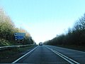
 North Devon , The A361 - geograph.org.uk - 3359337.jpg 4,288 × 2,848; 5.25 MB
-
 North Devon , The A361 - geograph.org.uk - 3359338.jpg 4,288 × 2,848; 3.97 MB
-
 Old Tilery Cottage - geograph.org.uk - 6433730.jpg 4,288 × 2,848; 2.77 MB
-
 Ordnance Survey Cut Mark - geograph.org.uk - 3860791.jpg 480 × 640; 91 KB
-
 Ordnance Survey Cut Mark - geograph.org.uk - 4740071.jpg 4,000 × 3,000; 3.76 MB
-
 Ordnance Survey Cut Mark - geograph.org.uk - 5026032.jpg 440 × 640; 102 KB
-
 Ordnance Survey Cut Mark - geograph.org.uk - 5026035.jpg 529 × 640; 134 KB
-
 Parsonage Lane Cross - geograph.org.uk - 6287035.jpg 1,024 × 768; 277 KB
-
 Parsonage Lane Cross - geograph.org.uk - 6434083.jpg 4,288 × 2,848; 1.72 MB
-
 Parsonage Lane Cross, West Buckland - geograph.org.uk - 3334167.jpg 1,600 × 1,063; 515 KB
-
 Pasture, west of Dassel Park Farm - geograph.org.uk - 6287043.jpg 1,024 × 768; 184 KB
-
 Pond near Crossbury - geograph.org.uk - 6286174.jpg 1,024 × 768; 293 KB
-
 Pond near Crossbury Wood - geograph.org.uk - 6286172.jpg 1,024 × 768; 349 KB
-
 Possibly very close to the source of Venn Stream - geograph.org.uk - 3301090.jpg 1,063 × 1,600; 849 KB
-
 Postbox, East Buckland Cross - geograph.org.uk - 6434778.jpg 1,717 × 3,092; 799 KB
-
 Punch Bowl Wood from Brayley Hill - geograph.org.uk - 620973.jpg 640 × 432; 67 KB
-
 River Bray - geograph.org.uk - 5987561.jpg 1,024 × 768; 262 KB
-
 River Bray - geograph.org.uk - 620916.jpg 640 × 472; 113 KB
-
 River Bray from Brayley Bridge - geograph.org.uk - 620947.jpg 640 × 480; 149 KB
-
 River Bray tributary at Charles Bottom - geograph.org.uk - 5988376.jpg 1,024 × 768; 338 KB
-
 Scene at West Buckland - geograph.org.uk - 6434111.jpg 3,639 × 2,233; 1.08 MB
-
 Sheep by Mill Lane - geograph.org.uk - 6435278.jpg 4,288 × 2,848; 1.93 MB
-
 Sheep near Brayley Bridge - geograph.org.uk - 620936.jpg 640 × 392; 104 KB
-
 Sheep near West Buckland - geograph.org.uk - 6434312.jpg 4,058 × 2,537; 1.89 MB
-
 Sheep near West Buckland - geograph.org.uk - 6434347.jpg 3,249 × 1,948; 1.31 MB
-
 Sheep near West Buckland - geograph.org.uk - 6434607.jpg 3,891 × 2,188; 1.59 MB
-
 Sheep pasture near West Buckland - geograph.org.uk - 6434617.jpg 3,264 × 1,832; 1.41 MB
-
 Sheep pasture, north of Growlersmoor Plantations - geograph.org.uk - 6286597.jpg 1,024 × 768; 171 KB
-
 Sheep pasture, West Buckland - geograph.org.uk - 6434120.jpg 4,288 × 2,848; 2.09 MB
-
 Signpost near Stoodleigh Barton - geograph.org.uk - 6437122.jpg 2,848 × 4,288; 2.47 MB
-
 Signpost, Wistford Cross - Goodwells Head Cross - geograph.org.uk - 6436423.jpg 2,828 × 4,008; 1.19 MB
-
 St Michael's Church, East Buckland - geograph.org.uk - 5987625.jpg 1,024 × 768; 178 KB
-
 St Michael's Church, East Buckland - geograph.org.uk - 6199386.jpg 2,793 × 1,652; 628 KB
-
 St Michael's Church, East Buckland - geograph.org.uk - 6435236.jpg 2,986 × 1,684; 782 KB
-
 St Michael's Church, East Buckland - geograph.org.uk - 6435249.jpg 2,999 × 1,721; 744 KB
-
 St Peter's Church, West Buckland - geograph.org.uk - 6207034.jpg 799 × 1,024; 195 KB
-
 St Peter's Church, West Buckland - geograph.org.uk - 6433971.jpg 1,832 × 3,264; 849 KB
-
 St. Peters Church, West Buckland - geograph.org.uk - 6363915.jpg 5,472 × 4,000; 5.23 MB
-
 St. Peters Church, West Buckland - geograph.org.uk - 6363917.jpg 3,648 × 5,472; 5.35 MB
-
 St. Peters Church, West Buckland - geograph.org.uk - 6363920.jpg 3,614 × 5,421; 4.75 MB
-
 Stables at Mill Farm - geograph.org.uk - 5988366.jpg 1,024 × 789; 164 KB


.jpg)


.jpg)


.jpg)


