Category:East Stratton
Jump to navigation
Jump to search
village in Hampshire, United Kingdom  | |||||
| Upload media | |||||
| Instance of | |||||
|---|---|---|---|---|---|
| Location | Micheldever, City of Winchester, Hampshire, South East England, England | ||||
 | |||||
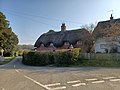
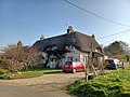
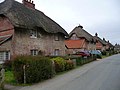
English: East Statton is a picturesque estate village situation at the entrance to the landscaped grounds of Stratton Park, some eight miles north of Winchester, Hampshire, England in the parish of Micheldever. Both park and village are of great interest and demonstrate the evolution of a landscape directed by three eminent families - Wrothesley, Russell and Baring - during the 17th, 18th and 19th centuries.
Subcategories
This category has the following 5 subcategories, out of 5 total.
Media in category "East Stratton"
The following 119 files are in this category, out of 119 total.
-
 22-31 East Stratton 01.jpg 4,000 × 3,000; 3.72 MB
-
 22-31 East Stratton 02.jpg 4,000 × 3,000; 4.22 MB
-
 22-31 East Stratton 03.jpg 4,000 × 3,000; 4.29 MB
-
 22-31 East Stratton 04.jpg 4,000 × 3,000; 3.19 MB
-
 22-31 East Stratton 05.jpg 4,000 × 3,000; 4.77 MB
-
 22-31 East Stratton 06.jpg 4,000 × 3,000; 3.2 MB
-
 22-31 East Stratton 07.jpg 4,000 × 3,000; 2.97 MB
-
 22-31 East Stratton 08.jpg 4,000 × 3,000; 3.55 MB
-
 35, East Stratton.jpg 4,000 × 3,000; 5 MB
-
 43 and 42, East Stratton.jpg 4,000 × 3,000; 3.56 MB
-
 44 and 45, East Stratton.jpg 4,000 × 3,000; 4.38 MB
-
 46 East Stratton.jpg 4,000 × 3,000; 3.2 MB
-
 47 and 48, East Stratton 01.jpg 4,000 × 3,000; 3.81 MB
-
 47 and 48, East Stratton 02.jpg 4,000 × 3,000; 2.93 MB
-
 A33 by the East Stratton turning - geograph.org.uk - 2411405.jpg 800 × 546; 103 KB
-
 Approach to East Stratton - geograph.org.uk - 3542753.jpg 640 × 425; 151 KB
-
 Approach to East Stratton - geograph.org.uk - 3543657.jpg 640 × 425; 150 KB
-
 Approach to East Stratton from the north - geograph.org.uk - 3543668.jpg 640 × 425; 150 KB
-
 Approaching East Stratton from the north - geograph.org.uk - 3543673.jpg 640 × 425; 142 KB
-
 Around the corner to East Stratton - geograph.org.uk - 3545223.jpg 640 × 425; 120 KB
-
 Baring Close, East Stratton - geograph.org.uk - 355011.jpg 640 × 427; 146 KB
-
 Black Wood - geograph.org.uk - 164890.jpg 640 × 426; 155 KB
-
 Black Wood - geograph.org.uk - 168006.jpg 640 × 426; 153 KB
-
 Bramble and Homa Cottage, East Stratton.jpg 4,000 × 3,000; 3.97 MB
-

-
 Bus Shelter, East Stratton - geograph.org.uk - 355019.jpg 427 × 640; 204 KB
-

-

-
 Coniferous tree near East Stratton (1) - geograph.org.uk - 2772827.jpg 501 × 640; 281 KB
-
 Coniferous tree near East Stratton (2) - geograph.org.uk - 2772843.jpg 449 × 640; 218 KB
-
 Cottages, East Stratton - geograph.org.uk - 2773463.jpg 640 × 443; 152 KB
-
 Cow near East Stratton - geograph.org.uk - 2773222.jpg 493 × 640; 182 KB
-
 Detail of East Stratton village hall - geograph.org.uk - 354961.jpg 500 × 640; 159 KB
-
 East Stratton - One of five... - geograph.org.uk - 1257017.jpg 640 × 480; 74 KB
-
 East Stratton - Telephone Box - geograph.org.uk - 1257015.jpg 640 × 480; 79 KB
-
 East Stratton - Village Hall - geograph.org.uk - 1257023.jpg 640 × 480; 79 KB
-
 East Stratton - Village Hall - geograph.org.uk - 1257026.jpg 640 × 480; 83 KB
-
 East Stratton - Wall - geograph.org.uk - 1257036.jpg 640 × 480; 83 KB
-
 East Stratton - worth a visit - geograph.org.uk - 2899022.jpg 800 × 651; 108 KB
-
 East Stratton 01.jpg 4,000 × 3,000; 3.29 MB
-
 East Stratton 02.jpg 4,000 × 3,000; 3.72 MB
-
 East Stratton 03.jpg 4,000 × 3,000; 4.38 MB
-
 East Stratton 04.jpg 4,000 × 3,000; 4.18 MB
-
 East Stratton 05.jpg 4,000 × 3,000; 4.44 MB
-
 East Stratton 06.jpg 4,000 × 3,000; 5.98 MB
-
 East Stratton 07.jpg 4,000 × 3,000; 4.82 MB
-
 East Stratton 08.jpg 4,000 × 3,000; 3.79 MB
-
 East Stratton 09.jpg 3,000 × 4,000; 4.77 MB
-
 East Stratton 10.jpg 3,000 × 4,000; 4.75 MB
-
 East Stratton 12.jpg 4,000 × 3,000; 3.47 MB
-
 East Stratton 13.jpg 4,000 × 3,000; 3.43 MB
-
 East Stratton, Hampshire - geograph.org.uk - 2433537.jpg 1,800 × 1,200; 997 KB
-
 Entering East Stratton from the south - geograph.org.uk - 3543661.jpg 640 × 425; 116 KB
-
 Farmland south of East Stratton - geograph.org.uk - 3542301.jpg 640 × 425; 103 KB
-
 Farmland south of East Stratton - geograph.org.uk - 3813262.jpg 1,024 × 680; 220 KB
-
 Farmland, East Stratton, Micheldever - geograph.org.uk - 2845516.jpg 640 × 480; 156 KB
-

-
 Footpath leaving East Stratton - geograph.org.uk - 3543655.jpg 640 × 425; 153 KB
-
 Gate piers near East Stratton - geograph.org.uk - 2772879.jpg 640 × 473; 211 KB
-
 Heading north from East Stratton - geograph.org.uk - 3543670.jpg 640 × 425; 144 KB
-
 Heading north from East Stratton - geograph.org.uk - 3543672.jpg 640 × 425; 121 KB
-
 Heading north from East Stratton - geograph.org.uk - 3545253.jpg 640 × 425; 128 KB
-
 Heading north from East Stratton - geograph.org.uk - 3545256.jpg 640 × 425; 138 KB
-
 House at Whiteway Farm, nr East Stratton - geograph.org.uk - 354060.jpg 640 × 427; 173 KB
-
 Houses in East Stratton - geograph.org.uk - 1837614.jpg 640 × 480; 121 KB
-
 K6 Telephone Kiosk east of East Stratton Farm.jpg 3,000 × 4,000; 4.54 MB
-
 Lane towards East Stratton - geograph.org.uk - 3545234.jpg 640 × 425; 122 KB
-
 Lane towards East Stratton - geograph.org.uk - 3545264.jpg 640 × 425; 139 KB
-
 Lane towards East Stratton - geograph.org.uk - 3550158.jpg 640 × 425; 130 KB
-

-

-
 Near East Stratton, Hampshire - geograph.org.uk - 2433529.jpg 3,504 × 2,336; 698 KB
-

-
 Old School House, East Stratton.jpg 4,000 × 3,000; 5.2 MB
-
 Passing through East Stratton - geograph.org.uk - 3543664.jpg 640 × 425; 124 KB
-
 Pheasant pens in Thorny Down Wood - geograph.org.uk - 303574.jpg 640 × 427; 202 KB
-

-
 Road junction at East Stratton - geograph.org.uk - 1837610.jpg 640 × 480; 140 KB
-

-
 Stratton Lane, East Stratton, Hampshire - geograph.org.uk - 2716228.jpg 1,024 × 767; 152 KB
-
 Stratton Park - geograph.org.uk - 2649038.jpg 800 × 600; 107 KB
-
 Stratton Park near East Stratton - geograph.org.uk - 2772958.jpg 640 × 443; 200 KB
-
 Sweet Briar Cottage, East Stratton 01.jpg 4,000 × 3,000; 3.38 MB
-
 Sweet Briar Cottage, East Stratton 02.jpg 4,000 × 3,000; 3.33 MB
-
 Sweet chestnut near East Stratton - geograph.org.uk - 2772857.jpg 640 × 480; 254 KB
-

-

-
 Thatched cottages, East Stratton, Hampshire - geograph.org.uk - 2716223.jpg 1,024 × 769; 239 KB
-
 The Bothy, East Stratton - geograph.org.uk - 355001.jpg 640 × 427; 189 KB
-
 The Cottage, East Stratton.jpg 4,000 × 3,000; 5.07 MB
-
 The Northbrook Arms - geograph.org.uk - 3158982.jpg 3,648 × 2,736; 2.44 MB
-
 The Northbrook Arms, East Stratton - geograph.org.uk - 1837617.jpg 640 × 480; 139 KB
-

-
 Village Hall at East Stratton - geograph.org.uk - 354967.jpg 640 × 427; 150 KB
-
 Walled Enclosure south of Stratton House - geograph.org.uk - 354982.jpg 640 × 416; 221 KB
-
 Wellingtonia near East Stratton - geograph.org.uk - 2772818.jpg 480 × 640; 283 KB
-
 A33 turning to Micheldever Station - geograph.org.uk - 125062.jpg 640 × 480; 270 KB
-
 Byway emerging from Norn's Copse - geograph.org.uk - 353619.jpg 427 × 640; 158 KB
-
 Clearing within Thorny Down Wood - geograph.org.uk - 302846.jpg 640 × 427; 112 KB
-
 Copse Lane approaching Burnt House Copse - geograph.org.uk - 302818.jpg 640 × 435; 158 KB
-
 Cul-de-sac in East Stratton - geograph.org.uk - 354100.jpg 640 × 427; 190 KB
-

-
 East Stratton - geograph.org.uk - 17822.jpg 640 × 427; 86 KB
-
 Embley Wood - geograph.org.uk - 442874.jpg 640 × 480; 164 KB
-
 Embley Wood - geograph.org.uk - 448665.jpg 640 × 480; 183 KB
-

-
 Farm track, north of West Stratton - geograph.org.uk - 166332.jpg 640 × 480; 342 KB
-

-
 Farmland east of Whiteway Farm - geograph.org.uk - 353622.jpg 640 × 427; 130 KB
-
 Farmland, Woodmancott - geograph.org.uk - 442878.jpg 640 × 480; 166 KB
-

-
 Footpath entering Thorny Down Wood - geograph.org.uk - 302836.jpg 640 × 427; 223 KB
-

-

-

-
 Larkwhistle Farm Road - geograph.org.uk - 164884.jpg 426 × 640; 177 KB
-
 Micheldever Wood - geograph.org.uk - 441763.jpg 640 × 480; 247 KB
-

-
 Track in Dodsley Wood - geograph.org.uk - 439678.jpg 480 × 640; 201 KB


_-_geograph.org.uk_-_2772827.jpg)
_-_geograph.org.uk_-_2772843.jpg)


_-_geograph.org.uk_-_2969355.jpg)
_-_geograph.org.uk_-_2969361.jpg)


