Category:East Putford
Jump to navigation
Jump to search
village in the United Kingdom  | |||||
| Upload media | |||||
| Instance of | |||||
|---|---|---|---|---|---|
| Location | Torridge, Devon, South West England, England | ||||
| Population |
| ||||
 | |||||
Media in category "East Putford"
The following 40 files are in this category, out of 40 total.
-
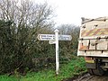
 A signpost at Putford Bridge - geograph.org.uk - 1836981.jpg 1,024 × 768; 384 KB
-
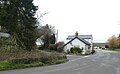
 Bountis Thorne - geograph.org.uk - 720946.jpg 640 × 480; 67 KB
-
 Bountis Thorne - geograph.org.uk - 721069.jpg 640 × 480; 106 KB
-
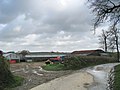
 Bridge and house at Powler's Piece crossroads - geograph.org.uk - 6104982.jpg 1,600 × 983; 654 KB
-
 Common Moor - geograph.org.uk - 1880900.jpg 640 × 480; 96 KB
-
 Common Moor Cross - geograph.org.uk - 1880909.jpg 640 × 480; 46 KB
-
 Common Moor Cross - geograph.org.uk - 689515.jpg 640 × 480; 75 KB
-
 Common Moor, road junction - geograph.org.uk - 3288796.jpg 640 × 480; 108 KB
-
 Cottages at Mambury Cross - geograph.org.uk - 720934.jpg 640 × 480; 121 KB
-
 Crossroads at Powler's Piece - geograph.org.uk - 1880894.jpg 640 × 480; 107 KB
-
 Dipple Brook valley - geograph.org.uk - 742139.jpg 640 × 480; 91 KB
-
 East Putford Church - geograph.org.uk - 81507.jpg 350 × 226; 28 KB
-
 Entrance to Ley Farm - geograph.org.uk - 721064.jpg 640 × 480; 139 KB
-
 Entrance to Winslade - geograph.org.uk - 660264.jpg 640 × 480; 133 KB
-
 Flying lamb, Nutton Farm - geograph.org.uk - 743795.jpg 640 × 352; 49 KB
-
 Forest track at Powler's Piece - geograph.org.uk - 413026.jpg 640 × 480; 103 KB
-
 Hedgebank and hedge near Wrangworthy Cross - geograph.org.uk - 6103312.jpg 1,600 × 1,173; 1.07 MB
-
 Mambury Farm - geograph.org.uk - 720939.jpg 640 × 480; 82 KB
-
 Mambury Manor - geograph.org.uk - 721041.jpg 640 × 480; 71 KB
-
 Narracott - geograph.org.uk - 718330.jpg 640 × 480; 161 KB
-
 Narracott Plantation - geograph.org.uk - 6104988.jpg 1,600 × 1,200; 1.03 MB
-

-
 Outbuilding - Powler's Piece - geograph.org.uk - 4109222.jpg 1,024 × 649; 153 KB
-
 Peacock, Nutton Farm - geograph.org.uk - 743801.jpg 518 × 640; 127 KB
-
 Powler's Piece - geograph.org.uk - 1198438.jpg 640 × 480; 74 KB
-
 Powler's Piece, road junction - geograph.org.uk - 3288811.jpg 640 × 480; 74 KB
-
 Powlers Piece - geograph.org.uk - 720917.jpg 640 × 480; 110 KB
-
 Putford Bridge - geograph.org.uk - 689503.jpg 640 × 480; 78 KB
-
 Road across Common Moor approaching Powler's Piece - geograph.org.uk - 6104977.jpg 1,600 × 1,194; 1.06 MB
-
 Road through Melbury Plantation - geograph.org.uk - 1880890.jpg 640 × 480; 87 KB
-
 Scrubland growth on Common Moor - geograph.org.uk - 1880906.jpg 640 × 480; 86 KB
-
 Signpost and rusty tractor at Powler's Piece crossroads - geograph.org.uk - 6104979.jpg 1,600 × 1,144; 935 KB
-
 Straight road across Common Moor - geograph.org.uk - 6103319.jpg 1,600 × 876; 517 KB
-
 Straight road south across Common Moor - geograph.org.uk - 6103314.jpg 1,600 × 999; 872 KB
-
 The view downstream from Putford Bridge - geograph.org.uk - 1821244.jpg 1,024 × 768; 293 KB
-
 The view upstream from Putford Bridge - geograph.org.uk - 1821242.jpg 1,024 × 768; 381 KB
-
 Tumulus near Wrangworthy Cross - geograph.org.uk - 1186532.jpg 640 × 480; 104 KB
-
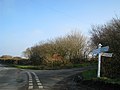
 Turning for Putford - geograph.org.uk - 3288748.jpg 640 × 480; 71 KB
-
 Venn Farm - geograph.org.uk - 720925.jpg 640 × 480; 109 KB
-
 Wrangworthy Cross - geograph.org.uk - 3288783.jpg 640 × 480; 63 KB


