Category:East Dundry
Jump to navigation
Jump to search
English: East Dundry is a hamlet in the civil parish of Dundry, in the North Somerset district, in the county of Somerset, England.
human settlement in United Kingdom  | |||||
| Upload media | |||||
| Instance of | |||||
|---|---|---|---|---|---|
| Location |
| ||||
 | |||||
Media in category "East Dundry"
The following 11 files are in this category, out of 11 total.
-
 Close to the suburban fringe - geograph.org.uk - 5387249.jpg 2,304 × 1,704; 1.61 MB
-
 East Dundry 1962.jpg 375 × 226; 69 KB
-
 East Dundry Lane at East Dundry - geograph.org.uk - 1346067.jpg 640 × 534; 169 KB
-
 EastDundry1.jpg 5,058 × 2,226; 9.27 MB
-
 Looking west in East Dundry - geograph.org.uk - 1344716.jpg 640 × 531; 186 KB
-
 Malago marker - geograph.org.uk - 5387625.jpg 2,304 × 1,704; 1.71 MB
-
 North Hill Farm, East Dundry - geograph.org.uk - 1346056.jpg 640 × 478; 153 KB
-
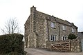 Rutland House, East Dundry - geograph.org.uk - 136497.jpg 640 × 426; 128 KB
-
 South east at Walnut Farm - geograph.org.uk - 1346045.jpg 640 × 427; 118 KB
-
 South east at Walnut Farm, East Dundry - geograph.org.uk - 1344627.jpg 640 × 493; 128 KB
-
 View south at East Dundry - geograph.org.uk - 1344649.jpg 640 × 495; 162 KB


