Category:Easington, County Durham
Jump to navigation
Jump to search
town in Easington Village, County Durham, UK  | |||||
| Upload media | |||||
| Instance of | |||||
|---|---|---|---|---|---|
| Location | Easington Village, County Durham, North East England, England | ||||
| Different from | |||||
 | |||||
English: Easington is a town in eastern County Durham, England. It comprises the ancient village of Easington Village and the ex-mining town of Easington Colliery, both of which are separate civil parishes. It is located at the junction of the A182 leading north-west to Hetton-le-Hole. Seaham Harbour and Houghton-le-Spring, and the A19, which travels north to Sunderland and south to Middlesbrough. As a former coal mining town, Easington is now an unemployment blackspot after the mine closed in 1993. The population of Easington Village is 2,164.
Nederlands: Easington is een plaats en civil parish in de Engelse unitary authority Durham. De plaats telt 2.302 inwoners.
Norsk bokmål: Easington er en by i Durham i England. Den er administrasjonsby for og har gitt navn til distriktet Easington.
Română: Easington este un oraş şi un district nemetropolitan în Regatul Unit, reşedinţa comitatului County Durham, în regiunea East, Anglia. Districtul are o populaţie de 94.000 locuitori, din care 2.302 locuiesc în oraşul propriu zis Easington.
Subcategories
This category has the following 4 subcategories, out of 4 total.
Media in category "Easington, County Durham"
The following 13 files are in this category, out of 13 total.
-
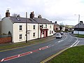
 Easington Board Office. built 1902.jpg 640 × 475; 75 KB
-
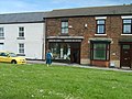 Easington Fashions - geograph.org.uk - 3522706.jpg 800 × 600; 143 KB
-
 Geese on guard - geograph.org.uk - 586351.jpg 640 × 480; 164 KB
-
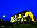 Half moon Pub (10203455523).jpg 912 × 684; 74 KB
-
 Horse on the Green - geograph.org.uk - 3522675.jpg 800 × 600; 135 KB
-
 Looking down at the village green.jpg 640 × 480; 86 KB
-
 The Masons Arms, Rosemary Lane, Easington - geograph.org.uk - 1707034.jpg 1,024 × 769; 213 KB
-
 Village green, Easington.jpg 640 × 480; 73 KB
-
 Farmland view - geograph.org.uk - 476180.jpg 640 × 480; 118 KB
-
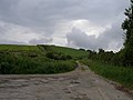
 Nature reclaims the old road. - geograph.org.uk - 475764.jpg 640 × 480; 110 KB
-
 Stile below A19 - geograph.org.uk - 320142.jpg 640 × 480; 114 KB
-
 The footpath rises over Andrew's Hill - geograph.org.uk - 475768.jpg 640 × 480; 69 KB
-
 View from Andrew's Hill - geograph.org.uk - 475762.jpg 640 × 480; 107 KB


.jpg)


