Category:Easenhall
Jump to navigation
Jump to search
village in Warwickshire, England, UK  | |||||
| Upload media | |||||
| Instance of | |||||
|---|---|---|---|---|---|
| Location | Rugby, Warwickshire, West Midlands, England | ||||
| Population |
| ||||
| Area |
| ||||
 | |||||
Media in category "Easenhall"
The following 128 files are in this category, out of 128 total.
-
 "Now, am I thirsty, or what" - geograph.org.uk - 5726208.jpg 960 × 1,280; 1.64 MB
-
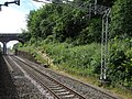
 350-100 London Midland Easenhall 12-07-2017 (35985552816).jpg 3,686 × 2,458; 8.64 MB
-
 60163 Tornado Easenhall Northbound(2) (43517556262).jpg 3,504 × 2,336; 8.97 MB
-
 60163 Tornado Easenhall Southbound(4) (43564331941).jpg 3,504 × 2,336; 7.39 MB
-
 66034 EWS Easenhall (41062292100).jpg 3,415 × 2,277; 7.36 MB
-
 66053 DB Easenhall 12-07-2017 (36103413035).jpg 4,336 × 2,891; 11.35 MB
-
 66504 Freightliner Easenhall 12-07-2017 (36062311466).jpg 4,326 × 2,884; 9.41 MB
-
 66529 freightliner Easenhall 12-07-2017 (36376807366).jpg 4,543 × 3,028; 12.76 MB
-
 66558 Freightliner Easenhall (1) (42682458654).jpg 3,504 × 2,336; 1.9 MB
-
 66712 GBRF Easenhall 12-07-2017 (36421827875).jpg 4,579 × 3,053; 9.85 MB
-
 70015 Freightliner Easenhall 12-07-2017 (36421799305).jpg 3,965 × 2,644; 9.68 MB
-
 90028 leading DBEWS Easenhall 12-07-2017 (36376774886).jpg 3,564 × 2,376; 7.58 MB
-
 All Oaks Wood - geograph.org.uk - 5175030.jpg 4,764 × 2,932; 7.7 MB
-
 Aphantopus hyperantus (35658521960).jpg 3,830 × 2,554; 6.2 MB
-
 Approaching the railway bridge - geograph.org.uk - 5503806.jpg 1,600 × 900; 349 KB
-
 Black Hovel Spinney - geograph.org.uk - 2842124.jpg 640 × 430; 42 KB
-
 Boat Inn Cottage - geograph.org.uk - 5046058.jpg 640 × 427; 108 KB
-
 Bridge 35, Hungerfield Bridge - geograph.org.uk - 4474178.jpg 1,024 × 775; 252 KB
-
 Bridge 35, Hungerfield Bridge - geograph.org.uk - 4474184.jpg 1,024 × 768; 248 KB
-

-
-
 Bridge ^34, Oxford Canal - geograph.org.uk - 6251481.jpg 1,600 × 1,065; 787 KB
-
 Bridge ^35 Hungerfield Bridge, Oxford Canal - geograph.org.uk - 6251444.jpg 1,600 × 1,065; 637 KB
-
 Bridge ^38, Oxford Canal - geograph.org.uk - 6251484.jpg 1,600 × 1,065; 838 KB
-
 Canalside pasture at Hungerfield in Warwickshire - geograph.org.uk - 5726975.jpg 1,280 × 960; 1.3 MB
-

-

-

-

-
 Cord Lane - geograph.org.uk - 5303113.jpg 2,322 × 4,128; 3.12 MB
-
 Cord Lane, Easenhall - geograph.org.uk - 2788519.jpg 1,280 × 856; 134 KB
-
 Cord Lane, Pailton - geograph.org.uk - 2788513.jpg 1,280 × 856; 149 KB
-
 Dutch barn at Hungerfield in Warwickshire - geograph.org.uk - 5726972.jpg 1,280 × 859; 1.07 MB
-
 Easenhall - geograph.org.uk - 2788536.jpg 1,280 × 856; 149 KB
-
 Easenhall - geograph.org.uk - 2789483.jpg 856 × 1,280; 211 KB
-
 Easenhall - geograph.org.uk - 459305.jpg 640 × 480; 164 KB
-
 Easenhall Chapel (converted) - geograph.org.uk - 4238667.jpg 1,600 × 1,200; 525 KB
-
 Easenhall CV23, UK - panoramio (1).jpg 5,472 × 3,648; 6.88 MB
-
 Easenhall CV23, UK - panoramio (2).jpg 5,472 × 3,648; 7.22 MB
-
 Easenhall CV23, UK - panoramio.jpg 5,472 × 3,648; 10.35 MB
-
 Easenhall main1 rd (looking east) 3u07.JPG 2,592 × 1,944; 951 KB
-
 Easenhall village sign - geograph.org.uk - 2790018.jpg 856 × 1,280; 76 KB
-
 Easenhall-Cord Lane - geograph.org.uk - 4238710.jpg 1,600 × 1,200; 480 KB
-
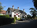
 Easenhall-The Golden Lion - geograph.org.uk - 4238733.jpg 1,600 × 1,200; 372 KB
-
 Easenhall2 3u07.JPG 2,592 × 1,944; 2.75 MB
-
 Easenhall3 3u07.JPG 2,592 × 1,944; 2.91 MB
-
 Entrance to Thorns Farm - geograph.org.uk - 5503804.jpg 900 × 1,600; 380 KB
-
 Farmland and woodland - geograph.org.uk - 3865993.jpg 640 × 430; 33 KB
-
 Farmland by the West Coast Main Line - geograph.org.uk - 4848954.jpg 640 × 426; 56 KB
-
 Farmland near Cathiron - geograph.org.uk - 4335330.jpg 640 × 430; 51 KB
-
 Farmland near Easenhall - geograph.org.uk - 2788517.jpg 856 × 1,280; 216 KB
-
 Farmland near Newbold Revel - geograph.org.uk - 3645969.jpg 640 × 394; 30 KB
-
 Fields beside Oxford Canal - geograph.org.uk - 5046064.jpg 640 × 427; 78 KB
-
 Flat farmland - geograph.org.uk - 4363094.jpg 640 × 430; 43 KB
-
 Hungerfield Bridge (no 35), from the north-east - geograph.org.uk - 5612124.jpg 1,024 × 768; 208 KB
-
-
 Keeper's Lodge at Town Thorns - geograph.org.uk - 4474197.jpg 1,024 × 748; 268 KB
-
 Larch Spinney - geograph.org.uk - 4363100.jpg 640 × 333; 31 KB
-
 Larch Spinney - geograph.org.uk - 5704433.jpg 640 × 343; 42 KB
-
-

-
 M6 Motorway near Thwaite Farm - geograph.org.uk - 1818343.jpg 640 × 480; 112 KB
-
 Mallards on the Oxford Canal - geograph.org.uk - 3460924.jpg 1,333 × 1,000; 1.42 MB
-
 Motorway Bridge - geograph.org.uk - 5303107.jpg 2,322 × 4,128; 2.28 MB
-

-
 Narrowboat on the Oxford Canal - geograph.org.uk - 4474097.jpg 1,024 × 818; 347 KB
-
 Narrowboat on the Oxford Canal - geograph.org.uk - 4474544.jpg 1,024 × 793; 231 KB
-
 Narrowboats east of Brinklow in Warwickshire - geograph.org.uk - 5726185.jpg 1,280 × 878; 1.48 MB
-
 Near Hare Spinney - geograph.org.uk - 4363106.jpg 640 × 430; 30 KB
-
 North Oxford canal alongside All Oaks Wood - geograph.org.uk - 5612638.jpg 1,024 × 819; 310 KB
-
 Oxford Canal alongside All Oaks Wood - geograph.org.uk - 3460926.jpg 1,333 × 1,000; 1.47 MB
-

-
 Oxford Canal at Hungerfield Bridge, Warwickshire - geograph.org.uk - 5727327.jpg 1,280 × 855; 1.07 MB
-
 Oxford Canal at Hungerfield in Warwickshire - geograph.org.uk - 5727646.jpg 1,280 × 863; 1.13 MB
-
 Oxford Canal by All Oaks Wood - geograph.org.uk - 5046068.jpg 640 × 427; 93 KB
-

-
 Oxford Canal south-east of Brinklow in Warwickshire - geograph.org.uk - 5726964.jpg 1,280 × 763; 1.04 MB
-
 Oxford Canal through woodland near Hungerfield - geograph.org.uk - 3460909.jpg 1,333 × 1,000; 1.52 MB
-
 Oxford Canal Walk - geograph.org.uk - 5207744.jpg 640 × 480; 87 KB
-
 Oxford Canal Walk - geograph.org.uk - 5207754.jpg 640 × 480; 127 KB
-
 Oxford Canal west of Cathiron in Warwickshire - geograph.org.uk - 5727654.jpg 1,280 × 960; 1.16 MB
-
 Oxford Canal west of Cathiron in Warwickshire - geograph.org.uk - 5727694.jpg 1,280 × 886; 1.21 MB
-
 Oxford Canal west of Cathiron in Warwickshire - geograph.org.uk - 5727715.jpg 1,280 × 825; 1.26 MB
-
 Oxford Canal west of Cathiron in Warwickshire - geograph.org.uk - 5727722.jpg 1,280 × 902; 1.56 MB
-
 Oxford Canal, All Oaks Wood reach - geograph.org.uk - 3153571.jpg 640 × 480; 116 KB
-
 Oxford canal, Bridge 37 - geograph.org.uk - 5175015.jpg 4,915 × 3,089; 7.31 MB
-

-
 Oxford Canal, Bridge Number 37 - geograph.org.uk - 3153751.jpg 640 × 480; 72 KB
-
 Pasture west of Cathiron in Warwickshire - geograph.org.uk - 5726945.jpg 1,280 × 884; 1.21 MB
-
 Pendolino Virgin Easenhall 12-07-2017 (35769016164).jpg 4,594 × 3,063; 15.76 MB
-
 Public bridleway crossing bridge 37 - geograph.org.uk - 4474607.jpg 1,024 × 768; 375 KB
-
 Public footpath near the Oxford Canal - geograph.org.uk - 4474540.jpg 1,024 × 690; 183 KB
-
 Pylon by a hedge near Easenhall - geograph.org.uk - 2230978.jpg 640 × 430; 119 KB
-
 Pylon by the West Coast Main Line - geograph.org.uk - 4848958.jpg 640 × 426; 67 KB
-
 Pylon in a field - geograph.org.uk - 3865989.jpg 640 × 430; 47 KB
-
 Pylon in a field - geograph.org.uk - 4902610.jpg 640 × 426; 55 KB
-
 Pylon near Easenhall - geograph.org.uk - 2842132.jpg 640 × 430; 27 KB
-
 Pylon near Easenhall - geograph.org.uk - 2842141.jpg 640 × 430; 32 KB
-
 Pylon near Easenhall - geograph.org.uk - 3865992.jpg 640 × 430; 39 KB
-
 Snowy landscape near Easenhall - geograph.org.uk - 2230971.jpg 640 × 430; 113 KB
-
 The Golden Lion, Easenhall - geograph.org.uk - 2790019.jpg 1,280 × 856; 114 KB
-
 The North Oxford canal at Hungerfield - geograph.org.uk - 5612632.jpg 1,024 × 768; 180 KB
-
 The Oxford canal - geograph.org.uk - 5503799.jpg 1,600 × 900; 514 KB
-
 Thieves beware^ - geograph.org.uk - 2788531.jpg 856 × 1,280; 141 KB
-
 Town Thorns farm - geograph.org.uk - 5175022.jpg 5,184 × 3,456; 5.62 MB
-
 Town Thorns Farm at Hungerfield - geograph.org.uk - 4474165.jpg 1,024 × 701; 234 KB
-
 Town Thorns Farm, Hungerfield - geograph.org.uk - 3460903.jpg 1,333 × 1,000; 982 KB
-
 Town Thorns Farm, Hungerfield - geograph.org.uk - 5612625.jpg 1,024 × 768; 164 KB
-
 Towpath along the Oxford Canal - geograph.org.uk - 4474150.jpg 1,024 × 768; 317 KB
-
 Trees impinging on the Oxford Canal - geograph.org.uk - 3460944.jpg 1,000 × 1,333; 1.46 MB
-
 Trees overhanging the Oxford Canal, All Oaks Wood - geograph.org.uk - 3460910.jpg 1,000 × 1,333; 1.54 MB
-

-
 View from a Rugby-Crewe train - Brinklow Road bridge - geograph.org.uk - 5818756.jpg 1,600 × 1,200; 692 KB
-

-
 Village communications - Easenhall - geograph.org.uk - 2788543.jpg 854 × 1,280; 127 KB
-
 Village green - geograph.org.uk - 5221006.jpg 640 × 480; 78 KB
-
 Village Green - geograph.org.uk - 5303116.jpg 4,128 × 2,322; 6.08 MB
-
 Virgin Pendolino near Easenhall - geograph.org.uk - 2788523.jpg 1,280 × 856; 187 KB
-
 West Coast Main Line - geograph.org.uk - 3682663.jpg 1,600 × 761; 379 KB
-
 West Coast Main Line - geograph.org.uk - 3682667.jpg 1,600 × 1,016; 539 KB
-
 West Coast Main Line - geograph.org.uk - 3682696.jpg 1,600 × 823; 301 KB
-
 Easenhall - geograph.org.uk - 456896.jpg 640 × 480; 138 KB
-
 Easenhall - geograph.org.uk - 456910.jpg 640 × 480; 145 KB
-
 Easenhall - geograph.org.uk - 457758.jpg 640 × 480; 162 KB
-
 Easenhall - geograph.org.uk - 459312.jpg 640 × 480; 152 KB
-
 Easenhall - geograph.org.uk - 59360.jpg 640 × 480; 246 KB
-
 Easenhall - geograph.org.uk - 79807.jpg 640 × 480; 115 KB
-
 The Golden Lion, Easenhall - geograph.org.uk - 59358.jpg 640 × 480; 236 KB

.jpg)
_(43517556262).jpg)
_(43564331941).jpg)
.jpg)
.jpg)
.jpg)
.jpg)
_(42682458654).jpg)
.jpg)
.jpg)
.jpg)

.jpg)


_-_geograph.org.uk_-_4238667.jpg)
.jpg)
.jpg)

_3u07.JPG)


,_from_the_north-east_-_geograph.org.uk_-_5612124.jpg)


.jpg)


