Category:Earth system science models
Jump to navigation
Jump to search
Media in category "Earth system science models"
The following 16 files are in this category, out of 16 total.
-
 Anthropogenic carbon flows 1850-2018.png 2,067 × 2,253; 157 KB
-
 Genomics GTL Program Payoffs.jpg 750 × 563; 501 KB
-
 Geoid Bronze Barnstar.png 2,150 × 2,048; 881 KB
-
 Geoid undulation 10k scale.jpg 1,200 × 1,200; 147 KB
-
 Geoid undulation to scale.jpg 1,200 × 1,200; 109 KB
-
 Global carbon budget components.png 2,067 × 2,597; 341 KB
-
 Global sea level rise projections 2000-2100.png 1,066 × 692; 11 KB
-
-
 MethaneInfographicGlobalCarbonProject2016ccBySa Fr.jpg 4,167 × 2,500; 577 KB
-
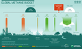 MethaneInfographicGlobalCarbonProject2016ccBySa.png 2,000 × 1,200; 199 KB
-
 Mitigation pathways.svg 526 × 371; 34 KB
-
 Multi-Angle Imager for Aerosols.jpg 613 × 460; 147 KB
-
 Omics data and marine phytoplankton.jpg 1,317 × 467; 188 KB
-
 Process-of-flood-inundation-during-the-19April2012-event.png 2,067 × 2,810; 641 KB
-
 Schematic-geological-map-of-the-High-Agri-Valley.png 2,066 × 1,411; 838 KB
-
 Ökosphäre Geosphäre System Erde.png 733 × 1,038; 21 KB


