Category:Earth photography during STS-99
Jump to navigation
Jump to search
English: Photographs of Earth taken during STS-99
Media in category "Earth photography during STS-99"
The following 200 files are in this category, out of 376 total.
(previous page) (next page)-
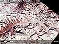
 Baltoro Muztagh map.png 1,336 × 1,252; 3.8 MB
-
 Diapontische Inseln.jpg 320 × 480; 85 KB
-
 Grand Lac des Esclaves vu de l'espace.jpg 300 × 293; 14 KB
-
 Hannah Bay.jpg 4,127 × 4,096; 2.86 MB
-
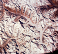
 Karakoram ISS.jpg 3,060 × 2,036; 1.97 MB
-
 Karakoram Nasa.JPG 540 × 405; 67 KB
-
 Lac-La-Moinerie-Quebec-Canada-astrobleme-nasa.jpg 4,096 × 4,099; 2.66 MB
-
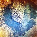 Mount kenya closeup nasa.JPG 4,127 × 4,096; 5.57 MB
-
 Nukumanu STS099-725-41.jpg 2,495 × 1,836; 590 KB
-
 Ontong Java STS099.jpg 4,127 × 4,096; 2.06 MB
-
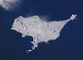 Pribilof-Inseln-St.Pauls.jpg 640 × 462; 50 KB
-

-
-

-

-

-

-

-

-

-
-

-

-

-

-

-

-

-

-
-

-

-

-
-

-

-

-

-

-

-

-

-

-

-

-

-

-

-

-

-

-
-

-

-

-

-

-

-

-

-

-
-

-

-

-
-

-

-

-

-

-

-

-

-

-
-

-

-

-

-

-

-

-

-

-

-

-

-

-

-

-

-

-

-

-

-

-

-

-

-
-

-

-

-

-

-

-

-

-

-

-

-

-

-

-

-
-

-

-

-

-

-

-

-

-

-

-

-
-

-

-
-

-

-
-

-

-
 STS-099 - DPLA - 4bcb0ae491a3465f73ca8c20c785ed4e.jpg 640 × 612; 55 KB
-

-

-

-

-

-

-

-

-

-

-

-
-

-

-

-

-
-

-

-

-

-
-

-

-

-

-

-

-

-

-

-

-
-

-

-

-

-

-

-
-

-

-

-

-

-

-

-

-

-

-

-
-

-

-

-

-

-

-

-

-

-


