Category:Eardiston
Jump to navigation
Jump to search
village in Worcestershire, England, UK  | |||||
| Upload media | |||||
| Instance of | |||||
|---|---|---|---|---|---|
| Location | Lindridge, Malvern Hills, Worcestershire, West Midlands, England | ||||
 | |||||
Media in category "Eardiston"
The following 15 files are in this category, out of 15 total.
-
 Bridge over the River Perry - geograph.org.uk - 238128.jpg 640 × 426; 114 KB
-
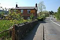 Cottage in Eardiston - geograph.org.uk - 417650.jpg 640 × 426; 126 KB
-
 River Perry Bridge - geograph.org.uk - 238134.jpg 457 × 640; 117 KB
-
 Steep Hill South From Menithwood - geograph.org.uk - 1490231.jpg 480 × 640; 155 KB
-
 Farmland at Tedsmore - geograph.org.uk - 311951.jpg 640 × 480; 110 KB
-
 Farmland near Shotatton - geograph.org.uk - 313223.jpg 640 × 506; 86 KB
-
 Farmland near Tedsmore - geograph.org.uk - 311957.jpg 640 × 480; 96 KB
-
 Farmland near Wykeymoss - geograph.org.uk - 311969.jpg 640 × 480; 96 KB
-
 Lane at Wykey - geograph.org.uk - 311978.jpg 640 × 480; 122 KB
-
 Lane near Grug Hill - geograph.org.uk - 312249.jpg 640 × 480; 92 KB
-
 Lane to Ruyton Manor - geograph.org.uk - 313221.jpg 640 × 480; 160 KB
-
 Road junction at Lane End - geograph.org.uk - 311982.jpg 640 × 480; 88 KB
-
 Shelvock Coppice - geograph.org.uk - 312243.jpg 640 × 480; 128 KB
-
 Shelvock lake - geograph.org.uk - 312246.jpg 640 × 480; 130 KB
-
 The lake, Boreatton Park - geograph.org.uk - 65372.jpg 640 × 342; 88 KB


