Category:Eaglesham
Jump to navigation
Jump to search
village in East Renfrewshire, Scotland, UK  | |||||
| Upload media | |||||
| Instance of | |||||
|---|---|---|---|---|---|
| Location |
| ||||
| Population |
| ||||
| official website | |||||
 | |||||
English: Eaglesham (pronounced "Eagle-sham" ) is a village in East Renfrewshire, Scotland. Today it is chiefly a dormitory town for commuters to nearby Glasgow, Paisley and other major urban centres. The village is distinctive in being based around a large triangular green.
Gàidhlig: 'S e baile anns an t- Siorrachd Rinn Friù an Ear a tha ann am Baile na h-Eaglais (Beurla: Eaglesham).
Nederlands: Eaglesham is een dorp in de Schotse council East Renfrewshire in het historisch graafschap Renfrewshire. Eaglesham ligt ongeveer 16 kilometer ten zuiden van Glasgow, ten zuideoosten van Newton Maes, ten zuiden van Busby en ten zuidwesten van East Kilbride.
Norsk bokmål: Eaglesham er en landsby ( village) i regionen East Renfrewshire i Skottland. Den ligger omtrent 16 kilometer sør for Glasgow. De nærmeste andre tettstedene er Newton Mearns i nordøst, Busby i nord og East Kilbride i øst.
Svenska: Eaglesham är en ort med 3 110 invånare (2004), som är belägen söder om Glasgow i Skottland i Storbritannien.
Subcategories
This category has the following 32 subcategories, out of 32 total.
B
- Ballageich Hill (5 F)
- Bonnyton Golf Club (2 F)
C
- Castle Hill, Eaglesham (8 F)
- Castlehill Farm, Eaglesham (3 F)
- Craigenfaulds Moss (4 F)
E
- Eaglesham cemetery (5 F)
- Eaglesham parish church (21 F)
- Eglinton Arms Hotel (2 F)
F
- Flow Moss, East Renfrewshire (6 F)
G
- Greenfield Hill, Eaglesham (1 F)
H
- High Dam, Eaglesham (4 F)
- Hole Ford (3 F)
- Holehouse Road bridge (2 F)
M
- Mid Dam (2 F)
- Moor Yett Plantation (2 F)
N
- Nether Enoch (8 F)
P
- Park Farm, East Renfrewshire (3 F)
- Polnoon Lodge (3 F)
- Polnoon Street (8 F)
S
T
- The Weavers' Trail (8 F)
W
- Whitelee Wind Farm (120 F)
Media in category "Eaglesham"
The following 61 files are in this category, out of 61 total.
-
 Bairdsknowe Service Reservoir - geograph.org.uk - 74547.jpg 640 × 480; 104 KB
-
 Bridge Over White Cart Water - geograph.org.uk - 59646.jpg 640 × 480; 179 KB
-
 Burr on Horsechestnut.JPG 2,288 × 1,712; 1.35 MB
-
 Carswell Centre. Old United Presbyterian Church in Eaglesham, Renfrewshire.jpg 4,896 × 2,752; 2.46 MB
-
 Cheapside Street - geograph.org.uk - 1484249.jpg 640 × 479; 105 KB
-
 Coo Lane - geograph.org.uk - 1484274.jpg 480 × 640; 79 KB
-
 Cross Keys House - Coat of Arms.JPG 1,369 × 933; 498 KB
-

-
 Derelict Farm Building at Mid Borland - geograph.org.uk - 82063.jpg 640 × 480; 158 KB
-
 Dumdruff Hill - geograph.org.uk - 346170.jpg 640 × 480; 95 KB
-
 Eaglesham (50354400931).jpg 2,076 × 1,168; 2.04 MB
-
 Eaglesham - site of kennels.JPG 2,286 × 1,710; 2.51 MB
-
 Eaglesham - top of the 'A'.JPG 2,200 × 1,348; 1.41 MB
-
 Eaglesham Burn, The Orry, Eaglesham, Renfrewshire.jpg 4,896 × 2,752; 4.33 MB
-
 Eaglesham Fair 2009 - geograph.org.uk - 1503520.jpg 549 × 480; 109 KB
-
 Eaglesham Fingerpost - geograph.org.uk - 1530094.jpg 418 × 640; 111 KB
-
 Eaglesham in the Snow - geograph.org.uk - 638015.jpg 640 × 426; 120 KB
-
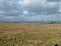
 Fields north of Eaglesham - geograph.org.uk - 1585522.jpg 640 × 480; 81 KB
-
 Gilmour Street - geograph.org.uk - 1484253.jpg 640 × 479; 79 KB
-
 Gilmour Street - geograph.org.uk - 1484265.jpg 640 × 480; 126 KB
-
 Gravestone - Eaglesham Graveyard.JPG 2,288 × 1,712; 1.34 MB
-
 High Borland - geograph.org.uk - 1803284.jpg 640 × 480; 88 KB
-
 Hillside - geograph.org.uk - 131529.jpg 640 × 480; 83 KB
-
 Hillside and Forest - geograph.org.uk - 131536.jpg 640 × 480; 88 KB
-
 Holehouse Road - geograph.org.uk - 1585811.jpg 640 × 480; 114 KB
-
 Holehouse Road at Glasgow Road - geograph.org.uk - 1585518.jpg 640 × 480; 115 KB
-
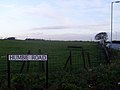
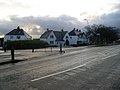
 Houses in Eaglesham - geograph.org.uk - 1585501.jpg 640 × 480; 108 KB
-
 Inosculated Willow.JPG 2,288 × 1,712; 1.29 MB
-
 Kirkland Bridge (geograph 3723865).jpg 640 × 480; 79 KB
-
 Kirkland Bridge - geograph.org.uk - 429856.jpg 640 × 427; 143 KB
-
 Kirkstyle - geograph.org.uk - 1450290.jpg 640 × 476; 89 KB
-
 Montgomery Square - geograph.org.uk - 1450602.jpg 640 × 480; 113 KB
-
 Montgomery Square - geograph.org.uk - 1477564.jpg 640 × 480; 77 KB
-
 Moor Road - geograph.org.uk - 1480616.jpg 614 × 428; 101 KB
-
 Moorland Cottage - geograph.org.uk - 1657830.jpg 640 × 500; 91 KB
-
 Ned's Mount or Topfaulds Plantation, Eaglesham.JPG 2,288 × 1,712; 1.44 MB
-
 Newton Means South & Eaglesham.svg 1,474 × 1,001; 88 KB
-
 Ordnance Survey Sheet NS 55 Thornliebank, Published 1959.jpg 5,584 × 5,922; 13.56 MB
-
 Playing field in the Orry, Eaglesham.jpg 5,712 × 4,284; 6.94 MB
-
 Quarry Lane from the Orry - geograph.org.uk - 1424767.jpg 640 × 480; 100 KB
-
 Rock Outcrop Near East Revoch - geograph.org.uk - 165101.jpg 640 × 480; 186 KB
-
 Rough Pasture and Bog - geograph.org.uk - 246092.jpg 640 × 480; 203 KB
-
 Row of shops, Eaglesham - geograph.org.uk - 23412.jpg 640 × 480; 88 KB
-
 Shops on Glasgow Road - geograph.org.uk - 1585511.jpg 640 × 480; 126 KB
-
 Silage Cut - geograph.org.uk - 1432364.jpg 640 × 350; 68 KB
-
 Snow Covered Fields - geograph.org.uk - 1651525.jpg 640 × 480; 208 KB
-
 Snow Covered Fields Near Eaglesham - geograph.org.uk - 1651533.jpg 640 × 480; 167 KB
-
 Snow Covered Road - geograph.org.uk - 1651554.jpg 640 × 480; 154 KB
-
 Snow Covered Road from Park Farm - geograph.org.uk - 1651515.jpg 480 × 640; 191 KB
-
 Snow Covered Road to Highhill Cottage - geograph.org.uk - 1651540.jpg 640 × 480; 168 KB
-
 Stonebyres Farm - geograph.org.uk - 110796.jpg 640 × 480; 92 KB
-
 The Moat Hill, The Orry, Eaglesham, Renfrewshire.jpg 4,875 × 2,266; 3.13 MB
-
 The new Southern Orbital Road - geograph.org.uk - 17343.jpg 640 × 480; 71 KB
-
 View north towards Glasgow - geograph.org.uk - 1585544.jpg 640 × 480; 65 KB
-
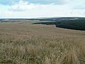
 View Towards Ardoch - geograph.org.uk - 979398.jpg 640 × 480; 198 KB
-
 Water Treatment Works Near Eaglesham - geograph.org.uk - 635400.jpg 640 × 480; 168 KB
-
 Waterfall in Eaglesham Glen or Green.JPG 2,288 × 1,712; 1.34 MB
-
 White Cart Water - geograph.org.uk - 635397.jpg 640 × 480; 180 KB
-
 Willow inosculation.JPG 2,288 × 1,712; 1.39 MB
-
 Wooded Hill Near Eaglesham - geograph.org.uk - 635408.jpg 640 × 480; 184 KB
-
 Zebra crossing at Glasgow Road - geograph.org.uk - 1585086.jpg 640 × 480; 137 KB


.jpg)


.jpg)


