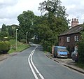
Category:Eagle, Lincolnshire
Jump to navigation
Jump to search
English: Eagle is a small, quiet, 'X' shaped village, south-west of Lincoln, England. It lies close to the A46 road.
village in Lincolnshire, United Kingdom | |||||
| Upload media | |||||
| Instance of | |||||
|---|---|---|---|---|---|
| Location | Eagle and Swinethorpe, North Kesteven, Lincolnshire, East Midlands, England | ||||
| Different from | |||||
 | |||||
Subcategories
This category has the following 4 subcategories, out of 4 total.
A
E
- Eagle Hall, Lincolnshire (10 F)
Media in category "Eagle, Lincolnshire"
The following 44 files are in this category, out of 44 total.
-
A536 Macclesfield Road, Eaton - geograph.org.uk - 1478440.jpg 640 × 601; 84 KB
-
Chapel House, Eagle - geograph.org.uk - 2386629.jpg 4,000 × 3,000; 2.91 MB
-
Church Close, Eagle - geograph.org.uk - 3599111.jpg 640 × 480; 109 KB
-
Crop field south of Eagle - geograph.org.uk - 3514484.jpg 640 × 480; 61 KB
-
Cycle Route 64 entering Eagle - geograph.org.uk - 2383461.jpg 4,000 × 3,000; 2.88 MB
-
Dusk at Swinethorpe - geograph.org.uk - 1826720.jpg 640 × 426; 99 KB
-
Dusk at Swinethorpe - geograph.org.uk - 1826733.jpg 640 × 426; 89 KB
-
Eagle and Thorpe AHB crossing - geograph.org.uk - 2232903.jpg 640 × 427; 64 KB
-
Eagle farmland - geograph.org.uk - 1830043.jpg 640 × 426; 95 KB
-
Eagle Post Office - geograph.org.uk - 3200130.jpg 640 × 427; 83 KB
-
Eight Row - geograph.org.uk - 904775.jpg 640 × 427; 60 KB
-
Field edge near Eagle - geograph.org.uk - 2540574.jpg 1,024 × 768; 197 KB
-
Fir Tree Farm - geograph.org.uk - 1830040.jpg 640 × 426; 112 KB
-
Footpath nr Eagle - geograph.org.uk - 1712087.jpg 640 × 447; 76 KB
-
Footpath to Eagle - geograph.org.uk - 278558.jpg 640 × 427; 87 KB
-
Gated public footpath near Eagle - geograph.org.uk - 1337278.jpg 640 × 480; 41 KB
-
High Street, Eagle - geograph.org.uk - 3514618.jpg 640 × 480; 71 KB
-
Hurn Wood - geograph.org.uk - 80571.jpg 640 × 427; 77 KB
-
Lines to Newark - geograph.org.uk - 361342.jpg 640 × 427; 90 KB
-
Mind how you drive - geograph.org.uk - 1712324.jpg 640 × 427; 84 KB
-
Old hedgeline - geograph.org.uk - 1830042.jpg 640 × 426; 67 KB
-
Paddock at Swinethorpe - geograph.org.uk - 2182460.jpg 640 × 427; 75 KB
-
Ponies and Aspen House - geograph.org.uk - 183600.jpg 640 × 427; 91 KB
-
Preston Farm - geograph.org.uk - 3583040.jpg 2,076 × 1,230; 1.65 MB
-
Signalbox and level crossing at Swinderby - geograph.org.uk - 2150981.jpg 1,024 × 757; 186 KB
-
Snowy Swinethorpe - geograph.org.uk - 2193117.jpg 640 × 427; 49 KB
-
Swinethorpe - geograph.org.uk - 2182448.jpg 640 × 427; 118 KB
-
Swinethorpe - geograph.org.uk - 2182453.jpg 640 × 427; 99 KB
-
Swinethorpe - geograph.org.uk - 2193115.jpg 640 × 427; 67 KB
-
The road towards Eagle village - geograph.org.uk - 1712070.jpg 640 × 451; 53 KB
-
The village Post Office, Eagle - geograph.org.uk - 3372359.jpg 1,600 × 1,200; 650 KB
-
Thorpe Lane near Eagle - geograph.org.uk - 2730900.jpg 1,280 × 960; 286 KB
-
View towards Grange Farm - geograph.org.uk - 2188201.jpg 640 × 427; 84 KB
-
Winter landscape near Eagle - geograph.org.uk - 1712197.jpg 640 × 427; 83 KB
-
Footpath to Eagle Barnsdale - geograph.org.uk - 167828.jpg 640 × 427; 81 KB
-
Housham Wood Farm - geograph.org.uk - 77656.jpg 640 × 427; 125 KB
-
Jobs Lane - geograph.org.uk - 183603.jpg 640 × 427; 101 KB
-
Preston Farm - geograph.org.uk - 76953.jpg 640 × 427; 61 KB
-
Scotland Farm - geograph.org.uk - 77651.jpg 640 × 427; 37 KB
-
View from Southern Lane - geograph.org.uk - 183605.jpg 640 × 427; 68 KB
-
Whisby Quarry - geograph.org.uk - 92098.jpg 640 × 427; 77 KB
-
Whisby Quarry from Jobs Lane - geograph.org.uk - 183602.jpg 640 × 427; 53 KB


