Category:Dutch Farm bridge
Jump to navigation
Jump to search
| Object location | | View all coordinates using: OpenStreetMap |
|---|
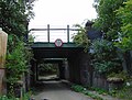
This is bridge SCR/1 on the Speke Junction to Church Road Junction branch.
Media in category "Dutch Farm bridge"
The following 4 files are in this category, out of 4 total.
-
 Benchmark at Dutch Farm Bridge.jpg 4,256 × 3,072; 7.58 MB
-
 Dutch Farm bridge 1.jpg 4,608 × 3,488; 7.32 MB
-
 Dutch Farm bridge 2.jpg 4,313 × 3,025; 7.55 MB
-
 Dutch Farm bridge 3.jpg 4,763 × 3,633; 9.84 MB


