Category:Dutch-language maps showing history of Europe
Jump to navigation
Jump to search
Subcategories
This category has only the following subcategory.
Media in category "Dutch-language maps showing history of Europe"
The following 77 files are in this category, out of 77 total.
-
1798bataafscherepubliek.svg 1,522 × 2,454; 1.55 MB
-
17e eeuws kaart met galgpaal.jpg 2,592 × 1,944; 480 KB
-
1801bataafscherepubliek.svg 1,521 × 2,255; 1.42 MB
-
1802bataafsgemenebest.svg 1,521 × 2,258; 1.41 MB
-
1910 Zeeland Bos.jpg 2,894 × 4,228; 2.13 MB
-
1e Punische oorlog.svg 835 × 394; 466 KB
-
1eEngelsNederlandseoorlog.png 401 × 535; 14 KB
-
20ste-eeuws Roemenië.gif 538 × 398; 14 KB
-
Antieke Boeotië.PNG 550 × 370; 24 KB
-
Atuatuca.PNG 435 × 497; 257 KB
-
Bakker Schut-plan.PNG 664 × 466; 23 KB
-
Barnsteenroutes.png 605 × 598; 12 KB
-
Battle of Actium-nl.png 2,984 × 2,219; 557 KB
-
Bijlmerramproute.png 511 × 354; 66 KB
-
Byzantijnse Rijk 1025.svg 2,670 × 958; 216 KB
-
Cimbrians and Teutons-nl.PNG 806 × 524; 35 KB
-
DerdeEngelsNederlandseoorlog.png 345 × 262; 9 KB
-
Despotate of Morea 1450-nl.svg 1,303 × 1,214; 228 KB
-
Duitse bond - Keizerrijk 1866-1867-1871.png 1,184 × 1,108; 73 KB
-
Etruskische beschaving.png 1,500 × 1,821; 727 KB
-
FatalevluchtBijlmer.JPG 640 × 512; 83 KB
-
Frankenrijk.jpg 1,400 × 1,180; 179 KB
-
Frankish Empire 481 to 814-nl.svg 1,735 × 1,227; 328 KB
-
Frankrijk 1350.svg 423 × 518; 189 KB
-
Friezen en Franken.jpg 845 × 573; 102 KB
-
Gotische oorlog.png 1,133 × 1,240; 1.09 MB
-
GraafschapLohn.gif 844 × 516; 46 KB
-
Greveningen nieuw.jpg 989 × 918; 123 KB
-
Greveningen.jpg 1,488 × 1,396; 529 KB
-
Groot-Bulgaarse Rijk (650-922).PNG 752 × 591; 37 KB
-
Groote Waard.jpg 1,201 × 713; 326 KB
-
Hannibal route of invasion-nl.png 762 × 476; 177 KB
-
Hannibal route of invasion-nl.svg 762 × 476; 495 KB
-
Iron Age Italy-nl.svg 432 × 525; 449 KB
-
Kaart Hanzesteden en handelsroutes.jpg 1,176 × 647; 853 KB
-
Kaart Kwintsheul1712.jpg 1,279 × 976; 311 KB
-
Kaart Monster1712.jpg 1,280 × 978; 349 KB
-
Kaart Scheveningen1712.jpg 1,278 × 976; 430 KB
-
Kaart van de diadochenrijken (300 v. Chr.).PNG 2,000 × 961; 1.71 MB
-
Kaartfransvlaanderen.jpg 502 × 346; 31 KB
-
Kon-holl.jpg 486 × 421; 60 KB
-
Koninkrijk.png 480 × 440; 11 KB
-
Lelantine War-nl.svg 711 × 723; 282 KB
-
Map Greece expansion 1832-1947-nl.svg 734 × 962; 56 KB
-
Map greek sanctuaries-nl.svg 993 × 793; 3.27 MB
-
Map Kingdom of Holland 1807-nl.svg 1,902 × 2,258; 619 KB
-
Map of the Imperial Circles (1560)-nl.svg 1,165 × 1,140; 342 KB
-
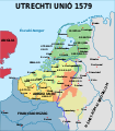
Map Union of Arras and Utrecht 1579-hu.svg 750 × 860; 134 KB
-
Map Union of Arras and Utrecht 1579-nl.svg 749 × 872; 139 KB
-
Marketgarden nederlands.png 655 × 897; 304 KB
-
NederlandDuitseBond.png 340 × 435; 26 KB
-
Nederlanden 1515.png 465 × 600; 99 KB
-
Nederlanden 1522.png 465 × 600; 99 KB
-
Nederlanden 1523.PNG 465 × 600; 82 KB
-
Nederlanden 1536.PNG 465 × 600; 83 KB
-
Nederlanden 1538.png 465 × 600; 100 KB
-
Nederlanden 1542-1543.png 465 × 600; 104 KB
-
OostenrijkseNederlanden.png 595 × 443; 25 KB
-
Ottomaanse Rijk in Centraal Europa in 1683 (NL).svg 877 × 605; 412 KB
-
Oude landkaart.jpg 808 × 474; 282 KB
-
Partition-plan-Flahaut-nl.svg 426 × 599; 312 KB
-
Partition-plan-Talleyrand-nl.svg 426 × 599; 312 KB
-
Plan Rome- Regiones.png 1,128 × 900; 200 KB
-
PlanFlahaut.png 485 × 692; 79 KB
-
Pontic-650-nl.PNG 406 × 448; 15 KB
-
Uitbreiding Pruisen 1807-1871.png 716 × 425; 30 KB
-
Uitbreiding Pruisen 1600-1795.png 510 × 357; 23 KB
-
Republiek kaart.PNG 1,756 × 1,368; 5.93 MB
-
Rijnmonden frisius.jpg 880 × 813; 340 KB
-
Roemenië 1600.png 360 × 284; 37 KB
-
Roemenië MASSR 1920.png 587 × 430; 44 KB
-
Romeinen kaart.png 600 × 995; 235 KB
-
Thessalië.png 561 × 599; 41 KB
-
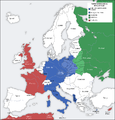
Tweede wereldoorlog inval in Polen 1939.png 960 × 1,000; 163 KB
-
Verdelingsplan Talleyrand.PNG 961 × 1,351; 205 KB
-
Vrede van Brest Litovsk in 1918.jpg 808 × 1,504; 242 KB
-
Vrede van Brest Litovsk.svg 810 × 1,158; 219 KB


