Category:Durweston
Jump to navigation
Jump to search
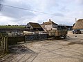
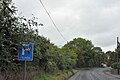
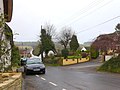
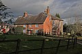
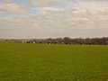
English: Durweston is a village in north Dorset, England, situated on the River Stour where it flows out of the Blackmore Vale through a steep, narrow gap between the Dorset Downs and Cranborne Chase hills, two miles west of Blandford Forum. The village has a population of 429. It was named in the Domesday Book of 1086, with a place-name of Derwinestone or Dervinestone, with references to a mill and vines. Its place name is unique, since there is no other settlement anywhere in the world named Durweston. There was once a coastal minesweeper called "HMS Durweston". She was launched at the Dorset Yacht Company’s Hamworthy yard on 18 August 1955.
village in Dorset, England, UK  | |||||
| Upload media | |||||
| Instance of | |||||
|---|---|---|---|---|---|
| Location | Dorset, South West England, England | ||||
| Population |
| ||||
| Said to be the same as | Durweston (Wikimedia duplicated page, civil parish) | ||||
 | |||||
Subcategories
This category has the following 4 subcategories, out of 4 total.
Media in category "Durweston"
The following 102 files are in this category, out of 102 total.
-
 A357 entering Durweston - geograph.org.uk - 5529659.jpg 640 × 427; 75 KB
-
 Barns, Shepherd's Corner Farm - geograph.org.uk - 1944648.jpg 640 × 399; 59 KB
-
 Bend at Enford Farm - geograph.org.uk - 5529664.jpg 640 × 427; 128 KB
-
 Bend in the A357 approaching Durweston - geograph.org.uk - 2076938.jpg 800 × 607; 169 KB
-
 Bend in the A357 at Enford Bottom - geograph.org.uk - 2077015.jpg 800 × 601; 220 KB
-
 Bridleway at The Plantation - geograph.org.uk - 3468589.jpg 640 × 480; 68 KB
-
 Daffodils by the A357 on south of Durweston - geograph.org.uk - 4834366.jpg 1,600 × 1,201; 261 KB
-
 Durweston Farmhouse - geograph.org.uk - 3338782.jpg 1,024 × 768; 160 KB
-
 Durweston Village Hall - geograph.org.uk - 3338830.jpg 1,024 × 768; 170 KB
-
 Durweston Village Hall - geograph.org.uk - 376944.jpg 640 × 427; 56 KB
-
 Durweston War Memorial - geograph.org.uk - 3124121.jpg 640 × 457; 80 KB
-
 Durweston, detail of finger-post - geograph.org.uk - 1915857.jpg 640 × 480; 71 KB
-
 Durweston, farmland - geograph.org.uk - 3343675.jpg 1,024 × 768; 124 KB
-
 Durweston, farmland - geograph.org.uk - 3343688.jpg 1,024 × 768; 178 KB
-
 Durweston, farmyard - geograph.org.uk - 3343658.jpg 1,024 × 768; 148 KB
-
 Durweston, fingerpost - geograph.org.uk - 3338752.jpg 768 × 1,024; 198 KB
-
 Durweston, Knighton Dairy - geograph.org.uk - 3339104.jpg 1,024 × 768; 152 KB
-
 Durweston, old finger post - geograph.org.uk - 1318585.jpg 480 × 640; 112 KB
-

-
 Durweston, playground - geograph.org.uk - 3339099.jpg 1,024 × 768; 226 KB
-

-
 Durweston, primary school - geograph.org.uk - 3338816.jpg 1,024 × 768; 161 KB
-
 Durweston, red telephone box - geograph.org.uk - 3477173.jpg 640 × 480; 98 KB
-
 Durweston, roadside daffodils - geograph.org.uk - 4393784.jpg 640 × 480; 91 KB
-
 Durweston, stile - geograph.org.uk - 3339094.jpg 768 × 1,024; 228 KB
-
 Durweston, Stour Valley Way - geograph.org.uk - 3339108.jpg 768 × 1,024; 125 KB
-
 Durweston, thatched cottages - geograph.org.uk - 3338791.jpg 1,024 × 948; 201 KB
-
 Durweston, Traveller's Rest Farm - geograph.org.uk - 3343682.jpg 1,024 × 757; 99 KB
-
 Durweston, war memorial - geograph.org.uk - 3338774.jpg 755 × 1,024; 180 KB
-
 Durweston, Water Lane - geograph.org.uk - 3338767.jpg 769 × 1,024; 256 KB
-
 Enford Farm - geograph.org.uk - 4834323.jpg 1,598 × 1,600; 240 KB
-
 Field Grove House - geograph.org.uk - 4864892.jpg 640 × 427; 99 KB
-
 Field next to Suttcombe Wood. - geograph.org.uk - 3289174.jpg 640 × 480; 73 KB
-
 Fields at Milton Lane - geograph.org.uk - 3289316.jpg 640 × 480; 72 KB
-
 Fodder Field at Blackfern Plantation - geograph.org.uk - 3289368.jpg 640 × 480; 86 KB
-
 Footpath by The Plantation - geograph.org.uk - 1944290.jpg 640 × 432; 81 KB
-
 Footpath crossroads in Turnworth - geograph.org.uk - 4890526.jpg 427 × 640; 54 KB
-
 Former Durweston Mill - geograph.org.uk - 6574135.jpg 1,024 × 683; 293 KB
-
 Former Durweston Mill and weir - geograph.org.uk - 6574134.jpg 1,024 × 683; 247 KB
-
 Free Down Border - geograph.org.uk - 3468600.jpg 640 × 480; 64 KB
-
 Free Down Border - geograph.org.uk - 4864880.jpg 640 × 427; 57 KB
-
 Grassland and woodland by Durweston Bridge - geograph.org.uk - 4834375.jpg 1,600 × 1,200; 200 KB
-
 Half mile to layby - geograph.org.uk - 5529662.jpg 640 × 427; 74 KB
-
 Houses in Durweston - geograph.org.uk - 3289139.jpg 640 × 480; 74 KB
-
 Jubilee Trail - geograph.org.uk - 1949469.jpg 640 × 417; 92 KB
-
 Jubilee Trail - geograph.org.uk - 1950288.jpg 640 × 480; 107 KB
-
 Jubilee Trail through Field Grove - geograph.org.uk - 4864831.jpg 640 × 427; 104 KB
-
 Jubilee Trail, Durweston - geograph.org.uk - 1390033.jpg 640 × 481; 214 KB
-
 Knighton Manor - Durweston - geograph.org.uk - 626887.jpg 640 × 422; 176 KB
-
 Lay-by north of Durweston, Dorset - geograph.org.uk - 2412171.jpg 1,024 × 768; 142 KB
-
 Lay-by on the A357 north of Durweston - geograph.org.uk - 4834341.jpg 1,598 × 1,600; 340 KB
-
 New Road near Winterborne Stickland - geograph.org.uk - 4890635.jpg 427 × 640; 87 KB
-
 Norton Lane - geograph.org.uk - 1944316.jpg 640 × 480; 115 KB
-

-

-

-
 Old road lay-by at Durweston - geograph.org.uk - 3707309.jpg 3,648 × 2,736; 3.88 MB
-
 Old Warren - geograph.org.uk - 377045.jpg 640 × 330; 61 KB
-
 Outhouses at The Folly - geograph.org.uk - 1944283.jpg 640 × 480; 107 KB
-
 Pond, Durweston Mill - geograph.org.uk - 1949426.jpg 480 × 640; 137 KB
-
 Poppies, Shepherd's Corner Farm - geograph.org.uk - 1944330.jpg 640 × 480; 103 KB
-
 Poppies, Shepherd's Corner Farm - geograph.org.uk - 1944483.jpg 640 × 459; 118 KB
-
 Purple poppies - geograph.org.uk - 1935931.jpg 2,816 × 2,112; 2.42 MB
-
 Pyramidal orchid above Durweston - geograph.org.uk - 1950301.jpg 488 × 640; 50 KB
-
 River Stour - geograph.org.uk - 1949356.jpg 480 × 640; 86 KB
-
 River Stour - geograph.org.uk - 6574130.jpg 1,024 × 683; 304 KB
-
 River Stour at Pressham Wood - geograph.org.uk - 3289122.jpg 640 × 480; 115 KB
-
 River Stour from Durweston Bridge - geograph.org.uk - 4834380.jpg 1,600 × 1,005; 225 KB
-
 Row of Cottages - geograph.org.uk - 382957.jpg 640 × 427; 71 KB
-
 Slucegates near the River Stour, off Mill Lane in Durweston. Peter Neaum. - panoramio.jpg 2,864 × 1,973; 3.41 MB
-
 Sluices on the footbridge at Durweston Mill - geograph.org.uk - 6574136.jpg 1,024 × 683; 201 KB
-

-
 The Mill at Durweston - geograph.org.uk - 1425640.jpg 640 × 482; 78 KB
-
 Towards Durweston - geograph.org.uk - 1949169.jpg 640 × 446; 102 KB
-
 Bridleway to Quarleston Down - geograph.org.uk - 459958.jpg 640 × 480; 108 KB
-
 Broadley Wood - geograph.org.uk - 376514.jpg 640 × 427; 139 KB
-
 Bryanston Club - geograph.org.uk - 163313.jpg 600 × 450; 74 KB
-
 Bryanston School at twilight - geograph.org.uk - 359272.jpg 640 × 427; 89 KB
-
 Downland Pasture, Bryanston - geograph.org.uk - 371922.jpg 640 × 480; 66 KB
-
 Durweston CE VA Primary School - geograph.org.uk - 382943.jpg 640 × 427; 118 KB
-
 Durweston School and Old School House - geograph.org.uk - 376957.jpg 640 × 427; 95 KB
-
 Edge of Field Grove - geograph.org.uk - 376342.jpg 640 × 427; 108 KB
-
 Enford Bottom - geograph.org.uk - 365875.jpg 640 × 427; 73 KB
-
 Enford Bottom - geograph.org.uk - 373448.jpg 640 × 427; 105 KB
-
 Field Grove - geograph.org.uk - 376338.jpg 640 × 427; 87 KB
-
 Footpath to Higher Barn Cottages - geograph.org.uk - 459970.jpg 640 × 480; 103 KB
-
 Higher Barn - geograph.org.uk - 376511.jpg 640 × 427; 82 KB
-
 House at Old Warren - geograph.org.uk - 377211.jpg 640 × 427; 72 KB
-
 Knighton House School, Durweston - geograph.org.uk - 163327.jpg 600 × 450; 91 KB
-
 Large sheep or hibernating caravans^ - geograph.org.uk - 371747.jpg 640 × 480; 80 KB
-
 Lodge on Bryanston estate - geograph.org.uk - 163320.jpg 600 × 450; 98 KB
-
 Milton Lane - geograph.org.uk - 382083.jpg 640 × 427; 98 KB
-
 Morgan's Wood - geograph.org.uk - 376347.jpg 640 × 427; 148 KB
-
 Near Websley Farm - geograph.org.uk - 376524.jpg 640 × 427; 93 KB
-
 No rain today^ near Bryanston - geograph.org.uk - 371915.jpg 640 × 480; 82 KB
-
 Norton Wood - geograph.org.uk - 369895.jpg 640 × 427; 138 KB
-
 Old Warren Plantation - geograph.org.uk - 372447.jpg 640 × 480; 99 KB
-
 Signpost - geograph.org.uk - 376353.jpg 640 × 427; 78 KB
-
 Traveller's Rest Farmhouse - geograph.org.uk - 376975.jpg 640 × 427; 126 KB
-
 Traveller's Rest Farmhouse - geograph.org.uk - 376988.jpg 640 × 465; 57 KB
-
 Village sign - geograph.org.uk - 163329.jpg 600 × 450; 63 KB
-
 Websley Farm - geograph.org.uk - 376521.jpg 640 × 427; 77 KB


