Category:Durleigh
Jump to navigation
Jump to search
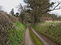
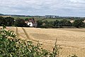
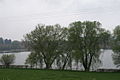
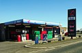
English: Durleigh is a village and civil parish on the outskirts of Bridgwater in the Sedgemoor district of Somerset, England.
village in the United Kingdom  | |||||
| Upload media | |||||
| Instance of | |||||
|---|---|---|---|---|---|
| Location | Sedgemoor, Somerset, South West England, England | ||||
| Said to be the same as | Durleigh (Wikimedia duplicated page, civil parish) | ||||
 | |||||
Subcategories
This category has the following 2 subcategories, out of 2 total.
H
- St Hugh's church, Durleigh (7 F)
W
- West Bower Manor (2 F)
Media in category "Durleigh"
The following 97 files are in this category, out of 97 total.
-
 Abandoned trailer - geograph.org.uk - 1835300.jpg 640 × 480; 111 KB
-
 Bower Lane, Durleigh - geograph.org.uk - 1192317.jpg 640 × 480; 130 KB
-
 Bridge over Hamp Brook - geograph.org.uk - 1835262.jpg 480 × 640; 133 KB
-
 Bridgwater , Cornflower Close - geograph.org.uk - 4846247.jpg 6,000 × 4,000; 4.26 MB
-
 Bridgwater , Durleigh Road - geograph.org.uk - 4842137.jpg 6,000 × 4,000; 6.35 MB
-
 Bridgwater , Grassy Field - geograph.org.uk - 4846222.jpg 6,000 × 4,000; 5.52 MB
-
 Bridgwater , Grassy Field - geograph.org.uk - 4846229.jpg 6,000 × 4,000; 4.96 MB
-
 Bridgwater , Grassy Field - geograph.org.uk - 4846230.jpg 6,000 × 4,000; 7.29 MB
-
 Bridgwater , Grassy Field - geograph.org.uk - 4846234.jpg 5,876 × 3,917; 5.67 MB
-
 Bridgwater , Grassy Field - geograph.org.uk - 4846238.jpg 5,692 × 3,795; 6.34 MB
-
 Bridgwater , Grassy Field - geograph.org.uk - 4846245.jpg 6,000 × 4,000; 4.45 MB
-
 Bridgwater , Grassy Field ^ Footbridge - geograph.org.uk - 4846231.jpg 6,000 × 4,000; 5.46 MB
-
 Bridgwater , Hamp Brook - geograph.org.uk - 4846232.jpg 4,000 × 6,000; 6.15 MB
-
 Bridgwater , Luxborough Road - geograph.org.uk - 4840760.jpg 6,000 × 4,000; 3.87 MB
-
 Bridgwater , Rhode Lane - geograph.org.uk - 4846239.jpg 6,000 × 4,000; 6.69 MB
-
 Bridgwater , Rhode Lane - geograph.org.uk - 4846242.jpg 6,000 × 4,000; 5.21 MB
-
 Bridgwater , Signpost - geograph.org.uk - 4840757.jpg 6,000 × 4,000; 6.12 MB
-
 Bridgwater , Small Stream - geograph.org.uk - 4846188.jpg 4,000 × 6,000; 5.55 MB
-
 Bridgwater , Spaxton Road - geograph.org.uk - 4840758.jpg 6,000 × 4,000; 6.7 MB
-
 Bridgwater , Spaxton Road - geograph.org.uk - 4840759.jpg 6,000 × 4,000; 4.08 MB
-
 Bridgwater , The Meads Eco-Park - geograph.org.uk - 4846209.jpg 6,000 × 4,000; 4.85 MB
-
 Building work at West Bower Farmhouse - geograph.org.uk - 4485704.jpg 1,024 × 768; 160 KB
-
 Clayhill Cottages - geograph.org.uk - 1988595.jpg 640 × 427; 85 KB
-

-

-
 Crossroads on Durleigh Hill - geograph.org.uk - 4485252.jpg 1,024 × 806; 210 KB
-
 Drainage channel, The Meads - geograph.org.uk - 1692178.jpg 640 × 480; 88 KB
-
 Durleigh , Durleigh Brook - geograph.org.uk - 4840716.jpg 4,000 × 6,000; 7.74 MB
-
 Durleigh , Durleigh Farm - geograph.org.uk - 4840713.jpg 6,000 × 4,000; 6.35 MB
-
 Durleigh , Durleigh Hill - geograph.org.uk - 4840655.jpg 6,000 × 4,000; 5.39 MB
-
 Durleigh , Durleigh Hill - geograph.org.uk - 4840658.jpg 6,000 × 4,000; 5.38 MB
-
 Durleigh , Durleigh Reservoir Entrance - geograph.org.uk - 4840708.jpg 6,000 × 4,000; 5.43 MB
-
 Durleigh , Enmore Road - geograph.org.uk - 4840659.jpg 6,000 × 4,000; 5.85 MB
-
 Durleigh , Enmore Road - geograph.org.uk - 4840670.jpg 6,000 × 4,000; 3.88 MB
-
 Durleigh , Reservoir Pump House - geograph.org.uk - 4840752.jpg 6,000 × 4,000; 3.42 MB
-
 Durleigh , Wedding Elegance - geograph.org.uk - 4840662.jpg 6,000 × 4,000; 4.04 MB
-
 Durleigh Brook and water treatment works - geograph.org.uk - 1192327.jpg 640 × 480; 133 KB
-
 Durleigh Dam and Reservoir - geograph.org.uk - 1192321.jpg 640 × 480; 115 KB
-
 Durleigh Hill and Enmore Road - geograph.org.uk - 3107958.jpg 640 × 480; 322 KB
-
 Durleigh Reservoir - geograph.org.uk - 2884660.jpg 640 × 480; 215 KB
-
 Durleigh Reservoir - geograph.org.uk - 4486246.jpg 1,024 × 735; 211 KB
-
 Durleigh Reservoir in autumn - geograph.org.uk - 1076102.jpg 640 × 480; 116 KB
-

-
 Durleigh reservoir.jpg 640 × 426; 116 KB
-
 Durleigh Road - geograph.org.uk - 1691929.jpg 640 × 408; 51 KB
-
 Durleigh water treatment works - geograph.org.uk - 1192323.jpg 640 × 480; 69 KB
-
 Enmore Road - geograph.org.uk - 2884651.jpg 640 × 480; 335 KB
-
 Entrance to Rexworthy Farm - geograph.org.uk - 1214563.jpg 640 × 480; 105 KB
-
 Field boundary by the Hamp Brook - geograph.org.uk - 1835288.jpg 640 × 480; 124 KB
-
 Field by Skimmerton Lane - geograph.org.uk - 1988712.jpg 640 × 480; 97 KB
-
 Field by Skimmerton Lane - geograph.org.uk - 1988747.jpg 640 × 425; 76 KB
-
 Field near Crossfield Farm - geograph.org.uk - 1214600.jpg 640 × 480; 128 KB
-
 Field, Durleigh - geograph.org.uk - 2884655.jpg 640 × 322; 166 KB
-
 Floodgate House - geograph.org.uk - 1835337.jpg 640 × 394; 80 KB
-
 Footpath By Gothelney Hall - geograph.org.uk - 1436759.jpg 640 × 480; 130 KB
-
 Hamp Brook - geograph.org.uk - 1692187.jpg 640 × 480; 81 KB
-
 Harvested field by Spaxton Road - geograph.org.uk - 1988565.jpg 640 × 480; 104 KB
-
 House at Floodgate, Rhode Lane - geograph.org.uk - 1192347.jpg 640 × 480; 73 KB
-
 House on Durleigh Hill - geograph.org.uk - 4485243.jpg 1,024 × 768; 212 KB
-
 Housebuilding at Milford Farm - geograph.org.uk - 4485246.jpg 1,024 × 823; 221 KB
-
 Lane to Rexworthy Farm (1) - geograph.org.uk - 1214554.jpg 640 × 480; 140 KB
-
 Lane to Rexworthy Farm (2) - geograph.org.uk - 1214557.jpg 640 × 480; 227 KB
-
 Little Clayhill Farm - geograph.org.uk - 1988684.jpg 640 × 407; 59 KB
-

-

-

-
 Pace service station, near Wembdon, Somerset - geograph.org.uk - 3434440.jpg 1,024 × 668; 128 KB
-
 Panorama, Clayhill - geograph.org.uk - 1988585.jpg 640 × 400; 75 KB
-
 Power line crossing Rhode Lane - geograph.org.uk - 1192342.jpg 640 × 480; 70 KB
-
 Pylon over Hollands Cottages - geograph.org.uk - 1214568.jpg 640 × 480; 156 KB
-
 Rhode Lane, near Bridgwater - geograph.org.uk - 1192351.jpg 640 × 480; 97 KB
-
 Road at Crossmoor House - geograph.org.uk - 1987950.jpg 480 × 640; 97 KB
-
 Sedgemoor , Claires House - geograph.org.uk - 4840637.jpg 6,000 × 4,000; 3.65 MB
-
 Sedgemoor , Durleigh Hill - geograph.org.uk - 4840650.jpg 4,000 × 6,000; 5.88 MB
-
 Sedgemoor , Floodgate Farm - geograph.org.uk - 4840639.jpg 6,000 × 4,000; 4.17 MB
-
 Sedgemoor , Grassy Field - geograph.org.uk - 4840391.jpg 6,000 × 4,000; 5.21 MB
-
 Sedgemoor , Grassy Field - geograph.org.uk - 4840629.jpg 6,000 × 4,000; 5.42 MB
-
 Sedgemoor , Grassy Field - geograph.org.uk - 4840645.jpg 6,000 × 4,000; 6.73 MB
-
 Sedgemoor , Mulberry House - geograph.org.uk - 4840630.jpg 6,000 × 4,000; 6.77 MB
-
 Sedgemoor , Rhode Lane - geograph.org.uk - 4840625.jpg 6,000 × 4,000; 5.9 MB
-
 Sedgemoor , Rhode Lane - geograph.org.uk - 4840626.jpg 6,000 × 4,000; 4.25 MB
-
 Sedgemoor , Rhode Lane - geograph.org.uk - 4840634.jpg 6,000 × 4,000; 7.08 MB
-
 Sedgemoor , Rhode Lane - geograph.org.uk - 4840641.jpg 6,000 × 4,000; 4.59 MB
-
 Sedgemoor , Rhode Lane - geograph.org.uk - 4840644.jpg 6,000 × 4,000; 6.63 MB
-
 Sedgemoor , Solar Farm - geograph.org.uk - 4840653.jpg 5,601 × 3,734; 4.49 MB
-
 Spaxton Road - geograph.org.uk - 1988695.jpg 640 × 453; 80 KB
-
 The Meads - geograph.org.uk - 1692075.jpg 640 × 480; 108 KB
-
 Towards the Durleigh Brook - geograph.org.uk - 1691977.jpg 640 × 471; 90 KB
-
 View towards Durleigh Reservoir - geograph.org.uk - 4486267.jpg 1,024 × 758; 160 KB
-
 Wessex water treatment works, Durleigh - geograph.org.uk - 4485249.jpg 1,024 × 768; 158 KB
-
 Durleigh Sailing Club - geograph.org.uk - 157305.jpg 640 × 426; 88 KB
-
 Enmore Inn - geograph.org.uk - 157318.jpg 640 × 426; 99 KB
-
 Field - geograph.org.uk - 157327.jpg 640 × 426; 107 KB
-
 Field - geograph.org.uk - 157330.jpg 640 × 426; 120 KB
-
 Poples Cottage - geograph.org.uk - 157319.jpg 640 × 426; 95 KB
-
 Rhode Scene - geograph.org.uk - 157343.jpg 640 × 426; 119 KB
-
 Rice's Farm. - geograph.org.uk - 146061.jpg 640 × 453; 89 KB


_-_geograph.org.uk_-_6234637.jpg)


_-_geograph.org.uk_-_1214554.jpg)
_-_geograph.org.uk_-_1214557.jpg)


