Category:Duntroon, New Zealand
Jump to navigation
Jump to search
locality in New Zealand  | |||||
| Upload media | |||||
| Instance of | |||||
|---|---|---|---|---|---|
| Location |
| ||||
| Population |
| ||||
 | |||||
English: The 2001 census recorded Duntroon as having a population of 120, consisting of 69 females and 51 males, an increase of 3 people or 2.6% since the 1996 census. By the 2006 census the population had declined to 114. The town was named by Scottish settler and farmer Robert Campbell. Economic activity has been mainly agricultural for much of the town's history, focusing primarily on sheep farming and the growth of crops such as wheat and barley. (→Duntroon, New Zealand)
Nederlands: Duntroon is een klein boerendorp in de regio Otago op het zuidereiland van Nieuw-Zeeland. Het ligt iets ten noorden van Oamaru in het Waitaki District. Vlakbij Duntroon zijn kliffen van kalksteen. (→Duntroon)
Deutsch: Duntroon (vom Schottischen Gälisch Dùn Treòin) ist eine kleine Landgemeinde im Waitaki-Distrikt auf Neuseelands Südinsel.
Subcategories
This category has the following 5 subcategories, out of 5 total.
G
- Duntroon Gaol (4 F)
N
- Nicol's Blacksmith Shop (4 F)
T
- Takiroa Rock Art Site (17 F)
V
- Vanished World Centre (4 F)
Media in category "Duntroon, New Zealand"
The following 9 files are in this category, out of 9 total.
-
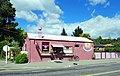 Duntroon Flying Pig Cafe.JPG 3,644 × 2,312; 3.48 MB
-
 Duntroon Flying Pigs.JPG 3,872 × 2,592; 2.8 MB
-
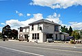 Duntroon Hotel 001.JPG 3,632 × 2,516; 3.97 MB
-
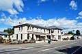 Duntroon Hotel 002.JPG 3,564 × 2,348; 3.63 MB
-
 Duntroon Main Street.JPG 3,608 × 2,416; 3.64 MB
-
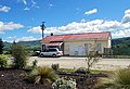 Duntroon Railway Station 001.JPG 3,532 × 2,420; 3.54 MB
-
 Duntroon Railway Station 002.JPG 3,872 × 2,592; 4.17 MB
-
 Duntroon Tree.JPG 2,592 × 3,872; 4.07 MB
-
 Duntroon War Memorial.JPG 3,724 × 2,424; 3.94 MB


