Category:Dunswell Lane underpass, East Riding of Yorkshire
Jump to navigation
Jump to search
Media in category "Dunswell Lane underpass, East Riding of Yorkshire"
The following 8 files are in this category, out of 8 total.
-
 Clay Hall Underpass, Cottingham - geograph.org.uk - 666979.jpg 640 × 447; 78 KB
-
 Dunswell Lane (geograph 4338671).jpg 1,024 × 768; 138 KB
-
 Dunswell Lane (geograph 6007222).jpg 1,024 × 768; 200 KB
-
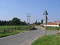
 Dunswell Lane and Beverley Bypass - geograph.org.uk - 390239.jpg 640 × 480; 66 KB
-
 Dunswell Lane at the southern Beverley bypass (geograph 2215936).jpg 800 × 600; 206 KB
-
 Dunswell Lane goes under the A1079 (geograph 5236392).jpg 1,200 × 799; 299 KB
-
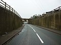
 Dunswell Lane Underpass - geograph.org.uk - 49263.jpg 640 × 480; 89 KB
-
 The road to Dunswell goes under the A1079 Beverley bypass (geograph 4374702).jpg 4,608 × 3,456; 5.63 MB

.jpg)
.jpg)

.jpg)
.jpg)

.jpg)