Category:Dunston, Staffordshire
Jump to navigation
Jump to search
English: Dunston is a small village in England lying on the west side of the A449 trunk road about . In 1680, there were 20 houses in Dunston, and in 1817 44 houses, with a population of 214. The population in 1951 was 295.
village and civil parish in Staffordshire, UK  | |||||
| Upload media | |||||
| Instance of | |||||
|---|---|---|---|---|---|
| Location | South Staffordshire, Staffordshire, West Midlands, England | ||||
| Population |
| ||||
| Said to be the same as | Dunston (Wikimedia duplicated page, civil parish) | ||||
 | |||||
Subcategories
This category has only the following subcategory.
L
Media in category "Dunston, Staffordshire"
The following 98 files are in this category, out of 98 total.
-
 A 449 near Home Farm - geograph.org.uk - 108882.jpg 640 × 480; 92 KB
-
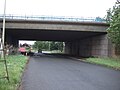
 A farm track crosses the M6 - geograph.org.uk - 4571212.jpg 1,500 × 995; 122 KB
-
 A449 approaching Dunston - geograph.org.uk - 6237791.jpg 800 × 600; 81 KB
-
 A449 at Dunston village boundary - geograph.org.uk - 4636965.jpg 640 × 481; 44 KB
-
 A449 in Dunston village - geograph.org.uk - 4636966.jpg 640 × 481; 52 KB
-
 A449 looking south near Dunston - geograph.org.uk - 2060803.jpg 640 × 480; 70 KB
-
 A449, Dunston - geograph.org.uk - 6237799.jpg 640 × 480; 83 KB
-
 Acton Bridge 93 - geograph.org.uk - 83751.jpg 640 × 480; 106 KB
-
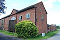
 Barn and stables at Hope Farm - geograph.org.uk - 4910762.jpg 1,600 × 1,064; 475 KB
-
 Bench-mark on Dunstan Church - geograph.org.uk - 3543650.jpg 2,560 × 1,920; 1.01 MB
-
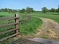
 Bridleway Across Field, Whittemore Lane - geograph.org.uk - 2472997.jpg 640 × 428; 109 KB
-
 Bridleway near Dunston - geograph.org.uk - 4548023.jpg 6,000 × 4,000; 5.83 MB
-
 Church of St James, Acton Trussell - geograph.org.uk - 2654729.jpg 640 × 430; 35 KB
-
-
 Dunston , Grassy Field - geograph.org.uk - 6284972.jpg 6,000 × 4,000; 4.16 MB
-
 Dunston , M6 Motorway - geograph.org.uk - 6284970.jpg 6,000 × 4,000; 4.2 MB
-
 Dunston , M6 Motorway - geograph.org.uk - 6284973.jpg 6,000 × 4,000; 4.89 MB
-
 Dunston , M6 Motorway - geograph.org.uk - 6284975.jpg 6,000 × 4,000; 4.69 MB
-
 Dunston Farm, Junction 13 M6 - geograph.org.uk - 2496911.jpg 640 × 428; 71 KB
-
 Dunston from the M6 - geograph.org.uk - 3380400.jpg 2,590 × 1,376; 808 KB
-
 Dunston Hall - geograph.org.uk - 858563.jpg 640 × 480; 102 KB
-
 Dunston school.JPG 1,353 × 956; 284 KB
-
 Dunston sign.JPG 576 × 643; 117 KB
-

-
 Entering Dunston Heath - geograph.org.uk - 2478322.jpg 640 × 428; 94 KB
-
 Farm track over the railway - geograph.org.uk - 2633131.jpg 640 × 480; 72 KB
-
 Farmhouse north of Dunston - geograph.org.uk - 4910947.jpg 1,600 × 1,064; 374 KB
-
 Farmland and a train near Dunston - geograph.org.uk - 4547996.jpg 6,000 × 4,000; 4.12 MB
-
 Farmland at Dunston Heath - geograph.org.uk - 4910822.jpg 1,600 × 1,064; 459 KB
-
 Field and houses at Dunston - geograph.org.uk - 250540.jpg 640 × 480; 78 KB
-
 Fields near the M6 - geograph.org.uk - 6237786.jpg 800 × 600; 98 KB
-
 Fingerpost at 'The Toft' crossroads - geograph.org.uk - 847653.jpg 640 × 480; 134 KB
-
 Footpath over the fields from Dunston - geograph.org.uk - 2440809.jpg 3,872 × 2,592; 4.84 MB
-
 Footpath towards Acton Trussell - geograph.org.uk - 6237787.jpg 800 × 600; 122 KB
-

-
 Grassy field near Dunston - geograph.org.uk - 4548013.jpg 6,000 × 4,000; 5.52 MB
-
 Grazing towards the M6 Motorway - geograph.org.uk - 6237783.jpg 800 × 600; 112 KB
-
 Hay House Farm, Dunston - geograph.org.uk - 2472972.jpg 640 × 428; 81 KB
-
 Heading to Lower Drayton Farm - geograph.org.uk - 1435281.jpg 640 × 601; 54 KB
-
 Home Farm house beside the A449 - geograph.org.uk - 2782678.jpg 1,142 × 857; 310 KB
-
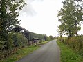
 Hope Farm, Whittemore Lane - geograph.org.uk - 2472960.jpg 640 × 428; 91 KB
-
 Houses near Dairy Farm, Dunston - geograph.org.uk - 6237797.jpg 800 × 600; 90 KB
-
 Houses on the A449, Dunston - geograph.org.uk - 6237793.jpg 800 × 600; 100 KB
-

-
 Lane junction at The Toft - geograph.org.uk - 2060850.jpg 640 × 480; 57 KB
-
 Lane near Hope Farm - geograph.org.uk - 2633122.jpg 640 × 480; 111 KB
-
 Lane to the Toft Farm - geograph.org.uk - 2478348.jpg 640 × 428; 114 KB
-
 Late 2nd C. Apsidal wing of Roman Villa - geograph.org.uk - 3242311.jpg 640 × 427; 117 KB
-
 Layby on the A449 near Dunston - geograph.org.uk - 2440812.jpg 3,872 × 2,592; 3.75 MB
-
 Little Heath crossroads - geograph.org.uk - 847662.jpg 640 × 480; 89 KB
-
 Little Heath lane junction - geograph.org.uk - 2060841.jpg 640 × 480; 46 KB
-

-
-
 M6 near Acton Trussell - geograph.org.uk - 2654732.jpg 640 × 430; 36 KB
-
 Near Teddesley Bridge - geograph.org.uk - 416022.jpg 640 × 480; 95 KB
-

-
 Old Vicarage Lane, Dunston - geograph.org.uk - 858575.jpg 640 × 480; 121 KB
-
 Ordnance Survey flush bracket on Dunstan Church - geograph.org.uk - 3543681.jpg 2,560 × 1,920; 1.05 MB
-
 OS flush bracket - Dunston Church - geograph.org.uk - 4973092.jpg 1,102 × 1,469; 909 KB
-
 Parkland, Dunston Hall - geograph.org.uk - 6237788.jpg 800 × 600; 142 KB
-
 Power supply at Little Heath - geograph.org.uk - 3668067.jpg 1,600 × 1,064; 471 KB
-

-
 School Lane-Whittamoor Lane junction - geograph.org.uk - 2060833.jpg 640 × 480; 91 KB
-
 South Staffordshire , A449 Road - geograph.org.uk - 3724924.jpg 4,276 × 2,830; 6.57 MB
-
 South Staffordshire , Countryside Scenery - geograph.org.uk - 3724919.jpg 4,274 × 2,826; 6.41 MB
-
 South Staffordshire , Countryside Scenery - geograph.org.uk - 3724922.jpg 4,288 × 2,848; 6.3 MB
-
 South Staffordshire , Dunston Scenery - geograph.org.uk - 4933583.jpg 6,000 × 4,000; 6.98 MB
-
 South Staffordshire , Grassy Field ^ Trees - geograph.org.uk - 4933581.jpg 6,000 × 4,000; 7.48 MB
-
 South Staffordshire , Grassy Field ^ Trees - geograph.org.uk - 4933582.jpg 6,000 × 4,000; 5.72 MB
-
 South Staffordshire , The M6 Motorway - geograph.org.uk - 3724915.jpg 4,288 × 2,848; 4.61 MB
-
 South Staffordshire , The M6 Motorway - geograph.org.uk - 3724927.jpg 4,266 × 2,816; 5.95 MB
-
 Speed camera on the A449 through Dunston - geograph.org.uk - 2440788.jpg 3,872 × 2,592; 4.34 MB
-
 St Leonard's Church, Dunston - geograph.org.uk - 2440779.jpg 3,872 × 2,592; 4.4 MB
-
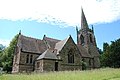 St Leonard's Church, Dunston - geograph.org.uk - 2478312.jpg 640 × 428; 68 KB
-
 St Leonard's Church, Dunston - geograph.org.uk - 6237794.jpg 800 × 600; 112 KB
-
 Stile to a field of Oilseed Rape - geograph.org.uk - 762826.jpg 640 × 480; 91 KB
-
 Taking their time - geograph.org.uk - 700048.jpg 640 × 426; 114 KB
-
 Teddesley Bridge - geograph.org.uk - 415998.jpg 640 × 480; 125 KB
-
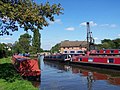 Teddesley Marina - geograph.org.uk - 235888.jpg 640 × 480; 94 KB
-
 The bridleway leading to Lower Drayton - geograph.org.uk - 2782673.jpg 734 × 979; 387 KB
-
 The lane to Butterhill - geograph.org.uk - 847660.jpg 640 × 480; 93 KB
-
 The M6 heading north - geograph.org.uk - 4571213.jpg 1,500 × 999; 98 KB
-
 The M6 travelling north - geograph.org.uk - 4576473.jpg 1,500 × 999; 122 KB
-
 The Toft - geograph.org.uk - 3668045.jpg 1,600 × 1,064; 374 KB
-

-
 Turn left to Dunston Heath - geograph.org.uk - 2633127.jpg 640 × 480; 65 KB
-
 Victorian estate cottages - geograph.org.uk - 4910830.jpg 1,600 × 1,064; 395 KB
-
 Warehouse beside the M6 - geograph.org.uk - 2900357.jpg 3,718 × 1,599; 1.96 MB
-
 Crows on the lampposts, dawn - geograph.org.uk - 250542.jpg 480 × 640; 16 KB
-
 Dryad's Saddle Fungus - geograph.org.uk - 552410.jpg 640 × 480; 128 KB
-
 Entrance to Plashes Farm - geograph.org.uk - 235895.jpg 640 × 480; 134 KB
-
 Grass Field near Dunston Heath Farm - geograph.org.uk - 237950.jpg 640 × 480; 88 KB
-
 Pasture, Plashes Farm - geograph.org.uk - 235897.jpg 640 × 480; 90 KB
-
 Plashes Farm - geograph.org.uk - 235898.jpg 640 × 480; 54 KB
-
 Road and Canal - geograph.org.uk - 235891.jpg 640 × 480; 120 KB
-
 Stubble - geograph.org.uk - 235896.jpg 640 × 480; 114 KB
-
 Teddesley - geograph.org.uk - 235887.jpg 640 × 480; 102 KB
-


_-_geograph.org.uk_-_3527272.jpg)


