Category:Dunston, Norfolk
Jump to navigation
Jump to search
English: Dunston is a small village which lies approximately 3 miles south of Norwich. It is located in the valley of the River Tas between Stoke Holy Cross and Caistor St. Edmund. It has a common which is popular with walkers.
village in Norfolk, United Kingdom  | |||||
| Upload media | |||||
| Instance of |
| ||||
|---|---|---|---|---|---|
| Location | Stoke Holy Cross, South Norfolk, Norfolk, East of England, England | ||||
 | |||||
Subcategories
This category has the following 3 subcategories, out of 3 total.
Media in category "Dunston, Norfolk"
The following 59 files are in this category, out of 59 total.
-
 A bramble patch on Dunston Common - geograph.org.uk - 5289547.jpg 640 × 480; 522 KB
-
 A140 Ipswich Road, Dunston - geograph.org.uk - 4203913.jpg 3,072 × 2,304; 1.79 MB
-
 A140 Ipswich Road, Dunston - geograph.org.uk - 4203968.jpg 3,072 × 2,223; 2.54 MB
-
 A140 Ipswich Road, Dunston - geograph.org.uk - 4226998.jpg 3,072 × 2,304; 1.68 MB
-

-
 Autumnal colours on Dunston Common - geograph.org.uk - 2143384.jpg 640 × 530; 257 KB
-
 Autumnal tree on Dunston Common - geograph.org.uk - 2143331.jpg 480 × 640; 219 KB
-

-
 Car park at Dunston Common - geograph.org.uk - 5289444.jpg 640 × 480; 432 KB
-
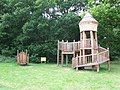
 Children's play area on Dunston Common - geograph.org.uk - 5289510.jpg 640 × 539; 541 KB
-
 Children's play area on Dunston Common - geograph.org.uk - 5289512.jpg 640 × 578; 606 KB
-

-
 Dogs on Dunston Common - geograph.org.uk - 5289481.jpg 640 × 480; 470 KB
-

-
 Dunston Field (information) - geograph.org.uk - 5287324.jpg 480 × 640; 334 KB
-
 Electricity substation on Dunston Common - geograph.org.uk - 5289497.jpg 640 × 596; 623 KB
-
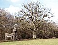 Fairy tree and fairy castle - geograph.org.uk - 5289501.jpg 640 × 497; 411 KB
-
 Footbridge on Dunston Common - geograph.org.uk - 2143328.jpg 480 × 640; 190 KB
-
 Footpath marker on Dunston Common - geograph.org.uk - 5289491.jpg 640 × 428; 479 KB
-
 Footpath traversing Dunston Field - geograph.org.uk - 5287331.jpg 640 × 551; 257 KB
-
 Golf course at Dunston Hall Hotel - geograph.org.uk - 5962942.jpg 800 × 563; 201 KB
-
 Mangreen, Dunston - geograph.org.uk - 4414432.jpg 3,072 × 2,304; 1.69 MB
-
 Meadow on Dunston Common - geograph.org.uk - 5289451.jpg 640 × 480; 437 KB
-
 Mill Road, Dunston - geograph.org.uk - 3871545.jpg 2,925 × 2,192; 1.64 MB
-
 Mill Road, Dunston - geograph.org.uk - 3871600.jpg 3,072 × 2,304; 1.62 MB
-

-

-
 On the northern edge of Dunston Common - geograph.org.uk - 5289483.jpg 640 × 480; 503 KB
-
 On the puzzle trail on Dunston Common - geograph.org.uk - 2143344.jpg 640 × 480; 213 KB
-

-

-
 Path on Dunston Common - geograph.org.uk - 5289517.jpg 640 × 480; 511 KB
-
 Pond on the edge of Dunston Common - geograph.org.uk - 2143340.jpg 640 × 480; 181 KB
-
 Pond on the edge of Dunston Common - geograph.org.uk - 5289453.jpg 640 × 480; 497 KB
-
 Pond on the edge of Dunston Common - geograph.org.uk - 5289527.jpg 640 × 546; 533 KB
-
 Royal Mail postbox on Dunston Common - geograph.org.uk - 5289470.jpg 507 × 640; 472 KB
-

-
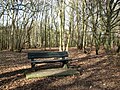 Seat on Dunston Common - geograph.org.uk - 5289515.jpg 640 × 480; 512 KB
-

-
 Sign on Dunston Common - geograph.org.uk - 5289449.jpg 640 × 564; 497 KB
-
 Snowdrops on Dunston Common - geograph.org.uk - 5289477.jpg 640 × 583; 628 KB
-
 Snowdrops on the edge of Dunston Common - geograph.org.uk - 5289423.jpg 640 × 480; 569 KB
-
 Snowdrops on the edge of Dunston Common - geograph.org.uk - 5289486.jpg 640 × 480; 518 KB
-

-
 Stoke Road sign - geograph.org.uk - 3871593.jpg 3,008 × 2,254; 1.81 MB
-
 Stoke Road sign - geograph.org.uk - 4203955.jpg 3,072 × 2,304; 3.19 MB
-
 Stoke Road, Dunston - geograph.org.uk - 3871590.jpg 3,072 × 2,026; 1.76 MB
-
 Stoke Road, Dunston - geograph.org.uk - 4203924.jpg 3,072 × 2,304; 1.77 MB
-
 The River Tas at Dunston Field - geograph.org.uk - 5288484.jpg 640 × 360; 293 KB
-

-
 The River Tas north of Dunston - geograph.org.uk - 5288485.jpg 640 × 360; 253 KB
-
 Unnamed lane to Stoke Holy Cross - geograph.org.uk - 1539743.jpg 640 × 460; 89 KB
-

-

-
 View from the edge of Notre Dame Wood - geograph.org.uk - 1539733.jpg 640 × 510; 108 KB
-
 View to Dunston Hall - geograph.org.uk - 5962927.jpg 800 × 538; 113 KB
-
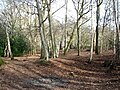
 Wood on Dunston Common - geograph.org.uk - 5289479.jpg 640 × 480; 529 KB
-

-
 Wooden Climbing Frame - geograph.org.uk - 1431978.jpg 640 × 480; 127 KB


_-_geograph.org.uk_-_5287324.jpg)


