Category:Dunkineely
Jump to navigation
Jump to search
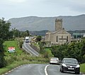
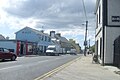
English: Dunkineely is a small village in County Donegal in North West Ireland. It is situated approximately 12 miles from the town of Donegal and 5 miles from Killybegs. It is a small single street village with a population of around 300 in its surroundings. There is a dun on the edge of the village from which Dunkineely derives its name. The village lies at the top of St John's Point, a narrow peninsula jutting seven miles into Donegal Bay, which boasts beautiful sceenary and is a world renowned diving site.
village in Ulster, Ireland  | |||||
| Upload media | |||||
| Instance of | |||||
|---|---|---|---|---|---|
| Location | County Donegal, Ulster, Ireland | ||||
| Elevation above sea level |
| ||||
 | |||||
Media in category "Dunkineely"
The following 72 files are in this category, out of 72 total.
-
 "Evie Rose", Killybegs - geograph.org.uk - 4957949.jpg 640 × 480; 146 KB
-
 Bay View Hotel, Killybegs - geograph.org.uk - 2524208.jpg 640 × 480; 51 KB
-

-
 Bridge Street, Killybegs - geograph.org.uk - 2524213.jpg 640 × 480; 53 KB
-
 Butcher, Killybegs - geograph.org.uk - 2525048.jpg 640 × 480; 56 KB
-
 Car park, Killybegs - geograph.org.uk - 2524269.jpg 640 × 480; 46 KB
-
 Church at Beaugreen Glebe, Dunkineely - geograph.org.uk - 961828.jpg 640 × 567; 81 KB
-
 Church Street, Killybegs - geograph.org.uk - 2524255.jpg 640 × 480; 51 KB
-
 Church Street, Killybegs - geograph.org.uk - 2525037.jpg 640 × 480; 58 KB
-
 Conlin Road, Drumbeagh - geograph.org.uk - 2530182.jpg 640 × 480; 42 KB
-
 Cruise liner, Killybegs - geograph.org.uk - 3013294.jpg 640 × 480; 47 KB
-
 Diamond Centre, Killybegs - geograph.org.uk - 2525047.jpg 640 × 480; 50 KB
-
 Drumgeagh (Ed Killybegs) - geograph.org.uk - 2530183.jpg 640 × 480; 54 KB
-
 Dunkineely Donegal Bay geograph-3185376-by-Ben-Brooksbank.jpg 2,316 × 1,372; 2.73 MB
-
 Dunkineely Methodist Church - geograph.org.uk - 2525387.jpg 640 × 480; 40 KB
-
 Dunkineely Methodist Church - geograph.org.uk - 871297.jpg 480 × 640; 46 KB
-
 Dunkineely.JPG 3,072 × 2,048; 2.8 MB
-
 ESB, Killybegs - geograph.org.uk - 2525057.jpg 640 × 480; 45 KB
-

-

-
 Fish market at Killybegs Harbour - geograph.org.uk - 1955562.jpg 640 × 473; 238 KB
-
 Fishing boat, Killybegs - geograph.org.uk - 5429140.jpg 640 × 480; 157 KB
-
 Fishing fleet, Killybegs - geograph.org.uk - 3012903.jpg 640 × 480; 58 KB
-
 Fishing trawler, Killybegs - geograph.org.uk - 4957974.jpg 640 × 480; 169 KB
-
 Fishing vessels at Killybegs - geograph.org.uk - 4950015.jpg 640 × 480; 132 KB
-
 Garda station, Killybegs - geograph.org.uk - 2525064.jpg 640 × 480; 49 KB
-
 Harbour Bar - McGinley's, Killybegs - geograph.org.uk - 2524209.jpg 640 × 480; 47 KB
-
 Harbour Store, Killybegs - geograph.org.uk - 2524277.jpg 640 × 480; 46 KB
-
 Intersection, Killybegs - geograph.org.uk - 2524284.jpg 640 × 480; 50 KB
-
 Killybegs fire-station - geograph.org.uk - 3012951.jpg 640 × 480; 68 KB
-
 Killybegs harbour - geograph.org.uk - 2524274.jpg 640 × 480; 44 KB
-
 Killybegs harbour - geograph.org.uk - 3012921.jpg 640 × 480; 86 KB
-
 Killybegs harbour - geograph.org.uk - 3012965.jpg 640 × 480; 36 KB
-
 Killybegs Harbour, Co. Donegal - geograph.org.uk - 2525759.jpg 2,575 × 1,502; 1.23 MB
-
 Killybegs Harbour, County Donegal - geograph.org.uk - 2272677.jpg 800 × 490; 274 KB
-
 Killybegs Sounds - geograph.org.uk - 2525055.jpg 640 × 480; 54 KB
-
 Little and large fishing boats - geograph.org.uk - 3012907.jpg 640 × 480; 82 KB
-
 Loading crates, Killybegs - geograph.org.uk - 4957970.jpg 640 × 480; 185 KB
-
 Mace, Killybegs - geograph.org.uk - 2525043.jpg 640 × 480; 47 KB
-
 Magee's, Killybegs - geograph.org.uk - 2525054.jpg 640 × 480; 59 KB
-

-
 Main Street, Killybegs - geograph.org.uk - 2524211.jpg 640 × 480; 50 KB
-
 Main Street, Killybegs - geograph.org.uk - 2524217.jpg 640 × 480; 56 KB
-
 Main Street, Killybegs - geograph.org.uk - 2525034.jpg 640 × 480; 49 KB
-
 Main Street, Killybegs - geograph.org.uk - 2525074.jpg 640 × 480; 58 KB
-
 Main Street, Killybegs - geograph.org.uk - 3534104.jpg 640 × 480; 55 KB
-
 Manor House, Dunkineely - geograph.org.uk - 871279.jpg 640 × 568; 76 KB
-
 Mellys, Killybegs - geograph.org.uk - 2525044.jpg 640 × 480; 57 KB
-
 Memorial, Killybegs - geograph.org.uk - 2524296.jpg 640 × 480; 68 KB
-
 MM Stores, Killybegs - geograph.org.uk - 2525053.jpg 640 × 480; 58 KB
-
 Mooney Boats Killybegs - geograph.org.uk - 3012928.jpg 640 × 480; 48 KB
-

-
 Old style buildings, Killybegs - geograph.org.uk - 2525088.jpg 640 × 480; 45 KB
-
 Over rooftops to Killybegs harbour - geograph.org.uk - 6475276.jpg 3,056 × 2,233; 1.89 MB
-
 Pub - Wizzy Brown, Killybegs - geograph.org.uk - 2525050.jpg 640 × 480; 63 KB
-
 Railway Underpass at Dunkineely - geograph.org.uk - 954512.jpg 640 × 480; 112 KB
-
 Repairing the nets, Killybegs - geograph.org.uk - 3013264.jpg 640 × 480; 61 KB
-
 Road to Bunlacky Shore - geograph.org.uk - 954489.jpg 640 × 480; 103 KB
-
 Roadworks, Killybegs - geograph.org.uk - 3534042.jpg 640 × 480; 44 KB
-
 Shore Road Killybegs the R263 toward the harbour - geograph.org.uk - 6475282.jpg 2,522 × 1,744; 1.78 MB
-

-
 Tara Hotel, Killybegs - geograph.org.uk - 2524280.jpg 640 × 480; 51 KB
-
 Tara Hotel, Killybegs - geograph.org.uk - 2525042.jpg 640 × 480; 50 KB
-
 The Bunlacky Shore, Dunkineely - geograph.org.uk - 954529.jpg 480 × 640; 136 KB
-
 The Silver Whisper cruise liner - geograph.org.uk - 3013285.jpg 640 × 480; 67 KB
-
 Three abreast on the Killybegs pier - geograph.org.uk - 4960511.jpg 800 × 534; 285 KB
-
 Trawler, Killybegs - geograph.org.uk - 3534039.jpg 640 × 480; 31 KB
-
 Trawlers berthed at Killybegs fish quay - geograph.org.uk - 6475279.jpg 3,912 × 2,880; 3.13 MB
-
 Trawlers, Killybegs - geograph.org.uk - 2524303.jpg 640 × 480; 47 KB
-
 Trawlers, Killybegs - geograph.org.uk - 4957962.jpg 640 × 480; 172 KB
-
 Ulster Bank, Killybegs - geograph.org.uk - 2525035.jpg 640 × 480; 47 KB
-
 Vessel Rachel Jay in Killybegs Harbour, Co. Donegal - geograph.org.uk - 2525796.jpg 2,816 × 1,872; 1.65 MB


_-_geograph.org.uk_-_2530183.jpg)


