Category:Dungworth
Jump to navigation
Jump to search
village in United Kingdom  | |||||
| Upload media | |||||
| Instance of | |||||
|---|---|---|---|---|---|
| Location | Bradfield, Sheffield, South Yorkshire, Yorkshire and the Humber, England | ||||
 | |||||
Subcategories
This category has only the following subcategory.
C
Media in category "Dungworth"
The following 56 files are in this category, out of 56 total.
-
-
 A view of Dungworth - geograph.org.uk - 2630758.jpg 2,608 × 1,952; 1.5 MB
-
 At Stopes - rainy road to Dungworth - geograph.org.uk - 2635147.jpg 2,433 × 1,825; 1.24 MB
-
 Barn and Cowhouse, Hall Broom Farm, Dungworth.jpg 2,516 × 1,853; 2.15 MB
-
 Below Holdworth Farms - geograph.org.uk - 124931.jpg 640 × 480; 180 KB
-
 Briers House Farm Barn, Dungworth.jpg 2,539 × 1,829; 3.62 MB
-
 Cliffe House - geograph.org.uk - 132656.jpg 640 × 480; 158 KB
-
 Cottages at Hill Top, Dungworth - geograph.org.uk - 3846967.jpg 3,631 × 5,083; 4.81 MB
-

-
 Dungworth ... Old and New Village Signs - geograph.org.uk - 972502.jpg 640 × 427; 101 KB
-
 Dungworth Methodist Church - geograph.org.uk - 5270242.jpg 1,600 × 1,200; 535 KB
-
 Dungworth to Hill Top - geograph.org.uk - 972498.jpg 640 × 480; 95 KB
-
 Dungworth village sign - geograph.org.uk - 4059193.jpg 2,465 × 1,849; 2.06 MB
-
 Dungworth Village Sign - geograph.org.uk - 972508.jpg 640 × 480; 137 KB
-
 Farmhouse, Hall Broom Farm, Dungworth.JPG 3,648 × 2,736; 3.98 MB
-

-
 Footbridge over Sykehouse Brook, east of Dungworth - geograph.org.uk - 5270238.jpg 1,600 × 1,200; 999 KB
-
 Footpath from Storrs Bridge to Dungworth - geograph.org.uk - 4839661.jpg 4,286 × 3,165; 3.69 MB
-

-
 Green Fold Farmhouse, Dungworth.JPG 3,648 × 2,736; 4.06 MB
-
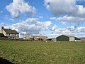
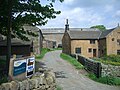
 Hall Broom Farm - geograph.org.uk - 132644.jpg 640 × 480; 160 KB
-
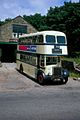
 Hill Top Road bus stop - geograph.org.uk - 1245454.jpg 640 × 480; 85 KB
-
 House at Hill Top near Dungworth - geograph.org.uk - 2630766.jpg 2,608 × 1,952; 1.97 MB
-

-
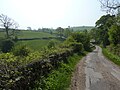 Lane near Dungworth - geograph.org.uk - 2375633.jpg 3,648 × 2,736; 5.7 MB
-
 Loxley Chase - geograph.org.uk - 124901.jpg 640 × 480; 140 KB
-
 Loxley Chase - geograph.org.uk - 1384287.jpg 640 × 480; 94 KB
-
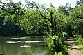
 Loxley Fisheries Pond, Loxley Valley - geograph.org.uk - 1014767.jpg 640 × 480; 113 KB
-
 Loxley Valley ... and the Waterworks - geograph.org.uk - 1039079.jpg 640 × 427; 51 KB
-
 Main Road in Dungworth - geograph.org.uk - 2587221.jpg 3,296 × 2,472; 1 MB
-
 One horseman pass this way, in Dungworth - geograph.org.uk - 2375623.jpg 3,648 × 2,736; 5.43 MB
-

-
-
 Padley Cottages, Dungworth.JPG 3,648 × 2,736; 3.94 MB
-
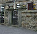 Padley Farmhouse Gate Piers, Dungworth.jpg 1,147 × 1,056; 866 KB
-
 Panorama From the Royal Hotel, Dungworth - geograph.org.uk - 5538970.jpg 7,926 × 2,468; 4.88 MB
-
 Panorama From the Royal Hotel, Dungworth - geograph.org.uk - 5539607.jpg 6,603 × 2,496; 6.25 MB
-

-
 Rickett Field Farm, near Dungworth - geograph.org.uk - 5270250.jpg 1,600 × 1,200; 428 KB
-
 Ringwood Lane, Dungworth - geograph.org.uk - 5270252.jpg 1,600 × 1,200; 485 KB
-
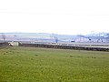
 Rivelin Lower Reservoir in winter - geograph.org.uk - 1724953.jpg 2,560 × 1,920; 533 KB
-
 River Loxley by Loxley Fisheries - geograph.org.uk - 1014792.jpg 640 × 480; 142 KB
-
 River Loxley Weir near Loxley Fisheries - geograph.org.uk - 1014794.jpg 640 × 480; 147 KB
-
-
 Small Reservoir on Middle Moss - geograph.org.uk - 1541870.jpg 640 × 480; 137 KB
-
 Sykehouse Farm, Dungworth.JPG 3,648 × 2,736; 4.01 MB
-
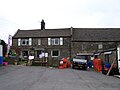
 The Royal Hotel - geograph.org.uk - 5538790.jpg 4,032 × 3,024; 3.99 MB
-
 The Royal Hotel - geograph.org.uk - 5538791.jpg 4,032 × 3,024; 4.3 MB
-
 The Royal Hotel. - geograph.org.uk - 5424216.jpg 640 × 427; 80 KB
-
 Tom Hill Farmhouse Cowhouse, Dungworth.jpg 3,648 × 2,736; 4.26 MB
-
 Tom Hill Farmhouse, Dungworth.jpg 1,819 × 1,344; 1.57 MB
-
 Tom Hill, Dungworth - geograph.org.uk - 5538787.jpg 4,032 × 3,024; 4.81 MB
-

-
 Weir Gear Near ... Loxley Fisheries - geograph.org.uk - 1014797.jpg 640 × 480; 130 KB
-
 Western Cruck Barn, Tomhill Farm, Dungworth.JPG 3,648 × 2,736; 4.11 MB
-
 Wyming Brook Drive - geograph.org.uk - 1372037.jpg 640 × 480; 70 KB


