Category:Duddington
Jump to navigation
Jump to search
English: Duddington is a small settlement in Northamptonshire, England. It is by the junction of the A47 and A43 roads, and is southwest of the town of Stamford.
village in Northamptonshire, United Kingdom  | |||||
| Upload media | |||||
| Instance of |
| ||||
|---|---|---|---|---|---|
| Location | Duddington-with-Fineshade, North Northamptonshire, Northamptonshire, East Midlands, England | ||||
 | |||||
Subcategories
This category has the following 4 subcategories, out of 4 total.
D
- Duddington Bridge (13 F)
- Duddington Mill (4 F)
- Duddington War Memorial (2 F)
M
Media in category "Duddington"
The following 44 files are in this category, out of 44 total.
-
 A Duddington Farmstead - geograph.org.uk - 1738845.jpg 3,648 × 2,736; 2.19 MB
-
 Bench mark on the wall of the Royal Oak pub at Duddington - geograph.org.uk - 1737797.jpg 3,648 × 2,736; 2.24 MB
-
 Collyweston Great Wood - geograph.org.uk - 84284.jpg 640 × 480; 170 KB
-
 Collyweston Quarry, near Duddington - geograph.org.uk - 2388794.jpg 640 × 428; 58 KB
-
 Creator- H. Allison & Co. Photographers (5444738805).jpg 800 × 611; 157 KB
-
 Crop field near Duddington - geograph.org.uk - 4136541.jpg 640 × 480; 75 KB
-
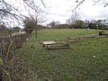 Duddington Cemetery - geograph.org.uk - 1739062.jpg 3,648 × 2,736; 2.21 MB
-
 Duddington Telephone Exchange (1) - geograph.org.uk - 4616341.jpg 4,608 × 3,456; 3.57 MB
-
 Duddington Telephone Exchange (2) - geograph.org.uk - 4616361.jpg 4,608 × 3,456; 3.66 MB
-
 Duddington village - geograph.org.uk - 1470662.jpg 640 × 457; 174 KB
-
 Duddington Village Houses - geograph.org.uk - 2383612.jpg 1,600 × 1,200; 506 KB
-
 Early spring at the T-junction in Duddington - geograph.org.uk - 1738765.jpg 2,736 × 3,648; 2.25 MB
-
 Easton Hornstocks - geograph.org.uk - 84134.jpg 640 × 480; 155 KB
-
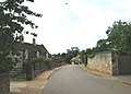
 Entrance to Duddington - geograph.org.uk - 4159321.jpg 640 × 470; 66 KB
-
 Flooded Jurassic Way beneath the A47 - geograph.org.uk - 1723187.jpg 4,000 × 3,000; 2.98 MB
-
 Footpath From Duddington - geograph.org.uk - 2388772.jpg 428 × 640; 115 KB
-
 Footpath to Duddington - geograph.org.uk - 2388766.jpg 640 × 428; 87 KB
-
 Grazing, Duddington - geograph.org.uk - 2124134.jpg 640 × 480; 96 KB
-
 Jurassic Way to Fineshade Wood - geograph.org.uk - 262021.jpg 640 × 480; 65 KB
-
 Kissing gate on the Jurassic Way - geograph.org.uk - 364997.jpg 640 × 427; 117 KB
-
 Mill Street - geograph.org.uk - 1470632.jpg 640 × 457; 141 KB
-
 Collyweston Quarry, Duddington - geograph.org.uk - 332672.jpg 640 × 426; 154 KB
-
 River Welland at Tixover Grange - geograph.org.uk - 364817.jpg 640 × 427; 90 KB
-
 Telephone Exchange, Duddington - geograph.org.uk - 4814788.jpg 2,592 × 1,944; 1.4 MB
-
 The Old School House, High Street, Duddington (geograph 5520812).jpg 3,226 × 4,840; 7.69 MB
-
 The River Welland - geograph.org.uk - 365859.jpg 640 × 427; 101 KB
-
 The River Welland at Duddington - geograph.org.uk - 192237.jpg 640 × 427; 157 KB
-
 The Royal Oak, Duddington - geograph.org.uk - 2804613.jpg 800 × 600; 116 KB
-
 A43 crossing Willow Brook, noisy - geograph.org.uk - 270198.jpg 640 × 480; 70 KB
-
 A43 crossing Willow Brook, peaceful - geograph.org.uk - 270188.jpg 640 × 480; 116 KB
-
 A43 road from Stamford to Corby - geograph.org.uk - 351706.jpg 640 × 480; 78 KB
-
 A47(T) layby, near Wittering Coppice - geograph.org.uk - 84142.jpg 640 × 480; 99 KB
-
 Dog friendly stile at Tixover Grange - geograph.org.uk - 365827.jpg 640 × 427; 137 KB
-
 Farmland at Tixover Grange, Rutland - geograph.org.uk - 192254.jpg 640 × 427; 123 KB
-
 Farmland at Tixover Grange, Rutland - geograph.org.uk - 365829.jpg 640 × 427; 98 KB
-
 Fishing lake on A43 - geograph.org.uk - 262025.jpg 640 × 480; 101 KB
-
 Foam Pile near Collyweston Quarry - geograph.org.uk - 332856.jpg 640 × 426; 154 KB
-
 High Street, Duddington - geograph.org.uk - 225699.jpg 640 × 480; 89 KB
-
 Road at Tixover Grange - geograph.org.uk - 192260.jpg 640 × 427; 200 KB
-
 Todd's Hill, Duddington, Northamptonshire - geograph.org.uk - 192203.jpg 640 × 427; 170 KB
-
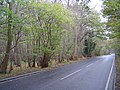
 Track through Fineshade Wood - geograph.org.uk - 261591.jpg 640 × 480; 106 KB
-

-
 Vigo Wood, southeast of Collyweston - geograph.org.uk - 84172.jpg 640 × 480; 144 KB
-
 Woodland margin - geograph.org.uk - 365867.jpg 640 × 427; 158 KB


.jpg)


_-_geograph.org.uk_-_4616341.jpg)
_-_geograph.org.uk_-_4616361.jpg)


.jpg)


_layby,_near_Wittering_Coppice_-_geograph.org.uk_-_84142.jpg)


