Category:Dry stone walls in Midlothian
Jump to navigation
Jump to search
Media in category "Dry stone walls in Midlothian"
The following 8 files are in this category, out of 8 total.
-
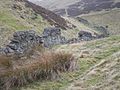
 Burn - wall crossing - geograph.org.uk - 477331.jpg 640 × 480; 109 KB
-
 Cock Rig - geograph.org.uk - 714274.jpg 640 × 480; 102 KB
-
 Drystane dyke, Burnside - geograph.org.uk - 1482945.jpg 640 × 480; 163 KB
-
 Drystane dyke, SW of Black Hill - geograph.org.uk - 669632.jpg 640 × 360; 101 KB
-
 Dyke beside the Kirk Burn - geograph.org.uk - 772666.jpg 640 × 480; 111 KB
-
 Near Gladhouse Reservoir - geograph.org.uk - 156908.jpg 640 × 480; 74 KB
-
 Old wall - geograph.org.uk - 110617.jpg 640 × 480; 170 KB
-
 Remains of a dyke - geograph.org.uk - 351458.jpg 640 × 480; 117 KB


