Category:Drumsagard Village
Jump to navigation
Jump to search
human settlement in South Lanarkshire, Scotland, UK | |||||
| Upload media | |||||
| Instance of | |||||
|---|---|---|---|---|---|
| Location | Cambuslang, South Lanarkshire, Scotland | ||||
 | |||||
Images for the Drumsagard district in Cambuslang, South Lanarkshire, Scotland.
Subcategories
This category has only the following subcategory.
T
Media in category "Drumsagard Village"
The following 21 files are in this category, out of 21 total.
-
 Back oHill Cottage (Derelict) (geograph 4875781).jpg 1,024 × 683; 164 KB
-
 Drumsargad Castle (site of) (geograph 4875905).jpg 1,024 × 683; 151 KB
-
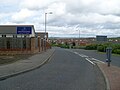
 Flemington Road at Hamilton Road - geograph.org.uk - 1359316.jpg 640 × 480; 110 KB
-
 Footpath in Drumsargad (geograph 7206668).jpg 1,024 × 768; 286 KB
-
 Hallside - geograph.org.uk - 886994.jpg 640 × 480; 57 KB
-
 Hallside and view across Glasgow - geograph.org.uk - 1359307.jpg 640 × 480; 141 KB
-
 Hallside, Near Cambuslang - geograph.org.uk - 107032.jpg 640 × 480; 97 KB
-
 Hallside. - geograph.org.uk - 13035.jpg 640 × 480; 54 KB
-
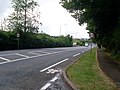 Hamilton Road - geograph.org.uk - 1359311.jpg 640 × 480; 144 KB
-
 Hamilton Road, near Dalton (geograph 1667085).jpg 640 × 480; 102 KB
-
 Manse Brae - geograph.org.uk - 1359301.jpg 640 × 480; 191 KB
-
 Memorial cairn (geograph 2990270).jpg 640 × 480; 283 KB
-
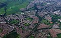 Newton and Cambuslang from the air (geograph 2988822) (cropped).jpg 615 × 384; 157 KB
-
 Newton and Cambuslang from the air (geograph 2988822).jpg 640 × 480; 190 KB
-
 Pathway by Magnolia Terrace - geograph.org.uk - 1359327.jpg 640 × 480; 162 KB
-
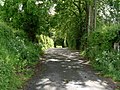
 Road into Drumsagard - geograph.org.uk - 1359332.jpg 640 × 480; 108 KB
-
 South Lanarkshire, Scotland 13 (2022-05-21).jpg 3,000 × 4,000; 3.42 MB
-
 South Lanarkshire, Scotland 16 (2022-05-21).jpg 3,468 × 4,624; 3.5 MB
-
 South Lanarkshire, Scotland 19 (2022-05-21).jpg 3,468 × 4,624; 3.52 MB
-
 South Lanarkshire, Scotland 3 (2022-05-21).jpg 3,468 × 4,624; 3.91 MB
-
 Trig point, Manse Brae (geograph 4875795).jpg 1,024 × 683; 223 KB
_(geograph_4875781).jpg)
_(geograph_4875905).jpg)

.jpg)


.jpg)

.jpg)
_(cropped).jpg)
.jpg)


.jpg)
.jpg)
.jpg)
.jpg)
.jpg)