Category:Dronfield
Jump to navigation
Jump to search
town and civil parish in North East Derbyshire, England  | |||||
| Upload media | |||||
| Instance of | |||||
|---|---|---|---|---|---|
| Location | North East Derbyshire, Derbyshire, East Midlands, England | ||||
| Said to be the same as | Dronfield (Wikimedia duplicated page, civil parish) | ||||
| official website | |||||
 | |||||
Subcategories
This category has the following 12 subcategories, out of 12 total.
C
- Coal Aston (27 F)
D
- Dronfield bottom (8 F)
- Dronfield civic centre (5 F)
- Dronfield Library (7 F)
- Dronfield Peel Monument (6 F)
- Dronfield railway station (18 F)
- Dronfield War Memorial (2 F)
- Dronfield Woodhouse (37 F)
J
O
P
Media in category "Dronfield"
The following 200 files are in this category, out of 399 total.
(previous page) (next page)-
 "The Coach and Horses", Dronfield - geograph.org.uk - 2896141.jpg 4,252 × 2,835; 2.56 MB
-
 "The Hearty Oak" at Dronfield Woodhouse - geograph.org.uk - 5304095.jpg 4,922 × 3,641; 4.04 MB
-
 "The Three Tuns", Dronfield - geograph.org.uk - 2896133.jpg 4,162 × 2,775; 2.45 MB
-
 'Frame It', framed - geograph.org.uk - 3307864.jpg 600 × 800; 108 KB
-
 11th tee Dore ^ Totley Golf Club - geograph.org.uk - 6271845.jpg 5,120 × 2,448; 4.88 MB
-
 150 Stubley Lane, Dronfield - geograph.org.uk - 2623650.jpg 2,286 × 1,715; 909 KB
-
 30 , 40 - it's not tennis^ - geograph.org.uk - 3336414.jpg 4,000 × 2,248; 1.44 MB
-

-
 A corner of Hallowes Golf Course - geograph.org.uk - 2425881.jpg 950 × 698; 300 KB
-
 A view of Bull Close Farm - geograph.org.uk - 5614472.jpg 4,908 × 3,612; 3.76 MB
-
 A61 - geograph.org.uk - 4924727.jpg 640 × 426; 51 KB
-
 A61 - geograph.org.uk - 4924733.jpg 640 × 426; 59 KB
-
 A61 - geograph.org.uk - 4924734.jpg 640 × 426; 52 KB
-
 A61 - geograph.org.uk - 4924741.jpg 640 × 426; 55 KB
-
 A61 Dronfield by-pass - geograph.org.uk - 3749343.jpg 4,000 × 2,248; 5.87 MB
-
 A61 Dronfield by-pass - geograph.org.uk - 3757532.jpg 800 × 533; 137 KB
-
 A61 Dronfield by-pass, towards Bowshaw roundabout - geograph.org.uk - 3308064.jpg 3,954 × 2,164; 1.96 MB
-
 A61 Dronfield Bypass - geograph.org.uk - 3307853.jpg 800 × 600; 135 KB
-
 A61, Dronfield bypass - geograph.org.uk - 4924719.jpg 640 × 426; 50 KB
-
 A61-B6057 junction at roundabout - geograph.org.uk - 6150018.jpg 1,024 × 683; 174 KB
-
 Another view of Hallowes Hall - geograph.org.uk - 5614942.jpg 3,557 × 4,866; 4.18 MB
-
 Approaching Barnes Farm - geograph.org.uk - 3307847.jpg 800 × 600; 106 KB
-
 B6056 minor road under A61 Dronfield bypass - geograph.org.uk - 4403614.jpg 1,024 × 768; 206 KB
-
 Badger sett undermines path, steps and old stile - geograph.org.uk - 6271846.jpg 1,724 × 2,921; 3.03 MB
-
 Barlow Lees Lane and views beyond - geograph.org.uk - 2425931.jpg 950 × 713; 276 KB
-
 Barnes Farm - geograph.org.uk - 3308055.jpg 4,000 × 2,248; 1.46 MB
-
 Barnes Farm - geograph.org.uk - 3412165.jpg 2,048 × 1,536; 662 KB
-
 Barnes Lane and Upper Birchitt - geograph.org.uk - 2733578.jpg 3,240 × 2,396; 1.32 MB
-
 Beachwood road, Dronfield - panoramio.jpg 5,376 × 3,024; 3.97 MB
-
 Beehive coke oven, Summerley - geograph.org.uk - 1735333.jpg 853 × 1,280; 425 KB
-

-
 Benchmark on garage of ^20 Highfields Road - geograph.org.uk - 6059906.jpg 672 × 1,024; 276 KB
-

-

-

-

-
 Benchmark on Green Lane building at Aston End - geograph.org.uk - 5968436.jpg 1,024 × 683; 300 KB
-

-
 Benchmark on railway bridge on Unstone Hill - geograph.org.uk - 6059157.jpg 1,024 × 683; 267 KB
-
 Benchmark on the garage of ^2 Park Avenue - geograph.org.uk - 5968417.jpg 658 × 1,024; 290 KB
-
 Benchmark on The Three Tuns pub - geograph.org.uk - 6059105.jpg 670 × 1,024; 275 KB
-

-
 Benchmark on ^107 Stonelow Road - geograph.org.uk - 6186096.jpg 1,024 × 660; 294 KB
-
 Benchmark on ^128 Hilltop Road - geograph.org.uk - 6059620.jpg 1,024 × 665; 292 KB
-
 Benchmark on ^23 Hilltop Road - geograph.org.uk - 6059836.jpg 1,024 × 683; 309 KB
-
 Benchmark on ^55 Hollins Spring Avenue - geograph.org.uk - 6059877.jpg 683 × 1,024; 171 KB
-
 Benchmark on ^63 Hilltop Road - geograph.org.uk - 6059657.jpg 1,024 × 664; 232 KB
-
 Benchmark on ^8 Oakdell - geograph.org.uk - 6186126.jpg 683 × 1,024; 249 KB
-
 Benchmark on ^83-85 Stonelow Road - geograph.org.uk - 6186078.jpg 1,024 × 683; 217 KB
-
 Benchmark on ^85 Hallowes Lane - geograph.org.uk - 6059994.jpg 1,024 × 683; 240 KB
-
 Border View Farm shop and Cow Shed Cafe - geograph.org.uk - 6271850.jpg 4,640 × 2,352; 2.62 MB
-
 Bowshaw Farm (geograph 2874081).jpg 3,148 × 2,260; 1.68 MB
-
 Bowshaw Farm (geograph 3412157).jpg 2,048 × 1,536; 518 KB
-
 Bowshaw Inn - geograph.org.uk - 2426399.jpg 950 × 612; 288 KB
-
 Bright finance stadium.jpg 500 × 375; 46 KB
-

-
 Business premises on Callywhite Lane - geograph.org.uk - 2460789.jpg 950 × 657; 278 KB
-
 By Cowley Lane - geograph.org.uk - 2425935.jpg 950 × 703; 289 KB
-
 By Northern Common, Mickley - geograph.org.uk - 3118141.jpg 768 × 1,024; 275 KB
-
 Calf at Border View Farm - geograph.org.uk - 6188329.jpg 4,783 × 3,724; 4.16 MB
-
 Carr Lane, Dronfield Woodhouse - geograph.org.uk - 5057378.jpg 640 × 480; 59 KB
-
 Cattle and meadow land towards Cowley - geograph.org.uk - 2425970.jpg 950 × 708; 311 KB
-
 Cecil Road, Dronfield - geograph.org.uk - 2835374.jpg 2,354 × 1,766; 1,022 KB
-

-
 Chesterfield Road approaching Dronfield - geograph.org.uk - 2460786.jpg 950 × 684; 282 KB
-
 Chesterfield Road, Dronfield - geograph.org.uk - 2426504.jpg 950 × 768; 315 KB
-
 Chesterfield Road, Dronfield - geograph.org.uk - 3722806.jpg 1,024 × 768; 175 KB
-
 Coach ^ Horses, Dronfield, Derbyshire - geograph.org.uk - 1908173.jpg 1,024 × 682; 218 KB
-
 Coniston road, Dronfield - panoramio (1).jpg 5,376 × 3,024; 4.29 MB
-
 Coniston road, Dronfield - panoramio.jpg 5,376 × 3,024; 5.06 MB
-
 Corner of Callywhite Lane - geograph.org.uk - 2460792.jpg 950 × 594; 264 KB
-

-

-
 Cross Lane, Northeast Derbyshire - geograph.org.uk - 1908212.jpg 1,024 × 683; 245 KB
-

-
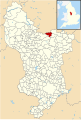 Derbyshire UK parish map highlighting Dronfield.svg 888 × 1,308; 2.35 MB
-
 Derwent Road - geograph.org.uk - 1998434.jpg 2,848 × 2,144; 1.51 MB
-
 Dore and Totley Golf Club course - geograph.org.uk - 2426443.jpg 950 × 713; 266 KB
-
 Dore and Totley golf course - geograph.org.uk - 3118715.jpg 1,024 × 455; 108 KB
-
 Dore and Totley Golf Course - geograph.org.uk - 3915616.jpg 2,396 × 1,712; 1.86 MB
-
 Double bridge under the A61 - geograph.org.uk - 2426425.jpg 950 × 713; 292 KB
-
 Drone Valley Nature Reserve - geograph.org.uk - 1985709.jpg 2,848 × 2,144; 1.53 MB
-
 Drone Valley Walk crosses Half Acre Lane - geograph.org.uk - 3308092.jpg 4,000 × 2,248; 2.16 MB
-
 Dronfield , The A61 Unstone-Dronfield By-Pass - geograph.org.uk - 5951732.jpg 6,000 × 4,000; 5.58 MB
-
 Dronfield , The A61 Unstone-Dronfield By-Pass - geograph.org.uk - 5951733.jpg 6,000 × 4,000; 5.78 MB
-
 Dronfield - Bridge Inn - geograph.org.uk - 2488592.jpg 1,200 × 1,600; 409 KB
-
 Dronfield - butchers on High Street - geograph.org.uk - 2297949.jpg 1,600 × 1,237; 468 KB
-
 Dronfield - Callywhite Lane View - geograph.org.uk - 812795.jpg 640 × 480; 58 KB
-
 Dronfield - Cecil Avenue - geograph.org.uk - 587903.jpg 640 × 480; 95 KB
-
 Dronfield - Cemetery - geograph.org.uk - 1448073.jpg 640 × 480; 114 KB
-

-
 Dronfield - Dronfield Methodist Church - 20220917113657.jpg 4,896 × 3,264; 16.73 MB
-

-

-

-
 Dronfield - joiners workshop - geograph.org.uk - 2300921.jpg 1,600 × 1,186; 479 KB
-
 Dronfield - Lea Road Bridge (Tjc1 26) - 20220917122855.jpg 4,896 × 3,264; 18.66 MB
-
 Dronfield - Lea Road Bridge (Tjc1 26) - 20220917123122.jpg 4,896 × 3,264; 16.88 MB
-
 Dronfield - Lea Road Bridge (Tjc1 26) - 20220917123651.jpg 4,896 × 3,264; 17.53 MB
-

-
 Dronfield - Manor Court - 20220917112243.jpg 4,896 × 3,264; 16.95 MB
-
 Dronfield - panoramio (1).jpg 5,376 × 3,024; 5.76 MB
-
 Dronfield - panoramio (2).jpg 5,376 × 3,024; 6.02 MB
-
 Dronfield - panoramio (3).jpg 5,376 × 3,024; 5.14 MB
-
 Dronfield - panoramio (4).jpg 3,024 × 5,376; 5.1 MB
-
 Dronfield - panoramio (5).jpg 5,376 × 3,024; 3.88 MB
-
 Dronfield - panoramio.jpg 3,024 × 5,376; 5.45 MB
-
 Dronfield - Premises Occupied By The Slinn Computer Group - 20220917120201.jpg 4,896 × 3,264; 19.36 MB
-
 Dronfield - railway bridge at end of Mill Lane - geograph.org.uk - 2297961.jpg 1,200 × 1,600; 483 KB
-
 Dronfield - Stubley Hollow - geograph.org.uk - 1448626.jpg 640 × 480; 67 KB
-
 Dronfield - The Green Dragon Inn - 20220917120735.jpg 4,896 × 3,264; 19.38 MB
-
 Dronfield - The Old Grammar School - 20220917115503.jpg 4,896 × 3,264; 17.08 MB
-
 Dronfield - The Old Grammar School - 20220917115627.jpg 4,896 × 3,264; 17.15 MB
-
 Dronfield - The Old Vicarage - 20220917120354.jpg 4,896 × 3,264; 18.32 MB
-
 Dronfield - The Red House - 20220917120024.jpg 4,850 × 3,207; 17.9 MB
-
 Dronfield - The Sidings - geograph.org.uk - 2300931.jpg 1,600 × 1,200; 464 KB
-

-

-
 Dronfield - Vale House - 20220917121946.jpg 4,783 × 3,185; 16.94 MB
-
 Dronfield 2000 Round Walk this way - geograph.org.uk - 3308060.jpg 4,000 × 2,248; 1.21 MB
-
 Dronfield Constabulary.jpg 2,658 × 1,772; 3.7 MB
-

-
 Dronfield Railway Station - geograph.org.uk - 4718175.jpg 640 × 455; 107 KB
-
 Dronfield roofscape - geograph.org.uk - 3757529.jpg 800 × 533; 92 KB
-
 Dronfield Train Station - geograph.org.uk - 5044828.jpg 1,200 × 799; 396 KB
-
 Dronfield-Unstone bypass - panoramio.jpg 5,376 × 3,024; 5.57 MB
-
 Dronfield-Unstone bypass, Dronfield - panoramio (1).jpg 5,376 × 3,024; 4.17 MB
-
 Dronfield-Unstone bypass, Dronfield - panoramio (2).jpg 3,024 × 5,376; 3.08 MB
-
 Dronfield-Unstone bypass, Dronfield - panoramio (3).jpg 3,024 × 5,376; 3.52 MB
-
 Dronfield-Unstone bypass, Dronfield - panoramio (4).jpg 5,376 × 3,024; 3.42 MB
-
 Dronfield-Unstone bypass, Dronfield - panoramio.jpg 5,376 × 3,024; 4.04 MB
-
 Dronfield.jpg 1,384 × 920; 796 KB
-
 Dyche Lane exit from the roundabout - geograph.org.uk - 2426323.jpg 950 × 713; 284 KB
-

-
 Dyche Lane, Dronfield, Derbyshire - geograph.org.uk - 1908185.jpg 640 × 427; 73 KB
-
 Elderberry blossom, cloud and blue sky - geograph.org.uk - 6188368.jpg 4,919 × 3,803; 4.38 MB
-
 Entrance to Border View Farm - geograph.org.uk - 2867641.jpg 3,991 × 2,243; 1.6 MB
-
 Entrance to Hallowes Golf Club - geograph.org.uk - 6059305.jpg 1,024 × 683; 195 KB
-
 Entrance to recreation ground from Gosforth Lane - geograph.org.uk - 6059847.jpg 1,024 × 683; 224 KB
-
 Entrance to ^83-85 Stonelow Road - geograph.org.uk - 6186086.jpg 1,024 × 683; 207 KB
-
 Farm access off Cross Lane, NE Derbyshire - geograph.org.uk - 1908216.jpg 1,024 × 683; 200 KB
-
 Farm building, Cross Lane - geograph.org.uk - 3409811.jpg 3,648 × 2,736; 4.82 MB
-
 Farm buildings near Mickley - geograph.org.uk - 2426075.jpg 950 × 657; 276 KB
-

-
 Farm track and houses by Sheffield Road (geograph 2426417).jpg 950 × 654; 273 KB
-
 Farmland, Unstone Farm - geograph.org.uk - 3423092.jpg 800 × 562; 97 KB
-
 Ferndale garden Centre car park - geograph.org.uk - 4403610.jpg 1,024 × 768; 131 KB
-
 Field and Birchin Lee Farm - geograph.org.uk - 2426040.jpg 950 × 608; 274 KB
-
 Field at the edge of Dronfield - geograph.org.uk - 2460783.jpg 950 × 578; 240 KB
-
 Field by Dyche lane - geograph.org.uk - 2426353.jpg 950 × 713; 304 KB
-
 Field by Dyche Lane, Batemoor beyond - geograph.org.uk - 2426337.jpg 950 × 713; 294 KB
-
 Field footpath down to Chesterfield Road - geograph.org.uk - 2460785.jpg 950 × 713; 318 KB
-
 Field in the Drone valley - geograph.org.uk - 2980942.jpg 640 × 328; 48 KB
-
 Field to southern edge of Nor Wood - geograph.org.uk - 2460858.jpg 950 × 679; 284 KB
-
 Fields and farm shed by Rod Moor Road - geograph.org.uk - 2426085.jpg 950 × 530; 236 KB
-

-

-
 Fields east of Rod Moor Road - geograph.org.uk - 2426092.jpg 950 × 612; 254 KB
-
 FirthWood2.jpg 2,592 × 3,872; 6.22 MB
-
 Floral display at Dronfield - geograph.org.uk - 1985691.jpg 2,144 × 2,848; 1.32 MB
-
 Footbridge east of Woodthorpe Hall - geograph.org.uk - 3412176.jpg 1,536 × 2,048; 519 KB
-
 Footbridge north of Summerwood Top - geograph.org.uk - 5341237.jpg 1,600 × 1,200; 319 KB
-
 Footbridge over the A61 - geograph.org.uk - 4924721.jpg 640 × 426; 53 KB
-
 Footbridge over The Moss - geograph.org.uk - 737197.jpg 640 × 480; 139 KB
-
 Footbridge west of Holmefield Farm - geograph.org.uk - 3412147.jpg 2,048 × 1,536; 519 KB
-
 Footpath along southern boundary of Gosforth Estate - geograph.org.uk - 3749341.jpg 3,992 × 2,234; 5.63 MB
-
 Footpath along the south side of the golf course - geograph.org.uk - 3412163.jpg 2,048 × 1,536; 709 KB
-
 Footpath at the edge of Dronfield - geograph.org.uk - 3757524.jpg 533 × 800; 167 KB
-
 Footpath junction in Hallowes - geograph.org.uk - 1993759.jpg 640 × 480; 85 KB
-
 Footpath near Summerwood Place - geograph.org.uk - 2733604.jpg 3,240 × 2,394; 1.17 MB
-
 Footpath on Rod Moor - geograph.org.uk - 2532944.jpg 3,296 × 2,472; 1.17 MB
-

-
 Footpath sign at junction of paths - geograph.org.uk - 2426069.jpg 691 × 950; 283 KB
-
 Footpath south of Dronfield - geograph.org.uk - 2425878.jpg 950 × 713; 322 KB
-
 Footpath through wood beside golf course - geograph.org.uk - 6059583.jpg 1,024 × 683; 315 KB
-
 Footpath to Dronfield Woodhouse - geograph.org.uk - 3117710.jpg 1,024 × 768; 199 KB
-
 Forest of signs - geograph.org.uk - 3307869.jpg 800 × 600; 168 KB
-
 Formerly the Hearts of Oak, then the Hearty Oak - geograph.org.uk - 5684343.jpg 5,370 × 3,014; 2.3 MB
-
 Foundry "ladle" and flowerbed north of Dronfield - geograph.org.uk - 2896145.jpg 4,608 × 3,072; 3.24 MB
-
 Four way signpost - geograph.org.uk - 3757522.jpg 800 × 533; 130 KB
-
 Fresh meat at Mickley, Derbyshire - geograph.org.uk - 2623632.jpg 2,608 × 1,952; 1.53 MB
-
 Garage business on Callywhite Lane, Dronfield - geograph.org.uk - 2836555.jpg 2,318 × 1,739; 1.62 MB
-

-
 Gates and driveway to Highfield - geograph.org.uk - 3752921.jpg 800 × 533; 160 KB
-
 Gnarled trees on Hallowes golf course - geograph.org.uk - 5614481.jpg 5,018 × 3,714; 5.46 MB
-
 Golfers on Dore and Totley Golf Course - geograph.org.uk - 2623642.jpg 2,302 × 1,727; 1.46 MB
-
 Golfers on Hallowes golf course - geograph.org.uk - 5614946.jpg 4,763 × 3,648; 4.47 MB
-
 Gorse, first sign of yellow - geograph.org.uk - 1712054.jpg 640 × 480; 95 KB
-
 Gosforth Drive - geograph.org.uk - 4924728.jpg 640 × 426; 55 KB
-
 Gosforth Drive, Dronfield - geograph.org.uk - 1075111.jpg 640 × 480; 43 KB
-
 Gosforth drive, Dronfield - panoramio.jpg 3,024 × 5,376; 3.98 MB
-
 Gosforth Lane - Entering Dronfield - geograph.org.uk - 1448109.jpg 640 × 480; 79 KB
-
 Gosforth Lane Bridge, A61 - geograph.org.uk - 4924720.jpg 640 × 426; 54 KB
-
 Gosforth Lane electricity substation - geograph.org.uk - 6059855.jpg 1,024 × 668; 243 KB
-
 Gosforth Lane, Dronfield - geograph.org.uk - 1075103.jpg 640 × 480; 46 KB
-
 Grazing off Rod Moor Road - geograph.org.uk - 5057397.jpg 640 × 480; 47 KB
-
 Grazing, East Hollow - geograph.org.uk - 5057365.jpg 640 × 480; 53 KB
-
 Greendale Shopping Centre, Dronfield, Derbyshire.jpg 2,736 × 1,824; 3.82 MB
-
 Half Acre Lane - geograph.org.uk - 1735411.jpg 1,280 × 853; 366 KB
-
 Halfacre Lane with railway bridge - geograph.org.uk - 2835366.jpg 1,952 × 2,608; 1.95 MB


.jpg)
.jpg)


.jpg)


_-_geograph.org.uk_-_959659.jpg)


_-_20220917122855.jpg)
_-_20220917123122.jpg)
_-_20220917123651.jpg)


.jpg)
.jpg)
.jpg)
.jpg)
.jpg)


.jpg)
.jpg)
.jpg)
.jpg)


_off_Holmesfield_Road_-_geograph.org.uk_-_5057368.jpg)
.jpg)


