Category:Driffield, East Riding of Yorkshire
Jump to navigation
Jump to search
English: Driffield, also known as Great Driffield, is a market town and civil parish in the East Riding of Yorkshire, England.
market town and civil parish in the East Riding of Yorkshire, England  | |||||
| Upload media | |||||
| Instance of | |||||
|---|---|---|---|---|---|
| Location | East Riding of Yorkshire, Yorkshire and the Humber, England | ||||
| Population |
| ||||
| Different from | |||||
| Said to be the same as | Driffield (Wikimedia duplicated page, civil parish) | ||||
 | |||||
Subcategories
This category has the following 18 subcategories, out of 18 total.
Media in category "Driffield, East Riding of Yorkshire"
The following 200 files are in this category, out of 593 total.
(previous page) (next page)-
 30 miles to the M62 - geograph.org.uk - 4357117.jpg 640 × 480; 62 KB
-
 A 614 - geograph.org.uk - 6658698.jpg 1,024 × 768; 174 KB
-
 A bend in Wansford Road - geograph.org.uk - 4287881.jpg 640 × 480; 65 KB
-
 A unknown farm on Driffield Spellowgate - geograph.org.uk - 2327135.jpg 800 × 600; 242 KB
-
 A woodland in winter - geograph.org.uk - 5429816.jpg 640 × 426; 105 KB
-

-
 A166 heading east - geograph.org.uk - 4370508.jpg 640 × 480; 90 KB
-
 A614 - geograph.org.uk - 5429778.jpg 640 × 426; 47 KB
-
 A614 - geograph.org.uk - 5429782.jpg 640 × 426; 63 KB
-
 A614 approaching roundabout north of Driffield - geograph.org.uk - 4591314.jpg 1,600 × 1,067; 1.2 MB
-

-
 A614 bypassing Driffield - geograph.org.uk - 4357110.jpg 640 × 480; 76 KB
-
 A614 Driffield by-pass - geograph.org.uk - 4362424.jpg 640 × 480; 60 KB
-
 A614 Driffield by-pass - geograph.org.uk - 4368031.jpg 640 × 480; 100 KB
-
 A614 Driffield by-pass - geograph.org.uk - 4370482.jpg 640 × 480; 66 KB
-
 A614 Driffield by-pass - geograph.org.uk - 4371574.jpg 640 × 480; 79 KB
-

-
 A614 near Driffield - geograph.org.uk - 4357106.jpg 640 × 480; 60 KB
-
 A614 near Little Houndale - geograph.org.uk - 4362393.jpg 640 × 480; 60 KB
-
 A614 near Skeetings Farm - geograph.org.uk - 4357098.jpg 640 × 480; 94 KB
-
 A614 towards Goole - geograph.org.uk - 4357218.jpg 640 × 480; 88 KB
-
 Advertising truck - geograph.org.uk - 4362400.jpg 640 × 480; 78 KB
-
 Albion Street, Driffield 1910 (archive ref PO-1-33-16) (34893819780).jpg 900 × 569; 123 KB
-
 Alfred Bean Hospital - geograph.org.uk - 4288137.jpg 640 × 480; 56 KB
-
 An old coal yard - geograph.org.uk - 5429823.jpg 640 × 426; 67 KB
-
 Approaching Driffield - geograph.org.uk - 4287895.jpg 640 × 480; 62 KB
-
 Approaching level crossing - geograph.org.uk - 4287492.jpg 640 × 480; 71 KB
-
 Awaiting a new tenant - geograph.org.uk - 3764751.jpg 640 × 480; 58 KB
-
 B1249 - geograph.org.uk - 5367770.jpg 640 × 426; 57 KB
-

-
 B1249 towards Driffield - geograph.org.uk - 4287835.jpg 640 × 480; 72 KB
-
 B1249 towards Driffield - geograph.org.uk - 4287862.jpg 640 × 480; 81 KB
-
 Back Lane, Little Driffield - geograph.org.uk - 4321230.jpg 1,024 × 768; 136 KB
-
 Bank building, Driffield - geograph.org.uk - 2203864.jpg 640 × 480; 90 KB
-
 Barclays Bank - geograph.org.uk - 4255001.jpg 1,024 × 768; 141 KB
-
 Barn by Driffield Rd - geograph.org.uk - 5427930.jpg 640 × 426; 72 KB
-
 Bell Mill from Skerne Hill - geograph.org.uk - 2971199.jpg 4,000 × 3,000; 2.27 MB
-
 Bell Mills - geograph.org.uk - 5065784.jpg 2,848 × 2,136; 1.39 MB
-
 Bell Mills - geograph.org.uk - 5427928.jpg 640 × 426; 70 KB
-
 Bell Mills - geograph.org.uk - 5427929.jpg 640 × 426; 61 KB
-
 Bell Mills - geograph.org.uk - 5427931.jpg 640 × 426; 49 KB
-
 Bell Mills - geograph.org.uk - 5537725.jpg 1,024 × 768; 780 KB
-
 Bell Mills Garden Centre - geograph.org.uk - 5064758.jpg 640 × 480; 64 KB
-
 Bell Mills Garden Centre - geograph.org.uk - 5430142.jpg 640 × 426; 101 KB
-
 Bell Mills outflow - geograph.org.uk - 2971215.jpg 3,000 × 4,000; 4.05 MB
-
 Bell Mills Plantation - geograph.org.uk - 5064742.jpg 640 × 480; 93 KB
-
 Bell Mills, Driffield - geograph.org.uk - 2371718.jpg 563 × 640; 177 KB
-
 Belmills Farm - geograph.org.uk - 5427923.jpg 640 × 426; 63 KB
-
 Belmills Farm - geograph.org.uk - 5427924.jpg 640 × 426; 47 KB
-
 Below All Saints' church tower - geograph.org.uk - 3324153.jpg 640 × 480; 146 KB
-

-

-

-
 Bend in the B1249 - geograph.org.uk - 4287834.jpg 640 × 480; 97 KB
-
 Beverley Rd - geograph.org.uk - 5375221.jpg 640 × 426; 57 KB
-
 Beverley Rd - geograph.org.uk - 5429829.jpg 640 × 426; 63 KB
-

-
 Bracken Road, Driffield - geograph.org.uk - 5042602.jpg 640 × 441; 305 KB
-
 Bradshaw Flour Mill - geograph.org.uk - 5246549.jpg 640 × 480; 78 KB
-
 Bradshaw Flour Mill - geograph.org.uk - 5430165.jpg 640 × 426; 84 KB
-
 Bradshaw's Bell Mills - geograph.org.uk - 2971209.jpg 3,000 × 4,000; 3.56 MB
-

-
 Bridge over Driffield bypass - geograph.org.uk - 4497924.jpg 1,024 × 768; 156 KB
-
 Bridge over the A164 - geograph.org.uk - 4357208.jpg 640 × 480; 73 KB
-
 Bridge Street, Driffield 1910 (archive ref PO-1-33-17) (34471335843).jpg 900 × 569; 114 KB
-
 Bridleway near Driffield - geograph.org.uk - 5206676.jpg 640 × 480; 179 KB
-
 Bridleway towards Driffield - geograph.org.uk - 4357089.jpg 640 × 480; 100 KB
-
 Brunswick Court - geograph.org.uk - 4287555.jpg 640 × 480; 61 KB
-
 Brunswick Court, Driffield - geograph.org.uk - 5065875.jpg 640 × 480; 60 KB
-

-
 Buffers Restaurant - geograph.org.uk - 3764740.jpg 640 × 480; 56 KB
-

-

-

-
 Bus garage, Driffield - geograph.org.uk - 3764746.jpg 800 × 564; 74 KB
-
 Bus stop and shelter on Bridlington Road, Driffield - geograph.org.uk - 5065830.jpg 2,524 × 1,762; 1.05 MB
-

-
 Bus stop on Beverley Road, Driffield - geograph.org.uk - 5064769.jpg 640 × 480; 74 KB
-
 Bus stop on Beverley Road, Driffield - geograph.org.uk - 5065859.jpg 640 × 480; 81 KB
-

-

-
 Byway near Little Driffield - geograph.org.uk - 6658663.jpg 1,024 × 768; 136 KB
-
 California - geograph.org.uk - 4287852.jpg 640 × 480; 55 KB
-

-

-
 Cemetery Lodge, Great Driffield - geograph.org.uk - 5708081.jpg 1,024 × 768; 184 KB
-
 Central Great Driffield - geograph.org.uk - 3745586.jpg 640 × 480; 65 KB
-
 Chesney Farm - geograph.org.uk - 4287896.jpg 640 × 388; 37 KB
-
 Church Lane - Middle Street North - geograph.org.uk - 2432292.jpg 640 × 480; 75 KB
-
 Church Rest Houses - geograph.org.uk - 4254975.jpg 1,024 × 768; 150 KB
-
 Clay Pit Farm - geograph.org.uk - 4357204.jpg 640 × 422; 50 KB
-

-

-

-

-

-

-
 Close up, Elizabeth II postbox on Mill Falls, Driffield - geograph.org.uk - 5065123.jpg 1,065 × 2,205; 495 KB
-

-
 Close up, Elizabeth II postbox on The Mount, Driffield - geograph.org.uk - 5064214.jpg 1,098 × 2,281; 406 KB
-
 Close up, Elizabeth II postbox on York Road, Driffield - geograph.org.uk - 5064834.jpg 1,386 × 2,693; 697 KB
-
 Close up, George V postbox on Exchange Street, Driffield - geograph.org.uk - 5064231.jpg 1,173 × 2,207; 524 KB
-

-
 Close up, George VI postbox on Park Avenue, Driffield - geograph.org.uk - 5065824.jpg 1,142 × 2,160; 670 KB
-
 Clump of trees - geograph.org.uk - 5367757.jpg 640 × 426; 53 KB
-
 Clump of trees - geograph.org.uk - 5429813.jpg 640 × 373; 44 KB
-
 Come on in, the water's lovely - geograph.org.uk - 2140116.jpg 800 × 600; 308 KB
-
 Costa, Driffield - geograph.org.uk - 5443472.jpg 640 × 426; 58 KB
-

-
 Cottages, Driffield - geograph.org.uk - 4286569.jpg 640 × 480; 68 KB
-
 Cottages, Riverhead, Great Driffield - geograph.org.uk - 3840413.jpg 1,024 × 768; 156 KB
-
 Council Offices, Driffield - geograph.org.uk - 5065899.jpg 640 × 480; 98 KB
-
 Crane at Driffield Riverhead - geograph.org.uk - 2371574.jpg 480 × 640; 208 KB
-
 Crane by the Driffield Canal - geograph.org.uk - 5436429.jpg 425 × 640; 60 KB
-
 Crane Gear Train - geograph.org.uk - 3494264.jpg 4,017 × 3,396; 2.77 MB
-
 Crop field near Skerne Leys - geograph.org.uk - 5064745.jpg 640 × 480; 77 KB
-
 Crop field near Spellowgate Farm - geograph.org.uk - 4368036.jpg 640 × 480; 78 KB
-
 Crop field north of Bridlington Road - geograph.org.uk - 4288143.jpg 640 × 439; 61 KB
-
 Crop field north of Little Driffield - geograph.org.uk - 4370509.jpg 640 × 480; 98 KB
-

-
 Crop field off the A166 - geograph.org.uk - 4368135.jpg 640 × 480; 84 KB
-
 Crop field south of the A614 - geograph.org.uk - 4361761.jpg 640 × 480; 94 KB
-
 Crop field towards Clay Pit Farm - geograph.org.uk - 4359014.jpg 640 × 480; 102 KB
-

-

-
 Demolition in progress - geograph.org.uk - 5416713.jpg 640 × 336; 50 KB
-
 Derelict coal yard, Driffield - geograph.org.uk - 5367788.jpg 640 × 426; 58 KB
-

-

-
 Disused buildings at Field House Farm - geograph.org.uk - 6699993.jpg 2,304 × 1,728; 867 KB
-
 Disused garage, Driffield - geograph.org.uk - 5206255.jpg 640 × 563; 186 KB
-

-

-

-

-
 Driffield - care home on Beverley Road - geograph.org.uk - 2536797.jpg 1,600 × 1,225; 591 KB
-
 Driffield - Church Houses - geograph.org.uk - 2535551.jpg 1,600 × 1,181; 509 KB
-
 Driffield - King Street - geograph.org.uk - 2536773.jpg 1,600 × 1,200; 636 KB
-
 Driffield - Masonic Hall - geograph.org.uk - 2536776.jpg 463 × 640; 105 KB
-
 Driffield - mill on Skerne Road - geograph.org.uk - 2536800.jpg 1,600 × 1,200; 403 KB
-
 Driffield - nursery on Beverley Road - geograph.org.uk - 2536793.jpg 1,600 × 1,251; 692 KB
-
 Driffield - Old Police Station - geograph.org.uk - 2536606.jpg 1,600 × 1,226; 587 KB
-
 Driffield - Police Station - geograph.org.uk - 2536592.jpg 1,600 × 1,205; 518 KB
-
 Driffield - Red Lion - geograph.org.uk - 2536619.jpg 1,200 × 1,600; 462 KB
-
 Driffield - school on Scarborough Road - geograph.org.uk - 2536596.jpg 1,600 × 1,224; 588 KB
-
 Driffield - south side of Exchange Street - geograph.org.uk - 2536614.jpg 1,600 × 1,218; 551 KB
-
 Driffield - Spread Eagle - geograph.org.uk - 2536600.jpg 1,600 × 1,187; 459 KB
-
 Driffield beck - geograph.org.uk - 4357223.jpg 640 × 480; 131 KB
-
 Driffield Beck - geograph.org.uk - 6150238.jpg 1,024 × 768; 270 KB
-
 Driffield Beck - geograph.org.uk - 6458432.jpg 640 × 480; 112 KB
-
 Driffield Beck, Driffield - geograph.org.uk - 3410220.jpg 800 × 600; 264 KB
-
 Driffield Canal - geograph.org.uk - 6150263.jpg 1,024 × 768; 161 KB
-
 Driffield Canal - geograph.org.uk - 6150265.jpg 1,024 × 768; 222 KB
-
 Driffield Canal and electricity substation - geograph.org.uk - 3840535.jpg 1,024 × 768; 245 KB
-
 Driffield Canal at River Head - geograph.org.uk - 6704617.jpg 4,608 × 3,456; 3.56 MB
-

-
 Driffield Canal reflections - geograph.org.uk - 2371222.jpg 464 × 640; 192 KB
-
 Driffield Canal toward Whinhill Lock - geograph.org.uk - 6703023.jpg 4,671 × 3,503; 3.22 MB
-
 Driffield Canal with vegetation encroaching - geograph.org.uk - 6702979.jpg 4,608 × 3,456; 4.02 MB
-
 Driffield Cattle Market 1953 (archive ref PH-4-11) (29964024723).jpg 2,345 × 1,517; 1.12 MB
-
 Driffield Cemetery - geograph.org.uk - 4287565.jpg 640 × 480; 121 KB
-
 Driffield Cemetery - geograph.org.uk - 6658705.jpg 1,024 × 768; 193 KB
-
 Driffield Cemetery. Bridlington Road - geograph.org.uk - 6699945.jpg 2,205 × 1,653; 783 KB
-
 Driffield Junior School - geograph.org.uk - 5065870.jpg 640 × 480; 59 KB
-
 Driffield Leisure Centre - geograph.org.uk - 4287562.jpg 640 × 480; 55 KB
-

-
 Driffield Navigation - geograph.org.uk - 2371739.jpg 640 × 426; 211 KB
-
 Driffield Navigation at Whin Hill - geograph.org.uk - 2371749.jpg 479 × 640; 207 KB
-
 Driffield Police Station - geograph.org.uk - 5065872.jpg 640 × 480; 46 KB
-

-
 Driffield Post Office - geograph.org.uk - 4286344.jpg 640 × 480; 64 KB
-
 Driffield Post Office - geograph.org.uk - 5065895.jpg 640 × 480; 74 KB
-
 Driffield School - geograph.org.uk - 4286553.jpg 640 × 468; 55 KB
-
 Driffield School - geograph.org.uk - 4286556.jpg 640 × 433; 72 KB
-
 Driffield Signalbox - geograph.org.uk - 5375231.jpg 640 × 340; 74 KB
-
 Driffield Signalbox - geograph.org.uk - 5430332.jpg 640 × 426; 78 KB
-
 Driffield Signalbox - geograph.org.uk - 5430349.jpg 426 × 640; 70 KB
-
 Driffield Signalbox on Skerne Road, Driffield - geograph.org.uk - 5207447.jpg 1,600 × 1,065; 550 KB
-
 Driffield Spellowgate (road) - geograph.org.uk - 2286472.jpg 800 × 600; 334 KB
-
 Driffield Spellowgate bridge - geograph.org.uk - 2098548.jpg 1,024 × 768; 121 KB
-
 Driffield Spellowgate bridge over A614 - geograph.org.uk - 4591321.jpg 1,600 × 1,066; 1.02 MB
-
 Driffield Spellowgate Bridge, A614 - geograph.org.uk - 5429783.jpg 640 × 390; 59 KB
-
 Driffield Station from Level Crossing - geograph.org.uk - 6700436.jpg 4,608 × 3,456; 3.47 MB
-
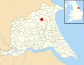 Driffield UK parish locator map.svg 1,425 × 1,107; 1.68 MB
-
 Driffield YO25 - geograph.org.uk - 3556743.jpg 3,581 × 2,502; 1.8 MB
-
 Driffield YO25 - geograph.org.uk - 3556751.jpg 3,212 × 2,336; 1.4 MB
-
 Driffield YO25 - geograph.org.uk - 3556762.jpg 3,451 × 2,629; 1.79 MB
-
 Driffield YO25 - geograph.org.uk - 3556797.jpg 3,772 × 2,634; 1.71 MB
-
 Driffield YO25 - geograph.org.uk - 3556939.jpg 2,793 × 2,582; 1.22 MB
-
 Driffield YO25 - geograph.org.uk - 3556959.jpg 4,032 × 2,416; 1.8 MB
-
 Driffield YO25 - geograph.org.uk - 3556986.jpg 3,800 × 2,771; 2.01 MB
-
 Driffield YO25 - geograph.org.uk - 3557018.jpg 3,479 × 2,540; 1.67 MB
-
 Driffield YO25 - geograph.org.uk - 3557063.jpg 3,680 × 2,575; 1.87 MB
-
 Driffield YO25 - geograph.org.uk - 3557127.jpg 2,359 × 2,496; 1,008 KB
-
 Driffield YO25 - geograph.org.uk - 3557142.jpg 3,893 × 2,618; 1.92 MB
-
 Driffield, All Saints Church - geograph.org.uk - 4113128.jpg 515 × 640; 61 KB
-
 Duncombe Drive, Driffield - geograph.org.uk - 5065081.jpg 640 × 480; 62 KB
-
 Duncombe Drive, Driffield - geograph.org.uk - 5065908.jpg 640 × 480; 50 KB
-
 Dunns Lane - geograph.org.uk - 5443456.jpg 640 × 426; 59 KB
-
 Early Evening at the Driffield Canal - geograph.org.uk - 3494240.jpg 3,696 × 2,480; 2.77 MB


_(34893819780).jpg)


_(34471335843).jpg)


_-_geograph.org.uk_-_4359003.jpg)


_(29964024723).jpg)


_(24623448104).jpg)


_-_geograph.org.uk_-_2286472.jpg)


