Category:Drei Weieren
Jump to navigation
Jump to search
| Object location | | View all coordinates using: OpenStreetMap |
|---|
urban park  | |||||
| Upload media | |||||
| Instance of | |||||
|---|---|---|---|---|---|
| Location |
| ||||
| Street address |
| ||||
| Heritage designation | |||||
 | |||||
Media in category "Drei Weieren"
The following 12 files are in this category, out of 12 total.
-
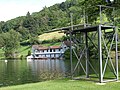
 3 Weieren (16481910693).jpg 3,264 × 2,448; 5.62 MB
-
 Mannenweiher.JPG 2,816 × 2,112; 2.54 MB
-
 Mannenweiher.jpg 1,916 × 2,500; 3.48 MB
-
 St. Gallen auf drei Weihern - Männerweiher 2008 - panoramio.jpg 1,440 × 363; 215 KB
-
 St.Gallen der Bubenweiher - Juni 2011 - panoramio.jpg 1,600 × 473; 267 KB
-
 St.Gallen Dreiweieren Bubenweiher 01.jpg 4,912 × 3,264; 5.72 MB
-
 St.Gallen Dreiweieren Bubenweiher 02.jpg 4,912 × 3,264; 4.88 MB
-
 St.Gallen Dreiweieren Eichweiher.jpg 4,912 × 3,264; 3.78 MB
-
 St.Gallen Dreiweieren Mannenweiher 01.jpg 4,912 × 3,264; 6.69 MB
-
 St.Gallen Dreiweieren Mannenweiher 02.jpg 4,912 × 3,264; 7 MB
-
 StGallen Weiherhaus Tafel.jpg 4,221 × 1,731; 1 MB
-
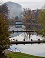
 The three lakes, St. Gallen.jpg 4,032 × 3,024; 2.5 MB
.jpg)


