Category:Draycott, Worcestershire
Jump to navigation
Jump to search
human settlement in United Kingdom  | |||||
| Upload media | |||||
| Instance of | |||||
|---|---|---|---|---|---|
| Location | Kempsey, Malvern Hills, Worcestershire, West Midlands, England | ||||
 | |||||
Media in category "Draycott, Worcestershire"
The following 34 files are in this category, out of 34 total.
-
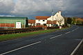 Hartland's Nursery at Draycott.jpg 640 × 426; 66 KB
-
 Oak Farm - geograph.org.uk - 22472.jpg 640 × 479; 86 KB
-
 River Severn near Clevelode - geograph.org.uk - 632101.jpg 640 × 480; 140 KB
-

-
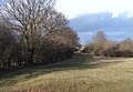
 Bridleway at Clevelode - geograph.org.uk - 631944.jpg 640 × 456; 56 KB
-

-

-
 Flood bank near Clevelode Rough - geograph.org.uk - 596546.jpg 640 × 426; 70 KB
-
 Flooded lane at Draycott near Kempsey - geograph.org.uk - 632504.jpg 640 × 426; 72 KB
-
 Flooded River Severn near Clevelode - geograph.org.uk - 631937.jpg 640 × 469; 72 KB
-
 Footpath at Clevelode - geograph.org.uk - 631941.jpg 640 × 480; 102 KB
-
 Footpath near Clevelode - geograph.org.uk - 631928.jpg 640 × 480; 104 KB
-
 Footpath to Clevelode - geograph.org.uk - 631924.jpg 640 × 480; 102 KB
-
 Footpath to Clevelode - geograph.org.uk - 631946.jpg 640 × 480; 101 KB
-
 Frosty field at Baynhall Farm - geograph.org.uk - 721954.jpg 640 × 426; 57 KB
-
 Frosty field at Baynham - geograph.org.uk - 721959.jpg 640 × 426; 64 KB
-
 House on the Clevelode lane - geograph.org.uk - 631898.jpg 640 × 468; 77 KB
-
 Lower Ham, Kempsey - geograph.org.uk - 631023.jpg 426 × 640; 52 KB
-
 Lower Ham, Kempsey - geograph.org.uk - 632518.jpg 640 × 426; 114 KB
-
 Oak Farm, Kempsey - geograph.org.uk - 631018.jpg 640 × 426; 93 KB
-
 Oak trees in parkland near the Nash - geograph.org.uk - 630079.jpg 640 × 426; 130 KB
-
-
 Path to Chapelhill - geograph.org.uk - 631933.jpg 640 × 447; 57 KB
-

-
 Pixham Farm viewed from the east - geograph.org.uk - 596528.jpg 640 × 426; 64 KB
-
 Pixham House - geograph.org.uk - 346358.jpg 640 × 426; 107 KB
-
 Portocks End - geograph.org.uk - 632135.jpg 640 × 480; 67 KB
-
 Riverside Caravan Park - geograph.org.uk - 632108.jpg 640 × 475; 75 KB
-
 Stubble field at Clevelode - geograph.org.uk - 631906.jpg 640 × 480; 86 KB
-
 The Clevelode Lane - geograph.org.uk - 631896.jpg 640 × 480; 85 KB
-
 Track at Draycott - geograph.org.uk - 632511.jpg 640 × 426; 94 KB
-
 Turf field at Draycott - geograph.org.uk - 632515.jpg 640 × 426; 37 KB
-
 Turf field at Kerswell Green - geograph.org.uk - 630040.jpg 426 × 640; 72 KB
-
 Turf field near Baynhall - geograph.org.uk - 630066.jpg 640 × 426; 73 KB


