Category:Draycott, Derbyshire
Jump to navigation
Jump to search
English: Draycott is a village in the Erewash borough of Derbyshire, England. It lies around 6 miles east of Derby and 3 miles South-West of Long Eaton. Draycott is part of the civil parish of Draycott and Church Wilne. The meandering course of the River Derwent forms the southwestern boundary of the parish.
village in Derbyshire, United Kingdom  | |||||
| Upload media | |||||
| Instance of | |||||
|---|---|---|---|---|---|
| Location | Draycott and Church Wilne, Erewash, Derbyshire, East Midlands, England | ||||
 | |||||
Subcategories
This category has the following 2 subcategories, out of 2 total.
D
- Draycott Mills (13 F)
V
- Victoria Mill, Draycott (24 F)
Media in category "Draycott, Derbyshire"
The following 47 files are in this category, out of 47 total.
-
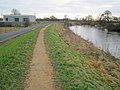
 A Fenced Path Toward Draycott - geograph.org.uk - 1330143.jpg 640 × 480; 120 KB
-

-
 Bench mark, Draycott House gates - geograph.org.uk - 3948000.jpg 1,280 × 960; 421 KB
-

-
 Cedars Farmhouse, Draycott.jpg 1,280 × 960; 306 KB
-

-
 Converted bank at Draycott - geograph.org.uk - 2683057.jpg 480 × 640; 82 KB
-
 Draycott Hall.jpg 1,280 × 960; 532 KB
-
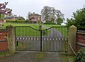 Draycott House.jpg 1,280 × 927; 308 KB
-

-

-
 Forget-Me-Nots - geograph.org.uk - 1295811.jpg 640 × 427; 214 KB
-

-
 Hopwell Road Bridge.jpg 1,280 × 960; 472 KB
-
 Inside Victoria Mill - geograph.org.uk - 843708.jpg 419 × 640; 84 KB
-
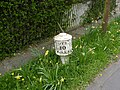 Milepost near Draycott House.jpg 1,280 × 960; 496 KB
-

-
 Nooning Lane Bridge.jpg 960 × 1,280; 392 KB
-
 Potter Lane Bridge.jpg 1,280 × 960; 440 KB
-
 Potters Lane, Draycott - geograph.org.uk - 843704.jpg 640 × 427; 158 KB
-
 River recording station at Draycott - geograph.org.uk - 2298928.jpg 640 × 480; 128 KB
-

-
 Rose and Crown, Draycott - geograph.org.uk - 2451480.jpg 640 × 480; 73 KB
-

-
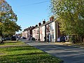
 Station Road, Draycott - geograph.org.uk - 843713.jpg 640 × 427; 179 KB
-
-

-
 The former Nooning ford, looking upstream (geograph 1821925).jpg 640 × 480; 70 KB
-
 The old A52 near Draycott - geograph.org.uk - 3947991.jpg 1,280 × 960; 393 KB
-
 The Olympian, Draycott - geograph.org.uk - 843711.jpg 640 × 433; 128 KB
-
 The River Derwent - South of Draycott - geograph.org.uk - 642664.jpg 640 × 427; 124 KB
-

-

-
 The Victoria, Draycott - geograph.org.uk - 2451488.jpg 640 × 480; 75 KB
-
 Town End Road Draycott - geograph.org.uk - 5499794.jpg 1,280 × 890; 301 KB
-
 Town End Road, Draycott - geograph.org.uk - 1295835.jpg 640 × 473; 99 KB
-
 Water intake facility at Draycott - geograph.org.uk - 2218659.jpg 1,024 × 768; 275 KB
-
 A fly-tipped washing wachine - geograph.org.uk - 642674.jpg 427 × 640; 122 KB
-
 Alders on the bank on the Derwent - geograph.org.uk - 1025855.jpg 640 × 427; 82 KB
-
 Breaston Coffin Stone - geograph.org.uk - 1472434.jpg 640 × 427; 207 KB
-
 Breaston Green at Sunset - geograph.org.uk - 1408037.jpg 640 × 480; 62 KB
-
 Dead Wait Geocache - geograph.org.uk - 58732.jpg 640 × 480; 141 KB
-
 Derby and Sandiacre Canal - Draycott - geograph.org.uk - 117809.jpg 640 × 480; 99 KB
-
 Fields behind Draycott Manor - geograph.org.uk - 64876.jpg 640 × 480; 69 KB
-
 Footpath at Wilne Cross - geograph.org.uk - 64872.jpg 640 × 480; 121 KB
-
 Modern goes over old that cuts ancient - geograph.org.uk - 66119.jpg 640 × 480; 137 KB
-
 Roman Road near Draycott. - geograph.org.uk - 64864.jpg 640 × 480; 73 KB


.jpg)


