Category:Drainage channels in Kingston upon Hull
Jump to navigation
Jump to search
Subcategories
This category has the following 6 subcategories, out of 6 total.
Media in category "Drainage channels in Kingston upon Hull"
The following 11 files are in this category, out of 11 total.
-
 A drain off Richnmond Way, Kingswood, Hull (geograph 3745401).jpg 1,024 × 681; 275 KB
-
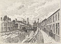 Cottingham Drain, c.1885.jpg 500 × 361; 114 KB
-
 Drain behind the housing (geograph 6249641).jpg 1,024 × 768; 268 KB
-
 Drain clearing, Bransholme, Hull (geograph 6996826).jpg 1,024 × 686; 1.45 MB
-
 East Carr, Sutton on Hull, Yorkshire (geograph 5634198).jpg 2,566 × 1,910; 2.64 MB
-
 East of Hull - geograph.org.uk - 303535.jpg 464 × 640; 118 KB
-
 Spyvee Street Bridge over Sutton Drain, c.1885.jpg 500 × 365; 97 KB
-
 Sutton Cross Drain - geograph.org.uk - 651397.jpg 640 × 480; 88 KB
-
 Sutton Drain Bank or Lime Street Bridge, 1883.jpg 500 × 369; 107 KB
-
 Suttoncross Drain (geograph 4881972).jpg 1,200 × 799; 406 KB
-
 Suttoncross Drain, Bransholme - geograph.org.uk - 774254.jpg 430 × 640; 133 KB
.jpg)

.jpg)
.jpg)


.jpg)

.jpg)