Category:Dpt des Hautes-Pyrénées by PIERRE ANDRE LECLERCQ
Jump to navigation
Jump to search
My pictures taken in the French department of Hautes-Pyrénées.

Media in category "Dpt des Hautes-Pyrénées by PIERRE ANDRE LECLERCQ"
The following 172 files are in this category, out of 172 total.
-
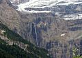
 Alharisses Crête des Alharisses,.jpg 2,592 × 1,944; 3.45 MB
-
 Ancizan (1).jpg 871 × 1,188; 1.08 MB
-
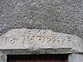 Ancizan linteau de la maison Carrère.jpg 2,592 × 1,944; 3.46 MB
-
 Ancizan linteau de la maison Modraia-Durant.jpg 2,564 × 1,361; 1.41 MB
-
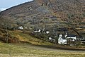
 Ancizan vallée d'Aure.jpg 2,355 × 1,481; 2.08 MB
-
 Ancizan vu des Marioules.jpg 2,592 × 1,680; 2.37 MB
-
 Ancizan vu du Pont de Grézian .jpg 3,456 × 2,592; 7.48 MB
-
 Ancizan, aprés l'orage sous un arc en ciel(diapo scannée).jpg 4,457 × 3,010; 8.07 MB
-
 Ancizan, l' Église Saint Martin.jpg 1,188 × 871; 1.07 MB
-
 Ancizan, La sapinière vue de Bignes.jpg 1,188 × 871; 1.08 MB
-
 Ancizan, Tour de la (Maison) Pène Castet, (2).jpg 2,023 × 3,358; 2.07 MB
-
 Ancizan, Tour de la (Maison) Pène Castet, (3).jpg 832 × 1,170; 921 KB
-
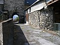
 Ancizan, Tour de la (Maison) Pène Castet,.jpg 871 × 1,188; 1.1 MB
-
 Ancizan.- Bareilles (1).jpg 2,592 × 1,944; 3.51 MB
-
 Ancizan.- Bareilles.jpg 1,944 × 2,592; 3.56 MB
-
 Ancizan.- Gite La Chaumière.jpg 1,188 × 871; 1.18 MB
-
 Ancizan.- le Monument aux Morts.jpg 1,278 × 1,732; 1.62 MB
-
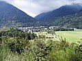 Ancizan.- Vallée d' Aure.jpg 2,592 × 1,944; 4.96 MB
-
 Aragnouet, le lac d'Orédon.jpg 1,600 × 1,200; 186 KB
-
 Aragnouet, Le Pic de Néouvielle et le Pic de Ramougn.jpg 1,600 × 1,196; 253 KB
-
 Aragnouet, sur la route du tunnel de Bielsa.- Le Pic de Bataillence..jpg 1,697 × 1,533; 1.51 MB
-
Arbizon vu de la Hourquette d Ancizan.webm 1 min 7 s, 1,920 × 1,080; 6.03 MB
-
 Arreau L'église Saint-Exupère,.jpg 3,456 × 2,592; 5.04 MB
-
 Arreau La maison des Lys..jpg 1,969 × 3,053; 3.22 MB
-
 Arreau Les aigles d'Aure (1).jpg 2,297 × 1,718; 507 KB
-
 Arreau Les aigles d'Aure (10).jpg 2,592 × 3,456; 4.31 MB
-
 Arreau Les aigles d'Aure (11).jpg 3,456 × 2,592; 5.85 MB
-
 Arreau Les aigles d'Aure (12).jpg 2,592 × 3,456; 4.11 MB
-
 Arreau Les aigles d'Aure (13).jpg 2,592 × 3,456; 5.11 MB
-
 Arreau Les aigles d'Aure (2).jpg 2,179 × 1,544; 421 KB
-
 Arreau Les aigles d'Aure (4).jpg 3,456 × 2,592; 1.92 MB
-
 Arreau Les aigles d'Aure (5).jpg 2,592 × 3,456; 4.89 MB
-
 Arreau Les aigles d'Aure (6).jpg 3,456 × 2,592; 3.78 MB
-
 Arreau Les aigles d'Aure (7).jpg 3,456 × 2,592; 3.3 MB
-
 Arreau Les aigles d'Aure (8).jpg 3,456 × 2,592; 4.96 MB
-
 Arreau Les aigles d'Aure (9).jpg 2,592 × 3,456; 1.44 MB
-
 Arreau Les aigles d'Aure (challenge).jpg 2,179 × 1,544; 1.55 MB
-
 Arreau préparation de gâteau à la broche.jpg 2,592 × 3,456; 5.04 MB
-
 Arreau, au long de la Neste.jpg 1,188 × 871; 998 KB
-
 Arreau, La Halle des producteurs locaux (2).jpg 3,456 × 2,592; 4.44 MB
-
 Arreau, La Halle des producteurs locaux.jpg 3,456 × 2,592; 2.62 MB
-
 Arreau, la neste d' Aure (2).jpg 604 × 453; 53 KB
-
 Arreau, la neste d' Aure rue des Moulins.jpg 3,456 × 2,592; 4.61 MB
-
 Arreau, la Neste d' Aure.jpg 604 × 453; 62 KB
-
 Arreau, Rue Saint Exupère.jpg 1,188 × 871; 885 KB
-
 Arreau, Église Notre-Dame.jpg 2,518 × 3,402; 3.23 MB
-
 Arreau.- Chrisme de l'Eglise Saint Exupère.jpg 2,035 × 1,680; 1.99 MB
-
 Au coeur de la Réserve naturelle régionale d'Aulon.jpg 2,048 × 1,536; 1.72 MB
-
 Au départ du parcours de santé de Grézian en 2010.jpg 3,456 × 2,592; 5.91 MB
-
 Aulon, les granges de Lurgues.jpg 1,186 × 869; 799 KB
-
 Azet bis.JPG 1,186 × 869; 180 KB
-
 Azet le Lustou.jpg 2,048 × 1,214; 559 KB
-
 Azet lustou.jpg 1,188 × 871; 338 KB
-
 Azet.jpg 871 × 1,188; 1,006 KB
-
 Bazus-Aure, l' Eglise Saint Michel.JPG 871 × 1,188; 1.05 MB
-
 Bazus-Aure, vue sur la chaîne du Lustou.jpg 1,188 × 871; 205 KB
-
 Bourips-village (1).jpg 1,188 × 871; 685 KB
-
 Bourips-village.jpg 1,188 × 871; 698 KB
-
 Cadeilhan-Trachère, vue sur Saint Lary Soulan.jpg 1,184 × 867; 337 KB
-
 Cadéac les bains.jpg 1,060 × 834; 936 KB
-
 Cadéac, route forestière.jpg 957 × 671; 97 KB
-
 Campan.- La carrière royale de l'Espiadet (2).jpg 1,188 × 871; 644 KB
-
 Campan.- La carrière royale de l'Espiadet (3).jpg 1,600 × 1,192; 1.18 MB
-
 Campan.- La carrière royale de l'Espiadet (4).jpg 1,600 × 1,196; 1.17 MB
-
 Campan.- La carrière royale de l'Espiadet (5).jpg 2,592 × 1,944; 2.56 MB
-
 Campan.- La carrière royale de l'Espiadet (bis).jpg 2,592 × 1,944; 3.15 MB
-
 Campan.- La carrière royale de l'Espiadet.jpg 1,188 × 871; 749 KB
-
 Ens 65170, l'Eglise Saint Etienne.jpg 1,188 × 871; 310 KB
-
 Estensan, Région Occitanie France (scan diapo).jpg 5,502 × 2,412; 8.57 MB
-
 Gavarnie, le Cirque (2).jpg 1,162 × 846; 184 KB
-
 Gavarnie, le Cirque.jpg 1,132 × 800; 187 KB
-
 Gavarnie, Ruisseau de Entortes au Bosquet Long.jpg 1,176 × 866; 228 KB
-
 Gavarnie,.jpg 1,188 × 871; 179 KB
-
 Grezian.- Église Saint Just et Pasteur.jpg 1,188 × 871; 175 KB
-
 Grézian.- le Grand et le Petit Arbizon.jpg 1,188 × 871; 174 KB
-
 Grézian.jpg 1,600 × 1,200; 463 KB
-
 Guchan.- Acrobranche en forêt suspendue.jpg 2,306 × 3,433; 4.93 MB
-
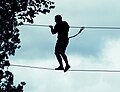 Guchan.- silhouette en forêt suspendue.jpg 2,186 × 1,675; 1.87 MB
-
 Guchen , armoirie du 17e siècle.-IA65000319.jpg 1,893 × 1,412; 1.99 MB
-
 Guchen , Le Lustou vu de la rue des Artigaoux.jpg 2,048 × 1,536; 2.2 MB
-
 Guchen ancienne carte-postale (1).jpg 1,024 × 623; 281 KB
-
 Guchen de la fontaine Postcards of Hautes-Pyrénées (Labouche) (1).jpg 1,012 × 648; 247 KB
-
 Guchen de la fontaine Postcards of Hautes-Pyrénées (Labouche) (3).jpg 1,600 × 1,047; 381 KB
-
 Guchen de la fontaine Postcards of Hautes-Pyrénées (Tito).jpg 975 × 613; 546 KB
-
 Guchen hospice Rolland.jpg 1,024 × 647; 250 KB
-
 Guchen Hospice Saint-Jean-Baptiste, (2).jpg 580 × 380; 220 KB
-
 Guchen Hospice Saint-Jean-Baptiste, (3).jpg 812 × 518; 138 KB
-
 Guchen Hospice Saint-Jean-Baptiste,.jpg 1,067 × 1,677; 469 KB
-
 Guchen la base sportive.tiff 1,840 × 1,286; 6.54 MB
-
 Guchen la Fontaine illuminée.jpg 2,048 × 1,536; 2.23 MB
-
 Guchen le Boulodrome Chemin de la Garenne,.jpg 1,912 × 926; 1.47 MB
-
 Guchen le château Rolland 2010.jpg 3,456 × 2,592; 4.68 MB
-
 Guchen un petit-matin d'hiver.tif 1,832 × 1,289; 7.31 MB
-
 Guchen Vallée d'Aure en2010 (1).jpg 2,592 × 3,456; 5.23 MB
-
 Guchen Vallée d'Aure en2010 (2).jpg 2,592 × 3,456; 5.1 MB
-
 Guchen Vallée d'Aure en2010 (3).jpg 2,592 × 3,456; 4.18 MB
-
 Guchen Vallée d'Aure en2010 (4).jpg 2,592 × 3,456; 3.86 MB
-
 Guchen Vallée d'Aure en2010 (5).jpg 1,743 × 2,103; 1.53 MB
-
 Guchen Villa la Champenoise (1).jpg 2,592 × 3,456; 4.73 MB
-
 Guchen Villa la Champenoise (2).jpg 3,456 × 2,592; 3.82 MB
-
 Guchen Villa la Champenoise t IA65000332.jpg 1,869 × 2,304; 1.6 MB
-
 Guchen église Postcards of Hautes-Pyrénées (Labouche).jpg 1,163 × 736; 303 KB
-
 Guchen, ancienne carte postale de la Maison du Procureur.jpg 1,035 × 1,600; 1.22 MB
-
 Guchen, Chalet route de la Vallée d' Aure..jpg 2,048 × 1,536; 1.66 MB
-
 Guchen, clocher de l'Église Saint-Brice Sainte-Catherine NB (2).jpg 2,592 × 1,680; 2.93 MB
-
 Guchen, clocher de l'Église Saint-Brice Sainte-Catherine NB (3).jpg 1,461 × 2,289; 1.34 MB
-
 Guchen, clocher de l'Église Saint-Brice Sainte-Catherine NB.jpg 1,566 × 2,524; 2.62 MB
-
 Guchen, clocher de l'Église Saint-Brice Sainte-Catherine.jpg 2,592 × 1,680; 2.69 MB
-
 Guchen, cour du Château Rolland.jpg 2,512 × 3,396; 2.11 MB
-
 Guchen, Crête du Pic de Lio.jpg 2,048 × 1,536; 2.18 MB
-
 Guchen, La fontaine.jpg 867 × 1,186; 181 KB
-
 Guchen, la Maison du Procureur en Vallée d'Aure (1).jpg 3,366 × 2,468; 1.77 MB
-
 Guchen, la Maison du Procureur en Vallée d'Aure (2).jpg 2,321 × 3,303; 3.96 MB
-
 Guchen, la Maison du Procureur en Vallée d'Aure (3).jpg 2,237 × 1,895; 2.18 MB
-
 Guchen, la Maison du Procureur.jpg 3,456 × 2,592; 4.9 MB
-
 Guchen, le Lavoir du Chemin des Genets.jpg 3,456 × 2,592; 5.57 MB
-
 Guchen, Le Lustou vu du CV des Choucas –.jpg 2,592 × 3,456; 5.58 MB
-
 Guchen, Le pic de Lio vu du chemin des Ecoles.jpg 1,188 × 871; 1.32 MB
-
 Guchen, le Pont de Grézian.jpg 2,430 × 1,839; 3.06 MB
-
 Guchen, le préventorium.jpg 3,384 × 2,492; 1.14 MB
-
 Guchen, vue sur la Chaîne du Lustou.jpg 1,200 × 835; 608 KB
-
 Guchen, vue sur la Vallée d'Aure, de la route de l'Arbizon.jpg 1,974 × 1,432; 835 KB
-
 Guchen, Église Sainte-Catherine PA00095377.jpg 1,470 × 1,273; 1.51 MB
-
 Guchen,.jpg 3,456 × 2,592; 2.04 MB
-
 Guchen,l'Église Sainte-Catherine et la Mairie.jpg 3,456 × 2,592; 2.35 MB
-
 Guchen.- Hara sur le Chemin de la Marioule.jpg 1,188 × 871; 251 KB
-
 Guchen.- la vallée d'Aure.jpg 1,188 × 871; 151 KB
-
 Guchen.- le Lavedan.jpg 1,188 × 871; 414 KB
-
 Guchen.- Portail 38 route de la Vallée d' Aure.jpg 871 × 1,188; 165 KB
-
 Hautes-Pyrénées, La Mongie (2).jpg 1,600 × 1,184; 246 KB
-
 Hautes-Pyrénées, La Mongie.jpg 1,732 × 2,448; 726 KB
-
 Joubarbe in Parc National des Pyrénées.jpg 2,980 × 2,592; 4.46 MB
-
 La Mongie (1).JPG 2,592 × 1,260; 861 KB
-
 La Mongie (2).JPG 2,592 × 1,944; 2 MB
-
 La Mongie.- La Chapelle Notre-Dame de La Mongie.jpg 1,160 × 849; 921 KB
-
 Le Lustou vu de Guchen.jpg 1,252 × 885; 296 KB
-
 Le massif du Luchonnais et Le Pic de Hourgade (2964m).jpg 1,188 × 871; 634 KB
-
 Le Pla d'Adet, la chaîne de l' Arbizon.jpg 1,188 × 871; 735 KB
-
 Les pics de Portarras et de Bastan.jpg 3,128 × 3,008; 6.9 MB
-
 Loudenvielle Église paroissiale de Saints Just et Pasteur.jpg 1,154 × 837; 601 KB
-
 Loudenvielle.- La mairie.jpg 1,152 × 864; 906 KB
-
 Luz-Saint-Sauveur, Le Pont Napoleon.jpg 871 × 1,188; 282 KB
-
 Mailh d'Aulon depuis les granges de Lurgues – à Aulon, Ete 2006.jpg 2,048 × 1,536; 1.73 MB
-
 Maison Rue Salcedo, 65240 Ancizan.jpg 1,188 × 871; 1.15 MB
-
 Monléon-Magnoac Carte postale de la Porte fortifiée.jpg 594 × 938; 623 KB
-
Pic du Midi de Bigorre Et 2016 vu de la Hourquette.ogv 42 s, 720 × 576; 3.7 MB
-
 Réserve naturelle régionale d'Aulon.jpg 1,707 × 955; 1.49 MB
-
 Saint Lary Soulan.- Station du Pla d'Adet (2).jpg 1,877 × 1,188; 1.73 MB
-
 Saint Lary Soulan.- Station du Pla d'Adet.jpg 1,877 × 1,188; 1.64 MB
-
 Saint-Lary-Soulan (2).JPG 1,152 × 864; 297 KB
-
 Saint-Lary-Soulan Fontaine du centre ville.JPG 1,152 × 864; 311 KB
-
 Saint-Lary-Soulan l' église Saint Bertrand.JPG 1,064 × 860; 244 KB
-
 Saint-Lary-Soulan la Mairie (2).JPG 1,152 × 864; 304 KB
-
 Saint-Lary-Soulan Saint Lary Soulan, LaTour d'Agut dite Tour Hachan (1).JPG 1,136 × 842; 286 KB
-
 Saint-Lary-Soulan Saint Lary Soulan, LaTour d'Agut dite Tour Hachan (2).JPG 1,152 × 864; 301 KB
-
 Sur le sentier menant à Auloueilh.jpg 2,048 × 1,536; 2.1 MB
-
 Vallon du Lavedan à l'entrée d' Aulon en Hiver.jpg 2,541 × 1,673; 2.74 MB
-
 Vallon du Lavedan à la Coume d'Espigous en Hiver.jpg 2,550 × 1,612; 1.98 MB
-
 Vallée d'Aure- Guchen.- la chaîne du Lustou, vu du quartier deths capis.jpg 1,188 × 871; 150 KB
-
 Vallée du Loudenvielle, lac de Genos.jpg 2,588 × 1,674; 1.16 MB
-
 Vielle-Aure village (2005).jpg 2,592 × 1,944; 2.3 MB
-
 Vielle-Aure.- La mine de manganèse (1).JPG 2,592 × 1,944; 2.08 MB
-
 Vielle-Aure.- La mine de manganèse (2).JPG 2,592 × 1,944; 2.31 MB
-
 Vielle-Aure.- La mine de manganèse (3).JPG 2,592 × 1,944; 2.11 MB
-
 Vielle-Aure.- La mine de manganèse (4).JPG 2,592 × 1,944; 2.2 MB
-
 Vielle-Aure.- La mine de manganèse (5).JPG 2,592 × 1,944; 2.49 MB
-
 Vielle-Aure.- La mine de manganèse (6).JPG 2,592 × 1,944; 2.88 MB
-
 Vielle-Aure.- La mine de manganèse (7).JPG 2,592 × 1,944; 2.55 MB
-
 Vielle-Aure.- La mine de manganèse (8).JPG 2,592 × 1,944; 2.74 MB
-
 Village de Guchen (1).jpg 3,456 × 2,590; 5.03 MB
-
 Village de Guchen (2).jpg 1,600 × 1,200; 1.04 MB
-
 Village de Guchen (3).jpg 2,048 × 1,536; 1.92 MB

.jpg)


.jpg)


_P%C3%A8ne_Castet,_(2).jpg)
_P%C3%A8ne_Castet,_(3).jpg)
_P%C3%A8ne_Castet,.jpg)
.jpg)


.jpg)
.jpg)
.jpg)
.jpg)
.jpg)
.jpg)
.jpg)
.jpg)
.jpg)
.jpg)
.jpg)
.jpg)
.jpg)


.jpg)

.jpg)


.jpg)


.jpg)
.jpg)
.jpg)
.jpg)
.jpg)


.jpg)
.jpg)


.jpg)
_(1).jpg)
_(3).jpg)
.jpg)

.jpg)
.jpg)


.jpg)
.jpg)
.jpg)
.jpg)
.jpg)
.jpg)
.jpg)

.jpg)


.jpg)
.jpg)


.jpg)
.jpg)
.jpg)


.jpg)


.JPG)
.JPG)


.jpg)


.jpg)

.JPG)


.JPG)
.JPG)
.JPG)


.jpg)
.JPG)
.JPG)
.JPG)
.JPG)
.JPG)
.JPG)
.JPG)
.JPG)
.jpg)
.jpg)
.jpg)