Category:Downland in Hampshire
Jump to navigation
Jump to search
Subcategories
This category has the following 3 subcategories, out of 3 total.
Media in category "Downland in Hampshire"
The following 47 files are in this category, out of 47 total.
-
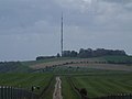
 Autumnal view from the downs above Kingsclere.jpg 3,264 × 2,448; 3.54 MB
-
 Downland above the Meon Valley - geograph.org.uk - 362895.jpg 640 × 480; 100 KB
-
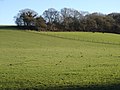
 Downland in the Candover Valley - geograph.org.uk - 284087.jpg 640 × 480; 129 KB
-
 Downland near Ashmansworth - geograph.org.uk - 403500.jpg 640 × 480; 125 KB
-
 Downland near Faccombe - geograph.org.uk - 403507.jpg 640 × 480; 123 KB
-
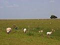
 Downland South of Hannington - geograph.org.uk - 697869.jpg 640 × 480; 61 KB
-
 Downland, Faccombe - geograph.org.uk - 769969.jpg 640 × 480; 122 KB
-
 Downland, Kingsclere - geograph.org.uk - 910905.jpg 640 × 480; 195 KB
-
 Downland, Kingsclere - geograph.org.uk - 910910.jpg 640 × 480; 144 KB
-
 Downland, Kingsclere - geograph.org.uk - 910919.jpg 640 × 480; 88 KB
-
 Downland, Linkenholt - geograph.org.uk - 769883.jpg 640 × 480; 126 KB
-
 Downland, Nether Wallop - geograph.org.uk - 519712.jpg 640 × 480; 123 KB
-
 Downs south of Cheesefoot Head - geograph.org.uk - 252005.jpg 640 × 480; 333 KB
-
 Downs South of Hannington - geograph.org.uk - 697865.jpg 640 × 480; 81 KB
-
 Edge of Breamore Down - geograph.org.uk - 409591.jpg 640 × 480; 49 KB
-
 Farmland below Hazel Down - geograph.org.uk - 909750.jpg 640 × 480; 107 KB
-
 Farmland below Hazel Down - geograph.org.uk - 909758.jpg 640 × 480; 93 KB
-
 Watership Down - geograph.org.uk - 24342.jpg 640 × 480; 390 KB
-
 Watership Down - geograph.org.uk - 3111.jpg 640 × 480; 20 KB
-
 Watership Down.gif 500 × 305; 101 KB
-
 Watership from northeast.jpg 480 × 360; 42 KB
-
 Byway and downland, Marten - geograph.org.uk - 738264.jpg 640 × 480; 179 KB
-
 Candover Valley downland - geograph.org.uk - 290903.jpg 640 × 480; 95 KB
-
 Chalk Downland in Winter - geograph.org.uk - 322967.jpg 640 × 480; 94 KB
-
 Downland at Four Corners - geograph.org.uk - 294897.jpg 640 × 480; 105 KB
-

-
 Downland near Kingsclere - geograph.org.uk - 173629.jpg 640 × 480; 95 KB
-
 Downland near Stapleton Farm - geograph.org.uk - 295106.jpg 640 × 480; 73 KB
-
 Downland of the upper Meon Valley - geograph.org.uk - 362885.jpg 640 × 480; 96 KB
-
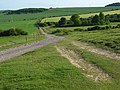 Downland track, Shipton Bellinger - geograph.org.uk - 440660.jpg 640 × 480; 182 KB
-
 Downland, Combe - geograph.org.uk - 763918.jpg 640 × 480; 101 KB
-
 Downland, Combe - geograph.org.uk - 769855.jpg 640 × 480; 128 KB
-
 Downland, Combe - geograph.org.uk - 769862.jpg 640 × 480; 111 KB
-
 Downland, Combe - geograph.org.uk - 769872.jpg 640 × 480; 95 KB
-
 Downland, East Woodhay - geograph.org.uk - 762435.jpg 640 × 480; 137 KB
-
 Downland, East Woodhay - geograph.org.uk - 763915.jpg 640 × 480; 143 KB
-
 Downland, East Woodhay - geograph.org.uk - 763916.jpg 640 × 480; 162 KB
-
 Downland, Hollington - geograph.org.uk - 403263.jpg 640 × 480; 133 KB
-
 Downland, Linkenholt - geograph.org.uk - 769894.jpg 640 × 480; 131 KB
-
 Downland, Nether Wallop - geograph.org.uk - 461280.jpg 640 × 480; 128 KB
-
 Downland, Nether Wallop - geograph.org.uk - 464992.jpg 640 × 480; 104 KB
-
 Downland, Nether Wallop - geograph.org.uk - 465032.jpg 640 × 480; 122 KB
-
 Downland, Tidcombe - geograph.org.uk - 417977.jpg 640 × 480; 136 KB
-
 Downs above Kingsclere - geograph.org.uk - 173419.jpg 640 × 480; 98 KB
-
 Downs above Kingsclere - geograph.org.uk - 361096.jpg 640 × 477; 77 KB
-
 Downs North-east of Overton - geograph.org.uk - 697774.jpg 640 × 480; 74 KB
-
 Downs, Litchfield - geograph.org.uk - 306296.jpg 640 × 480; 131 KB


