Category:Douglas Bridge
Jump to navigation
Jump to search
English: Douglas Bridge is a small village in County Tyrone, Northern Ireland, near Strabane. In the 2001 Census it had a population of 81 people. It lies within the Strabane District Council area.
village in United Kingdom  | |||||
| Upload media | |||||
| Instance of | |||||
|---|---|---|---|---|---|
| Location | Northern Ireland | ||||
 | |||||
Media in category "Douglas Bridge"
The following 78 files are in this category, out of 78 total.
-

-
 A low hill, Knockroe - geograph.org.uk - 4258588.jpg 640 × 480; 162 KB
-
 A rear view of the Ballantine cabin. - geograph.org.uk - 434742.jpg 640 × 426; 151 KB
-
 Abandoned buildings at Meenawaddy - geograph.org.uk - 197203.jpg 640 × 283; 35 KB
-
 An open field, Skinboy - geograph.org.uk - 4258602.jpg 640 × 480; 161 KB
-
 Backburn Road - geograph.org.uk - 197197.jpg 640 × 479; 61 KB
-
 Bearney Road, Elagh - geograph.org.uk - 4360605.jpg 640 × 480; 339 KB
-
 Birds - geograph.org.uk - 135223.jpg 640 × 479; 125 KB
-
 Bunbeg Townland, Douglas Bridge - geograph.org.uk - 135209.jpg 640 × 479; 108 KB
-
 Bunderg Road - geograph.org.uk - 4258586.jpg 640 × 480; 152 KB
-
 Bunderg Road, Knockroe - geograph.org.uk - 4258581.jpg 640 × 480; 143 KB
-
 Bunderg Road, Knockroe - geograph.org.uk - 4258590.jpg 640 × 480; 146 KB
-
 Burn, Elagh - geograph.org.uk - 4360625.jpg 640 × 480; 160 KB
-
 Camus Road - geograph.org.uk - 2397361.jpg 640 × 480; 60 KB
-
 Camus Road, Douglas Bridge - geograph.org.uk - 2397357.jpg 640 × 480; 55 KB
-
 Camus Road, Douglas Bridge - geograph.org.uk - 2397363.jpg 640 × 480; 52 KB
-
 Camus Road, Douglas Bridge - geograph.org.uk - 2397375.jpg 640 × 480; 44 KB
-
 Carrigullin Road, Douglas Bridge - geograph.org.uk - 192878.jpg 640 × 479; 65 KB
-
 Children's burial ground, Meenatumigan - geograph.org.uk - 126458.jpg 640 × 479; 185 KB
-
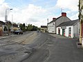
 Douglas Bridge - geograph.org.uk - 192869.jpg 640 × 479; 63 KB
-
 Douglas Bridge - geograph.org.uk - 192871.jpg 640 × 479; 68 KB
-

-
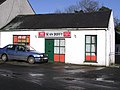 Douglas Bridge Post Office - geograph.org.uk - 135188.jpg 640 × 478; 91 KB
-
 Douglas Bridge, County Tyrone - geograph.org.uk - 2397378.jpg 640 × 480; 46 KB
-
 Douglas Presbyterian Church - geograph.org.uk - 135193.jpg 640 × 479; 101 KB
-
 Drumnahoe Townland, Douglas Bridge - geograph.org.uk - 135185.jpg 640 × 479; 94 KB
-
 Elagh Townland - geograph.org.uk - 192860.jpg 640 × 479; 69 KB
-
 Elagh, Douglas Bridge - geograph.org.uk - 192881.jpg 640 × 479; 71 KB
-
 Erin Road, Elagh - geograph.org.uk - 4360620.jpg 640 × 480; 151 KB
-
 Erin Road, Elagh - geograph.org.uk - 4360626.jpg 640 × 480; 145 KB
-
 Farm buildings at Shanonny - geograph.org.uk - 135225.jpg 640 × 479; 132 KB
-

-
 Gallon Upper - geograph.org.uk - 197205.jpg 640 × 479; 84 KB
-
 Gillygromes Hill, Douglas Bridge - geograph.org.uk - 135203.jpg 640 × 479; 81 KB
-
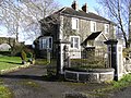 House at Douglas Bridge - geograph.org.uk - 135187.jpg 640 × 479; 177 KB
-
 Johnston's Memorial Hall, Douglas Bridge - geograph.org.uk - 135196.jpg 640 × 479; 142 KB
-
 Knock Road, Elagh - geograph.org.uk - 4360610.jpg 640 × 480; 150 KB
-
 Knock Road, Elagh - geograph.org.uk - 4360616.jpg 640 × 480; 151 KB
-
 Knockiniller Road, Douglas Bridge - geograph.org.uk - 2397379.jpg 640 × 480; 71 KB
-
 Knockiniller Road, Knockiniller - geograph.org.uk - 4258605.jpg 640 × 480; 140 KB
-
 Knockiniller Townland - geograph.org.uk - 4258610.jpg 640 × 480; 142 KB
-
 Knockiniller Townland - geograph.org.uk - 4258612.jpg 640 × 480; 138 KB
-
 Knockinller Road - geograph.org.uk - 197186.jpg 640 × 479; 74 KB
-
 Knockroe Townland - geograph.org.uk - 4258595.jpg 640 × 480; 153 KB
-
 Knockroe Townland, Douglas Bridge - geograph.org.uk - 135205.jpg 640 × 479; 111 KB
-
 Knockroe, Douglas Bridge - geograph.org.uk - 135207.jpg 640 × 479; 119 KB
-
 Koram Road - geograph.org.uk - 197187.jpg 640 × 479; 54 KB
-
 Ligfordrum - geograph.org.uk - 197193.jpg 640 × 479; 58 KB
-
 Ligfordrum - geograph.org.uk - 197194.jpg 640 × 479; 47 KB
-
 Ligfordrum - geograph.org.uk - 197469.jpg 640 × 479; 59 KB
-
 Ligfordrum Catholic school. - geograph.org.uk - 434863.jpg 640 × 426; 99 KB
-
 Ligfordrum Forest - geograph.org.uk - 197466.jpg 640 × 479; 48 KB
-
 Ligfordrum Forest - geograph.org.uk - 197467.jpg 640 × 479; 72 KB
-
 Ligfordrum or Douglas Townland - geograph.org.uk - 197192.jpg 640 × 298; 35 KB
-
 Ligfordrum Townland - geograph.org.uk - 197189.jpg 640 × 479; 47 KB
-
 Ligfordrum Townland - geograph.org.uk - 197459.jpg 640 × 479; 43 KB
-
 Lisnafin Glebe, Newtownstewart - geograph.org.uk - 135181.jpg 640 × 479; 92 KB
-
 Lisnafin Road, Douglas bridge - geograph.org.uk - 135184.jpg 640 × 479; 117 KB
-
 Lisnafin Townland - geograph.org.uk - 135183.jpg 640 × 479; 100 KB
-

-
 Maggie's fire and hearth. - geograph.org.uk - 434723.jpg 640 × 426; 137 KB
-
 Meenashesk Townland - geograph.org.uk - 192899.jpg 640 × 479; 50 KB
-
 Meenawaddy - geograph.org.uk - 197202.jpg 640 × 479; 60 KB
-
 Meenawaddy - geograph.org.uk - 197219.jpg 640 × 479; 91 KB
-
 Meenawaddy Townland - geograph.org.uk - 197199.jpg 640 × 479; 58 KB
-
 Meenawaddy Townland - geograph.org.uk - 197218.jpg 640 × 479; 63 KB
-
 Old farm at Koram - geograph.org.uk - 197183.jpg 640 × 479; 80 KB
-
 Outlook from Ballantine's Tyrone cabin. - geograph.org.uk - 434734.jpg 640 × 426; 133 KB
-
 Rough lane, Knockroe - geograph.org.uk - 4258584.jpg 640 × 480; 163 KB
-
 Shanonny Road, Douglas Bridge - geograph.org.uk - 3761913.jpg 640 × 480; 45 KB
-
 Shanonny Road, Drumnahoe - geograph.org.uk - 4225110.jpg 640 × 480; 153 KB
-
 Shanonny Townland, Douglas Bridge - geograph.org.uk - 135221.jpg 640 × 479; 127 KB
-
 Shanonny Townland, Newtownstewart - geograph.org.uk - 135218.jpg 640 × 479; 100 KB
-

-
 The Sportsman's Inn, Douglas Bridge - geograph.org.uk - 2397368.jpg 640 × 480; 46 KB
-
 The Sportsmans Inn, Douglas - geograph.org.uk - 135190.jpg 640 × 479; 92 KB
-
 Tirmegan Road, Douglas Bridge - geograph.org.uk - 135211.jpg 640 × 479; 147 KB
-
 Turf shed and stables, Gallan Upper - geograph.org.uk - 197207.jpg 640 × 285; 40 KB


