Category:Dorrington, Shropshire
Jump to navigation
Jump to search
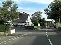
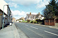
English: Dorrington is a village in Shropshire, England. The village lies on the A49 road, and did once have a railway station, but this is now closed, although the line that runs through the village is still running. There are two pubs.
village in Shropshire, England, UK  | |||||
| Upload media | |||||
| Instance of | |||||
|---|---|---|---|---|---|
| Location | Condover, Shropshire, West Midlands, England | ||||
 | |||||
Subcategories
This category has the following 2 subcategories, out of 2 total.
D
Media in category "Dorrington, Shropshire"
The following 50 files are in this category, out of 50 total.
-
 "Wot you lookin' at" - geograph.org.uk - 651211.jpg 640 × 480; 85 KB
-
 'The Hollies'. - geograph.org.uk - 651206.jpg 640 × 480; 88 KB
-
 A49 and Dorrington Horseshoes pub - geograph.org.uk - 3951928.jpg 4,320 × 3,240; 2.91 MB
-
-
 A49 at The Bank, Dorrington - geograph.org.uk - 3545373.jpg 640 × 480; 31 KB
-
 A49 passes Dorrington Old Hall - geograph.org.uk - 3773155.jpg 3,537 × 2,612; 1.61 MB
-
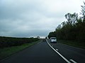
 A49 to north of Dorrington - geograph.org.uk - 2125529.jpg 640 × 480; 279 KB
-
 All in a day's work - geograph.org.uk - 858989.jpg 640 × 480; 293 KB
-
 Bridge Inn (1) near Dorrington - geograph.org.uk - 2821030.jpg 1,024 × 668; 175 KB
-
 Bridge Inn (2) - sign, near Dorrington - geograph.org.uk - 2821058.jpg 775 × 1,024; 188 KB
-

-
 Church Bridge, Dorrington.jpg 2,285 × 1,714; 1.87 MB
-
 Cound Brook near Dorrington - geograph.org.uk - 2822996.jpg 1,024 × 683; 285 KB
-
 Cound Brook near Dorrington - geograph.org.uk - 2823014.jpg 683 × 1,024; 276 KB
-
 Country lane to Stapleton, near Dorrington - geograph.org.uk - 2820494.jpg 1,024 × 659; 186 KB
-
 Dorrington Business Park - geograph.org.uk - 2125520.jpg 640 × 480; 169 KB
-
 Dorrington houses - geograph.org.uk - 2086266.jpg 640 × 480; 104 KB
-
 Dorrington Industrial Estate - geograph.org.uk - 858984.jpg 640 × 480; 231 KB
-
 Dorrington Old Hall.jpg 640 × 480; 64 KB
-
 Dorrington Primary School - geograph.org.uk - 1878265.jpg 998 × 749; 168 KB
-
 Dorrington station site - geograph.org.uk - 3262436.jpg 1,024 × 686; 117 KB
-

-
 Driveway to Stone House Farm - geograph.org.uk - 651194.jpg 640 × 480; 72 KB
-

-
 Erozone, Dorrington Business Park - geograph.org.uk - 1526856.jpg 640 × 480; 66 KB
-
 Main Road, Dorrington - geograph.org.uk - 2958246.jpg 640 × 480; 54 KB
-
 Netley Lodge.jpg 640 × 406; 207 KB
-
 Old Post Office, Dorrington.jpg 2,448 × 1,836; 1.31 MB
-
 OS flush bracket - Dorrington Horseshoes pub - geograph.org.uk - 4569471.jpg 979 × 1,306; 422 KB
-
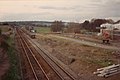
 Railway line near Dorrington - geograph.org.uk - 2823095.jpg 1,024 × 683; 262 KB
-
 Railway line near Dorrington - geograph.org.uk - 2823555.jpg 1,024 × 655; 224 KB
-
 Roadside house, Dorrington - geograph.org.uk - 3545378.jpg 640 × 480; 37 KB
-
-
 Station Road near Dorrington - geograph.org.uk - 2823053.jpg 1,024 × 682; 164 KB
-
 Station Road near Dorrington - geograph.org.uk - 2823066.jpg 672 × 1,024; 258 KB
-
 The Bridge Inn - geograph.org.uk - 1452318.jpg 640 × 332; 42 KB
-
 The Bridge Inn - geograph.org.uk - 1881067.jpg 742 × 557; 186 KB
-
 The Bridge Inn, Dorrington - geograph.org.uk - 2086262.jpg 640 × 480; 53 KB
-
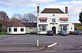
 The Horseshoes - geograph.org.uk - 858981.jpg 640 × 480; 211 KB
-
 The lane to the pub - geograph.org.uk - 750735.jpg 640 × 480; 109 KB
-
 The Lodge. - geograph.org.uk - 629128.jpg 640 × 480; 59 KB
-
 Trees in a Row. - geograph.org.uk - 629133.jpg 640 × 480; 67 KB
-
 Corner of Fox Covert. - geograph.org.uk - 652637.jpg 640 × 480; 116 KB
-
 Dorrington - geograph.org.uk - 36118.jpg 640 × 423; 118 KB
-
 Higher Netley. - geograph.org.uk - 629092.jpg 640 × 480; 61 KB
-
 Lane to Factory Dingle. - geograph.org.uk - 651164.jpg 640 × 480; 73 KB
-

-
 Old Hall. - geograph.org.uk - 629103 (cropped).jpg 387 × 387; 41 KB
-
 Old Hall. - geograph.org.uk - 629103.jpg 640 × 480; 83 KB
-
 Signal Bank. - geograph.org.uk - 629097.jpg 640 × 480; 50 KB


_near_Dorrington_-_geograph.org.uk_-_2821030.jpg)
_-_sign,_near_Dorrington_-_geograph.org.uk_-_2821058.jpg)


.jpg)

