Category:Dorrery
Jump to navigation
Jump to search
human settlement in Highland, Scotland, UK | |||||
| Upload media | |||||
| Instance of | |||||
|---|---|---|---|---|---|
| Location |
| ||||
 | |||||
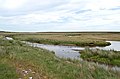
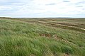
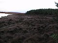
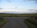
English: Dorrery is a small hamlet lying to the east of Ben Dorrery in the district of Halkirk in Caithness, Scottish Highlands and is in the Scottish council area of Highland.
Media in category "Dorrery"
The following 40 files are in this category, out of 40 total.
-
 Cnoc Loch Eileanaich - geograph.org.uk - 203322.jpg 640 × 424; 76 KB
-
 Loch Caise - geograph.org.uk - 204032.jpg 640 × 424; 57 KB
-
 Loch Caisie, Caithness - geograph.org.uk - 203662.jpg 640 × 424; 54 KB
-
 Loch Dubh - geograph.org.uk - 482019.jpg 640 × 486; 71 KB
-
 Loch Garbh forest - geograph.org.uk - 203328.jpg 640 × 424; 66 KB
-
 Loch Garbh forest - geograph.org.uk - 203330.jpg 640 × 424; 71 KB
-
 Loch More - geograph.org.uk - 204031.jpg 640 × 424; 36 KB
-
 Smiles 1878 robertdickbaker00smil 0115 Dorery Hills.jpg 1,949 × 1,513; 399 KB
-
 'Path' to Caol Loch - geograph.org.uk - 1106806.jpg 640 × 360; 49 KB
-
 Approaching Dorrerry - geograph.org.uk - 551223.jpg 640 × 480; 70 KB
-
 Approaching the junction for Dorrery - geograph.org.uk - 551169.jpg 640 × 480; 56 KB
-
 Ben Dorrery trig - geograph.org.uk - 172735.jpg 640 × 480; 90 KB
-
 Bog hole near Loch Dhu - geograph.org.uk - 203751.jpg 640 × 424; 74 KB
-
 Burn and bales - geograph.org.uk - 551466.jpg 640 × 480; 88 KB
-
 By Dalnaglaton - geograph.org.uk - 203910.jpg 640 × 424; 67 KB
-
 By Dalnaglaton - geograph.org.uk - 203917.jpg 640 × 424; 47 KB
-
 By Dalnaha - geograph.org.uk - 204026.jpg 640 × 424; 52 KB
-
 By Loch Dubh - geograph.org.uk - 203784.jpg 640 × 425; 67 KB
-
 Catanach and Skyline Loch - geograph.org.uk - 763617.jpg 640 × 479; 51 KB
-
 Cnoc an Eich - geograph.org.uk - 204027.jpg 640 × 424; 79 KB
-
 Cnoc nan Sithean - geograph.org.uk - 203823.jpg 640 × 424; 63 KB
-
 Contrasting farmland - geograph.org.uk - 551212.jpg 640 × 480; 59 KB
-
 Dwelling at Brawlbin - geograph.org.uk - 551222.jpg 640 × 480; 53 KB
-
 Farmland near Brawlbin Farm - geograph.org.uk - 551202.jpg 640 × 480; 71 KB
-
 Forestry - geograph.org.uk - 10000.jpg 576 × 432; 50 KB
-
 Forestry - geograph.org.uk - 427972.jpg 640 × 480; 90 KB
-
 Forestry near Shurrery. - geograph.org.uk - 551179.jpg 640 × 480; 57 KB
-
 Garbh Loch, Caithness - geograph.org.uk - 203657.jpg 640 × 424; 62 KB
-
 Junction at Brawlbin - geograph.org.uk - 551215.jpg 640 × 480; 48 KB
-
 Junction for Dorrery - geograph.org.uk - 551152.jpg 640 × 480; 56 KB
-
 Kingmaking Stone - geograph.org.uk - 729043.jpg 640 × 480; 146 KB
-
 Loch Gaineimh Burn - geograph.org.uk - 203327.jpg 640 × 425; 59 KB
-
 Luachair Block, Broubster Forest - geograph.org.uk - 686582.jpg 640 × 480; 98 KB
-
 Plantation boundary near Loch Calder - geograph.org.uk - 551439.jpg 640 × 480; 61 KB
-
 Private road to Shurrery Lodge - geograph.org.uk - 551158.jpg 640 × 480; 71 KB
-
 Road to Dalnawillan - geograph.org.uk - 482072.jpg 640 × 437; 58 KB
-
 Road to Loch Dubh - geograph.org.uk - 203760.jpg 640 × 424; 57 KB
-
 Southern slopes of Ben Dorrery - geograph.org.uk - 172736.jpg 640 × 480; 106 KB
-
 Sutherland moorland - geograph.org.uk - 551186.jpg 640 × 480; 68 KB
-
 Towards Altnabreac - geograph.org.uk - 203683.jpg 640 × 424; 48 KB


