Category:Dorpsstraat 33, Baambrugge
Jump to navigation
Jump to search
| Object location | | View all coordinates using: OpenStreetMap |
|---|
building in De Ronde Venen, Netherlands  | |||||
| Upload media | |||||
| Instance of | |||||
|---|---|---|---|---|---|
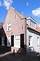
| Location | Baambrugge, Utrecht, Netherlands | ||||
| Street address |
| ||||
| Located on street |
| ||||
| Heritage designation |
| ||||
 | |||||
|
This is a category about rijksmonument number 6997
|
| Address |
|
Media in category "Dorpsstraat 33, Baambrugge"
The following 2 files are in this category, out of 2 total.
-
 Baambrugge - Dorpsstraat 33 RM6997.JPG 3,060 × 4,590; 1.18 MB
-
 Voor-en zijgevel - Baambrugge - 20026675 - RCE.jpg 1,193 × 1,200; 298 KB
