Category:Dorpsstraat 3, Havelte
Jump to navigation
Jump to search
| Object location | | View all coordinates using: OpenStreetMap |
|---|
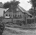
farmhouse in Westerveld, Netherlands  | |||||
| Upload media | |||||
| Instance of | |||||
|---|---|---|---|---|---|
| Location | Havelte, Drenthe, Netherlands | ||||
| Located on street |
| ||||
| Heritage designation |
| ||||
 | |||||
|
This is a category about rijksmonument number 21014
|
| Address |
|
Media in category "Dorpsstraat 3, Havelte"
The following 13 files are in this category, out of 13 total.
-
 Achter- en zijgevel nr. F 44-10 - Havelte - 20472935 - RCE.jpg 1,200 × 900; 114 KB
-
 Boerderij H.62 - Havelte - 20103521 - RCE.jpg 1,200 × 1,192; 419 KB
-
 Deeldeuren achtergevel nr. F 38-33 - Havelte - 20472931 - RCE.jpg 1,200 × 900; 131 KB
-
 Deeldeuren achtergevel nr. F 38-34 - Havelte - 20472932 - RCE.jpg 1,200 × 900; 132 KB
-
 Interieur - Havelte - 20402508 - RCE.jpg 1,200 × 960; 232 KB
-
 Muuranker '1791' nr. F 38-35 - Havelte - 20472933 - RCE.jpg 1,200 × 900; 118 KB
-
 Muuranker in schoorsteen '1779' nr. F 38-36 - Havelte - 20472934 - RCE.jpg 1,200 × 900; 73 KB
-
 Voor- en zijgevel nr. F 37-23 - Havelte - 20472929 - RCE.jpg 1,200 × 900; 156 KB
-
 Voor- en zijgevel nr. F 37-4 - Havelte - 20472928 - RCE.jpg 1,200 × 900; 163 KB
-
 Voor- en zijgevel nr. HV1-A - Havelte - 20472936 - RCE.jpg 1,200 × 900; 117 KB
-
 Voorgevel nr. F 37-22 - Havelte - 20472927 - RCE.jpg 1,200 × 900; 126 KB
-
 Zij- en achtergevel nr. F 38-32 - Havelte - 20472930 - RCE.jpg 1,200 × 900; 115 KB
-
 Zij- en achtergevel nr. HV1-C - Havelte - 20472937 - RCE.jpg 1,200 × 900; 119 KB


