Category:Dorpsstraat 1, Schiedam
Jump to navigation
Jump to search
| Object location | | View all coordinates using: OpenStreetMap |
|---|
 | |||||
| Upload media | |||||
| Instance of |
| ||||
|---|---|---|---|---|---|
| Location | Schiedam, South Holland, Netherlands | ||||
| Street address |
| ||||
| Located on street |
| ||||
| Heritage designation |
| ||||
 | |||||
|
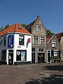
This is a category about rijksmonument number 33291
|
| Address |
|
Media in category "Dorpsstraat 1, Schiedam"
The following 5 files are in this category, out of 5 total.
-
 Achtergevels - Kethel - 20125059 - RCE.jpg 1,200 × 797; 198 KB
-
 Overzicht - Kethel - 20125057 - RCE.jpg 1,200 × 802; 242 KB
-
 Schiedam-Kethel - Dorpsstraat 1.jpg 1,944 × 2,592; 1.32 MB
-
 Schiedam-Kethel - Dorpsstraat 11.jpg 1,944 × 2,592; 1.41 MB
-
 Voorgevels - Kethel - 20125058 - RCE.jpg 1,200 × 805; 201 KB


