Category:Dorndorf-Steudnitz
Jump to navigation
Jump to search
human settlement   | |||||
| Upload media | |||||
| Instance of | |||||
|---|---|---|---|---|---|
| Location | Dornburg-Camburg, Saale-Holzland-Kreis, Thuringia, Germany | ||||
| Area |
| ||||
| official website | |||||
 | |||||
Subcategories
This category has the following 9 subcategories, out of 9 total.
C
- Carl-Alexander-Brücke (14 F)
D
- Dorfkirche Steudnitz (6 F)
- Dornburger Zement (5 F)
F
- Friedhof Dorndorf (3 F)
N
- Naturschutzgebiet Hohe Lehde (20 F)
P
V
- Views of Dornburger Schlösser (28 F)
W
- War memorial Dorndorf (7 F)
Media in category "Dorndorf-Steudnitz"
The following 72 files are in this category, out of 72 total.
-
 06177-Dorndorf-1905-Blick auf Dorndorf-Brück & Sohn Kunstverlag.jpg 1,488 × 1,000; 569 KB
-
 06179-Dorndorf-1905-Blick auf Dorndorf-Brück & Sohn Kunstverlag.jpg 1,491 × 1,000; 648 KB
-
 23099-Dornburg-1925-und Dorndorf-Brück & Sohn Kunstverlag.jpg 1,509 × 1,000; 602 KB
-
 23799-Dornburg-1927-Dornburg und Dorndorf-Brück & Sohn Kunstverlag.jpg 1,585 × 1,000; 679 KB
-
 24670-Dorndorf-1929-Blick auf Dorndorf-Brück & Sohn Kunstverlag.jpg 1,516 × 1,000; 543 KB
-
 Brunnen Dorndorf-Steudnitz.jpg 4,128 × 3,096; 5.08 MB
-
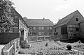
 Building Dorndorf-Steudnitz.jpg 4,128 × 3,096; 5.15 MB
-
 Bürgelsche Straße 2, Dorndorf-Streudnitz.jpg 4,608 × 3,456; 3.36 MB
-
 Dornburg - Saaletal vom Schloßpark.jpg 3,264 × 2,448; 1.11 MB
-
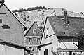
 Dornburg 1998-04-26 01.jpg 696 × 532; 133 KB
-
 Dornburg 1998-04-26 02.jpg 696 × 532; 160 KB
-
 Dornburg 1998-04-26 08.jpg 696 × 532; 126 KB
-
 Dornburg 1998-04-26 09.jpg 696 × 532; 126 KB
-
 Dornburg 1998-04-26 10.jpg 696 × 532; 137 KB
-
 Dornburg 1998-04-26 11.jpg 696 × 532; 125 KB
-
 Dornburg 1998-04-26 12.jpg 696 × 532; 141 KB
-
 Dornburg 1998-04-26 13.jpg 696 × 532; 149 KB
-
 Dornburg 1998-04-26 14.jpg 696 × 532; 126 KB
-
 Dornburg 1998-04-26 15.jpg 696 × 532; 131 KB
-
 Dornburg 1998-04-26 16.jpg 696 × 532; 139 KB
-
 Dornburg 1998-04-26 17.jpg 696 × 532; 159 KB
-
 Dornburg 1998-04-26 18.jpg 696 × 532; 128 KB
-
-
 Dornburg. View from Altes Schloss.jpg 4,770 × 3,178; 4.45 MB
-
 Dornburger Schlösser oberhalb von Dorndorf.JPG 4,000 × 3,000; 2.13 MB
-
 DornburgSaaleBr.JPG 2,864 × 2,144; 1.76 MB
-
 Dorndorf 1998-04-13.jpg 696 × 532; 161 KB
-
 Dorndorf an der Saale.JPG 1,600 × 1,200; 452 KB
-
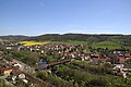
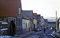
 Dorndorf Dornburg-Camburg.jpg 3,350 × 1,308; 1.29 MB
-
 Dorndorf Fenster.jpg 2,992 × 2,992; 2.9 MB
-
 Dorndorf Saale St. Peter.jpg 600 × 400; 85 KB
-
 Dorndorf-Steudnitz 1988-06-12 01.jpg 1,783 × 1,211; 1.02 MB
-
 Dorndorf-Steudnitz 1988-06-12 02.jpg 1,788 × 1,183; 402 KB
-
 Dorndorf-Steudnitz 1997-05-20.jpg 4,290 × 2,772; 2.67 MB
-
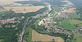 Dorndorf-Steudnitz 2017-07-17.jpg 5,066 × 2,616; 1.74 MB
-
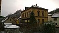
 Ehemalige Schule in Dorndorf-Steudnitz.jpg 2,592 × 1,456; 1.13 MB
-
 Ehemaliges Postamt Dorndorf-Steudnitz 1.jpg 4,128 × 3,096; 4.32 MB
-
 Ehemaliges Postamt Dorndorf-Steudnitz 2.jpg 3,096 × 4,128; 5.12 MB
-
 Ehemaliges Postamt Dorndorf-Steudnitz.jpg 2,592 × 1,456; 975 KB
-
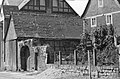
 Freiwillige Feuerwehr Dorndorf-Steudnitz.jpg 4,128 × 3,096; 4.73 MB
-

-
 Panorama of Dornburg. View from Altes Schloss.jpg 11,110 × 4,329; 14.27 MB
-
 Steudnitz 1988-06-18 01.jpg 1,732 × 1,158; 1.04 MB
-
 Steudnitz 1988-06-18 02.jpg 1,690 × 1,113; 1,022 KB
-
 Steudnitz 1988-06-18 03.jpg 1,706 × 1,137; 1.03 MB
-
 Steudnitz 1988-06-18 04.jpg 1,707 × 1,112; 1.07 MB
-
 Steudnitz 1988-06-18 05.jpg 1,720 × 1,142; 1.03 MB
-
 Steudnitz 1988-06-18 06.jpg 1,722 × 1,113; 1.05 MB
-
 Steudnitz 1988-06-18 07.jpg 1,732 × 1,150; 1.21 MB
-
 Steudnitz 1988-06-18 08.jpg 1,134 × 1,728; 1.01 MB
-
 Steudnitz 1988-06-18 09.jpg 1,717 × 1,129; 985 KB
-
 Steudnitz 1988-06-18 10.jpg 1,730 × 1,126; 1,018 KB
-
 Steudnitz 1988-06-18 11.jpg 1,724 × 1,129; 1.2 MB
-
 Steudnitz 1988-06-18 12.jpg 1,704 × 1,117; 1.02 MB
-
 Steudnitz 1988-06-18 13.jpg 1,693 × 1,101; 977 KB
-
 Steudnitz 1997-02-02 01.jpg 2,868 × 4,200; 2.14 MB
-
 Steudnitz 1997-02-02 02.jpg 4,334 × 2,758; 2.14 MB
-
 Steudnitz 1997-05-25 01.jpg 4,392 × 2,850; 2.61 MB
-
 Steudnitz 1997-05-25 02.jpg 4,428 × 2,748; 2.96 MB
-
 Steudnitz 2012-04-22 01.jpg 4,912 × 3,264; 6.74 MB
-
 Steudnitz 2012-04-22 02.jpg 4,912 × 3,264; 7.09 MB
-
 Steudnitz 2012-04-22 03.jpg 4,797 × 3,112; 7.59 MB
-
 Steudnitz 2014-01-12 01.jpg 4,912 × 3,264; 8.08 MB
-
 Steudnitz 2014-01-12 02.jpg 4,912 × 3,264; 9.16 MB
-
 Steudnitz 2014-01-12 03.jpg 4,912 × 3,264; 8.4 MB
-
 Steudnitz 2014-01-12 04.jpg 4,912 × 3,264; 8.18 MB
-
 SteudnitzTal.JPG 2,864 × 2,144; 1.92 MB
-
 Ueber dem Saalberge 22.jpg 1,439 × 683; 640 KB
-
 View on Dorndorf-Streudnitz.jpg 4,608 × 3,456; 3.18 MB
-
 Wappen Dorndorf-Steudnitz.png 320 × 331; 96 KB
-
 War memorial in Steudnitz.jpg 3,456 × 4,608; 3.47 MB
-
 Wichmar 3.jpg 4,032 × 3,024; 5.29 MB


