Category:Dorfkirche Zempow
Jump to navigation
Jump to search
| Object location | | View all coordinates using: OpenStreetMap |
|---|
This is the category of the Brandenburger Baudenkmal (cultural heritage monument) with the ID 09170944 (Wikidata)
|
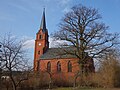
English: Zempow church, Wittstock/Dosse municipality, Ostprignitz-Ruppin district, Brandenburg state, Germany
Deutsch: Kirche in Zempow, Stadt Wittstock/Dosse, Landkreis Ostprignitz-Ruppin, Land Brandenburg, Deutschland
Français : Église de Zempow, ville de Wittstock/Dosse, arrondissement Prignitz-de-l'Est-Ruppin, état fédéral de Brandebourg, Allemagne
| Upload media | |||||
| Instance of | |||||
|---|---|---|---|---|---|
| Location | Zempow, Wittstock/Dosse, Ostprignitz-Ruppin District, Brandenburg, Germany | ||||
| Heritage designation | |||||
 | |||||
Subcategories
This category has only the following subcategory.
I
Media in category "Dorfkirche Zempow"
The following 10 files are in this category, out of 10 total.
-
 20030707100DR Zempow (Wittstock Dosse) Dorfkirche.jpg 1,912 × 2,574; 3.34 MB
-
 Brandenburg - Zempow.jpg 1,575 × 2,362; 3.36 MB
-
 Dorfkirche Zempow 2020.jpg 3,558 × 2,926; 1.9 MB
-
 Dorfkirche Zempow, Kriegerdenkmal.jpg 3,261 × 2,954; 3.66 MB
-
 Zempow church 2016 E.JPG 3,648 × 4,864; 6.55 MB
-
 Zempow church 2016 NE.JPG 4,864 × 3,648; 6.98 MB
-
 Zempow church 2016 NW.JPG 4,864 × 3,648; 5.08 MB
-
 Zempow church 2016 S distant.JPG 4,864 × 3,648; 5.06 MB
-
 Zempow church 2016 S.JPG 4,864 × 3,648; 5.36 MB
-
 Zempow church 2016 SSE.JPG 4,864 × 3,648; 7.29 MB
_Dorfkirche.jpg)


