Category:Dorfkirche Wietstock (Ludwigsfelde)
Jump to navigation
Jump to search
| Object location | | View all coordinates using: OpenStreetMap |
|---|
church building in Teltow-Fläming district, Brandenburg state, Germany  | |||||
| Upload media | |||||
| Instance of | |||||
|---|---|---|---|---|---|
| Location | Wietstock, Ludwigsfelde, Teltow-Fläming District, Brandenburg, Germany | ||||
| Street address |
| ||||
| Architectural style | |||||
| Heritage designation | |||||
| Inception |
| ||||
| Width |
| ||||
| Length |
| ||||
| Area |
| ||||
| Religion or worldview | |||||
 | |||||
This is the category of the Brandenburger Baudenkmal (cultural heritage monument) with the ID 09105550 (Wikidata)
|
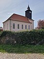
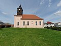
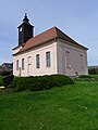
English: Pictures of the church in Wietstock, Ludwigsfelde municipality, Teltow-Fläming district, Brandenburg state, Germany.
Deutsch: Ansichten der Kirche in Wietstock, Stadt Ludwigsfelde , Landkreis Teltow-Fläming , Land Brandenburg , Deutschland.
Français : Photos de l'église à Wietstock, ville de Ludwigsfelde, , arrondissement de Teltow-Fläming , état federé de Brandebourg , Allemagne.
Español: Vistas de la iglesia en Wietstock, ciudad de Ludwigsfelde, distrito de Teltow-Fläming , estado federado de Brandeburgo , Alemania.
Address: Wietstocker Dorfstraße 3, Wietstock, 14974 Ludwigsfelde
Pages in category "Dorfkirche Wietstock (Ludwigsfelde)"
This category contains only the following page.
Media in category "Dorfkirche Wietstock (Ludwigsfelde)"
The following 18 files are in this category, out of 18 total.
-
 Dorfkirche Wietstock (Ludwigsfelde) 2024 E.jpg 2,736 × 3,648; 3.41 MB
-
 Dorfkirche Wietstock (Ludwigsfelde) 2024 NE.jpg 2,905 × 3,873; 1.98 MB
-
 Dorfkirche Wietstock (Ludwigsfelde) 2024 Panorama SE.jpg 2,736 × 3,648; 3.25 MB
-
 Dorfkirche Wietstock (Ludwigsfelde) 2024 Panorama SW.jpg 3,648 × 2,736; 3.39 MB
-
 Dorfkirche Wietstock (Ludwigsfelde) 2024 S.jpg 4,608 × 3,456; 4.44 MB
-
 Dorfkirche Wietstock (Ludwigsfelde) 2024 SE.jpg 2,736 × 3,648; 3.54 MB
-
 Dorfkirche Wietstock (Ludwigsfelde) 2024 Südfenster.jpg 2,736 × 3,648; 2.96 MB
-
 Dorfkirche Wietstock (Ludwigsfelde) 2024 Turm.jpg 2,736 × 3,648; 3.29 MB
-
 Dorfkirche Wietstock (Ludwigsfelde) 2024 Turmhaube.jpg 2,736 × 3,648; 3.04 MB
-
 Dorfkirche Wietstock (Ludwigsfelde) 2024 vermauertes Portal.jpg 3,648 × 2,736; 3.34 MB
-
 Dorfkirche Wietstock (Ludwigsfelde) 2024 Westportal.jpg 2,566 × 3,421; 1.54 MB
-
 Dorfkirche Wietstock (Ludwigsfelde) Grabstein an der Südseite.jpg 2,664 × 4,000; 4.92 MB
-
 Dorfkirche Wietstock (Ludwigsfelde) Ostseite.jpg 4,000 × 2,664; 5.91 MB
-
 Dorfkirche Wietstock (Ludwigsfelde) Südostseite.jpg 4,000 × 2,664; 6.05 MB
-
 Dorfkirche Wietstock (Ludwigsfelde) Südwestseite.jpg 4,000 × 2,664; 6.42 MB
-
 Dorfkirche Wietstock - Deutschland - panoramio.jpg 2,592 × 1,944; 1.66 MB
-
 Ludwigsfelde Wietstock Kirche.jpg 3,872 × 2,592; 347 KB
-
 Wietstock church.JPG 541 × 614; 239 KB
_2024_E.jpg)
_2024_NE.jpg)
_2024_Panorama_SE.jpg)
_2024_Panorama_SW.jpg)
_2024_S.jpg)
_2024_SE.jpg)
_2024_S%C3%BCdfenster.jpg)
_2024_Turm.jpg)
_2024_Turmhaube.jpg)
_2024_vermauertes_Portal.jpg)
_2024_Westportal.jpg)
_Grabstein_an_der_S%C3%BCdseite.jpg)
_Ostseite.jpg)
_S%C3%BCdostseite.jpg)
_S%C3%BCdwestseite.jpg)

