Category:Dorfkirche Steinhöfel
Jump to navigation
Jump to search
| Object location | | View all coordinates using: OpenStreetMap |
|---|
church building in Brandenburg, Germany  | |||||
| Upload media | |||||
| Instance of | |||||
|---|---|---|---|---|---|
| Location | Steinhöfel, Oder-Spree District, Brandenburg, Germany | ||||
| Heritage designation | |||||
 | |||||
This is the category of the Brandenburger Baudenkmal (cultural heritage monument) with the ID 09115315 (Wikidata)
|
Media in category "Dorfkirche Steinhöfel"
The following 22 files are in this category, out of 22 total.
-
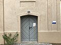
 Dorfkirche Steinhöfel Chor Südansicht.jpg 3,024 × 4,032; 2.61 MB
-
 Dorfkirche Steinhöfel Kirchenschiff und Patronatsloge Südseite.jpg 3,024 × 3,024; 2.07 MB
-
 Dorfkirche Steinhöfel Ostansicht.jpg 3,024 × 4,032; 3.02 MB
-
 Dorfkirche Steinhöfel Patronatsloge Südportal.jpg 4,032 × 3,024; 2.54 MB
-
 Dorfkirche Steinhöfel Südansicht.jpg 3,024 × 3,024; 2.5 MB
-
 Dorfkirche Steinhöfel Südostansicht.jpg 3,024 × 4,032; 3.47 MB
-
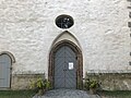 Dorfkirche Steinhöfel Westportal.jpg 4,032 × 3,024; 2.72 MB
-
 Dorfkirche Steinhöfel Westturm Glockengeschoss.jpg 3,024 × 4,032; 2.13 MB
-
 Dorfkirche Steinhöfel Westturm Nordostansicht.jpg 3,024 × 4,032; 2.51 MB
-
 Dorfkirche Steinhöfel Westturm Nordwestansicht.jpg 3,024 × 4,032; 2.88 MB
-
 Kirche Steinhöfel.jpg 3,872 × 2,592; 7.28 MB
-
 Steinhöfel - Dorfkirche - panoramio.jpg 480 × 640; 75 KB
-
 Steinhöfel - Kirche 14-07-2010 50.jpg 1,728 × 2,304; 2.97 MB
-
 Steinhöfel - Kirche 14-07-2010 51.jpg 2,304 × 1,728; 2.49 MB
-
 Steinhöfel - Kirche 14-07-2010 52.jpg 1,728 × 2,304; 2.2 MB
-
 Steinhöfel - Kirche 14-07-2010 57.jpg 1,728 × 2,304; 2.11 MB
-
 Steinhöfel - Kirche 14-07-2010 63.jpg 2,304 × 1,728; 1.73 MB
-
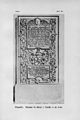
 Steinhöfel Epitaph für Balthasar Dieloff von Wulffen in der Kirche Lebus Tafel 30.jpg 4,194 × 6,271; 15.97 MB
-
 Steinhöfel Epitaph für Balthasar Dieloff von Wulffen in der Kirche.jpg 3,003 × 4,252; 7.61 MB
-
 Steinhöfel Grabstein für Adolph von Wulffen in der Kirche Lebus Tafel 31.jpg 4,194 × 6,271; 15.34 MB
-
 Steinhöfel Grabstein für Adolph von Wulffen in der Kirche.jpg 2,657 × 4,663; 6.57 MB
-
 Steinhöfel Kirche.jpg 3,872 × 2,592; 1.61 MB


