Category:Dorfkirche Stapel
Jump to navigation
Jump to search
| Object location | | View all coordinates using: OpenStreetMap |
|---|
 | |||||
| Upload media | |||||
| Instance of | |||||
|---|---|---|---|---|---|
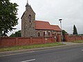
| Location | Stapel (Altmärkische Höhe), Lückstedt, Stendal District, Saxony-Anhalt, Germany | ||||
| Heritage designation | |||||
 | |||||
This is the category of the Saxony-Anhalt Kulturdenkmal (cultural heritage monument) with the ID 09436447 (Wikidata)
|
Media in category "Dorfkirche Stapel"
This category contains only the following file.
-
 Kirche Stapel.jpg 4,896 × 3,672; 5.54 MB