Category:Dorfkirche Siethen
Jump to navigation
Jump to search
| Object location | | View all coordinates using: OpenStreetMap |
|---|
church building in Ludwigsfelde, Landkreis Teltow-Fläming, Brandenburg, Germany  | |||||
| Upload media | |||||
| Instance of | |||||
|---|---|---|---|---|---|
| Location | Siethen, Ludwigsfelde, Teltow-Fläming District, Brandenburg, Germany | ||||
| Street address |
| ||||
| Architectural style | |||||
| Heritage designation | |||||
| Inception |
| ||||
| Width |
| ||||
| Length |
| ||||
| Area |
| ||||
| Religion or worldview | |||||
 | |||||
This is the category of the Brandenburger Baudenkmal (cultural heritage monument) with the ID 09105507 (Wikidata)
|
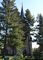
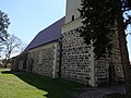
English: Pictures of the church in Siethen, Ludwigsfelde municipality, Teltow-Fläming district, Brandenburg state, Germany.
Deutsch: Ansichten der Kirche in Siethen, Stadt Ludwigsfelde , Landkreis Teltow-Fläming , Land Brandenburg , Deutschland.
Français : Photos de l'église à Siethen, ville de Ludwigsfelde, , arrondissement de Teltow-Fläming , état federé de Brandebourg , Allemagne.
Español: Vistas de la iglesia en Siethen, ciudad de Ludwigsfelde, distrito de Teltow-Fläming , estado federado de Brandeburgo , Alemania.
Address: Siethener Dorfstraße 6, 14974 Ludwigsfelde
Subcategories
This category has only the following subcategory.
I
Pages in category "Dorfkirche Siethen"
This category contains only the following page.
Media in category "Dorfkirche Siethen"
The following 21 files are in this category, out of 21 total.
-
 Dorfkirche Siethen - Deutschland - panoramio.jpg 2,592 × 1,944; 2.13 MB
-
 Dorfkirche Siethen 2019 Nordportal.jpg 4,731 × 3,504; 3.05 MB
-
 Dorfkirche Siethen 2019 NW.jpg 3,304 × 4,622; 6.1 MB
-
 Dorfkirche Siethen 2019 Panorama SE.jpg 4,864 × 3,648; 5.26 MB
-
 Dorfkirche Siethen 2019 S.jpg 4,500 × 4,676; 8.37 MB
-
 Dorfkirche Siethen 2019 SE.jpg 4,220 × 4,580; 6.78 MB
-
 Dorfkirche Siethen 2019 SW.jpg 4,826 × 3,598; 6.78 MB
-
 Dorfkirche Siethen 2019 Turmhaube.jpg 3,648 × 4,864; 4.01 MB
-
 Dorfkirche Siethen 2019 Westportal.jpg 3,648 × 4,864; 6.63 MB
-
 Dorfkirche Siethen Nordostansicht.jpg 2,592 × 1,944; 2.82 MB
-
 Dorfkirche Siethen Nordwestansicht.jpg 2,592 × 1,944; 1.82 MB
-
 Dorfkirche Siethen Ostansicht.jpg 1,944 × 2,592; 2.48 MB
-
 Dorfkirche Siethen Südansicht mit Einfriedung.jpg 2,592 × 1,944; 2.82 MB
-
 Dorfkirche Siethen Südansicht.jpg 2,592 × 1,944; 2.79 MB
-
 Dorfkirche Siethen Westturm Nordportal.jpg 1,944 × 2,592; 2.12 MB
-
 Dorfkirche Siethen Westturm Südansicht.jpg 1,944 × 2,592; 2.03 MB
-
 Dorfkirche Siethen Westturm.jpg 1,944 × 2,592; 2.19 MB
-
 Ludwigsfelde Siethen Ortsmitte asv2023-11 img3.jpg 4,840 × 4,840; 10.17 MB
-
 Ludwigsfelde Siethen Ortsmitte asv2023-11 img4.jpg 4,010 × 6,015; 14.84 MB
-
 Ludwigsfelde Siethen Ortsmitte asv2023-11 img5.jpg 6,712 × 4,475; 14.95 MB
-
 Siethen2 Brandenburg.JPG 720 × 540; 81 KB


