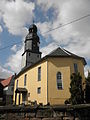
Category:Dorfkirche Seitenroda
Jump to navigation
Jump to search
| Object location | | View all coordinates using: OpenStreetMap |
|---|
church building in Germany  | |||||
| Upload media | |||||
| Instance of | |||||
|---|---|---|---|---|---|
| Location |
| ||||
| Heritage designation | |||||
 | |||||
Media in category "Dorfkirche Seitenroda"
The following 2 files are in this category, out of 2 total.
-
 Leuchtenburg (Thüringen), Blick vom Bergfried zur Dorfkirche Seitenroda.jpg 5,060 × 3,449; 4.83 MB
-
 Seitenroda Kirche.JPG 2,976 × 3,968; 5.11 MB
,_Blick_vom_Bergfried_zur_Dorfkirche_Seitenroda.jpg)