Category:Dorfkirche Schäpe
Jump to navigation
Jump to search
| Object location | | View all coordinates using: OpenStreetMap |
|---|
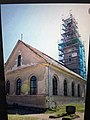
church building in Schäpe near Beelitz, Brandenburg .jpg) .jpg) | |||||
| Upload media | |||||
| Instance of | |||||
|---|---|---|---|---|---|
| Location | Beelitz, Potsdam-Mittelmark District, Brandenburg, Germany | ||||
| Heritage designation | |||||
| Inception |
| ||||
 | |||||
This is the category of the Brandenburger Baudenkmal (cultural heritage monument) with the ID 09191000 (Wikidata)
|
Subcategories
This category has only the following subcategory.
I
- Interior of Dorfkirche Schäpe (30 F)
Media in category "Dorfkirche Schäpe"
The following 58 files are in this category, out of 58 total.
-
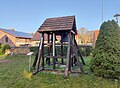
 Dorfkirche Schäpe freistehender Glockenturm.JPG 2,592 × 1,944; 1.71 MB
-
 Dorfkirche Schäpe historische Ansicht (cropped).JPG 587 × 905; 275 KB
-
 Dorfkirche Schäpe historische Ansicht.JPG 664 × 1,730; 524 KB
-
 Dorfkirche Schäpe Kirchenschiff Südseite Detail.JPG 2,592 × 1,944; 1.94 MB
-
 Dorfkirche Schäpe Kirchenschiff Südseite.JPG 2,592 × 1,944; 1.74 MB
-
 Dorfkirche Schäpe Nordwestansicht.JPG 2,592 × 1,944; 1.76 MB
-
 Dorfkirche Schäpe Ostseite.JPG 1,944 × 2,592; 1.98 MB
-
 Dorfkirche Schäpe Südwestansicht Hochformat.JPG 1,944 × 2,592; 1.61 MB
-
 Dorfkirche Schäpe Südwestansicht.JPG 2,592 × 1,944; 1.58 MB
-
 Dorfkirche Schäpe Westturm.JPG 1,944 × 2,592; 1.34 MB
-
 Dorfkirche Schäpe Übergang Turm Kirchenschiff.JPG 2,592 × 1,944; 1.62 MB
-
 Schäpe, Dorfkirche (07).jpg 1,983 × 2,612; 1.13 MB
-
 Schäpe, Dorfkirche (08).jpg 3,152 × 3,584; 1.74 MB
-
 Schäpe, Dorfkirche (13).jpg 4,127 × 5,505; 3.92 MB
-
 Schäpe, Dorfkirche (15).jpg 3,939 × 4,604; 2.35 MB
-
 Schäpe, Dorfkirche (16).jpg 6,016 × 4,753; 5.93 MB
-
 Schäpe, Dorfkirche (17).jpg 3,656 × 4,471; 3.11 MB
-
 Schäpe, Dorfkirche (18).jpg 2,077 × 4,537; 1.63 MB
-
 Schäpe, Dorfkirche (19).jpg 8,000 × 4,556; 7.17 MB
-
 Schäpe, Dorfkirche (20).jpg 8,000 × 4,963; 7.69 MB
-
 Schäpe, Dorfkirche (21).jpg 7,224 × 4,716; 6.16 MB
-
 Schäpe, Dorfkirche (22).jpg 5,000 × 4,301; 4.22 MB
-
 Schäpe, Dorfkirche (23).jpg 7,886 × 2,910; 2.4 MB
-
 Schäpe, Dorfkirche (24).jpg 5,424 × 6,475; 4.67 MB
-
 Schäpe, Dorfkirche (25).jpg 4,795 × 5,850; 3.47 MB
-
 Schäpe, Dorfkirche (26).jpg 5,828 × 5,665; 4.7 MB
-
 Schäpe, Dorfkirche (27).jpg 5,782 × 5,548; 3.91 MB
-
 Schäpe, Dorfkirche (28).jpg 5,457 × 7,732; 6.22 MB
-
 Schäpe, Dorfkirche (29).jpg 4,771 × 6,384; 5.6 MB
-
 Schäpe, Dorfkirche (30).jpg 7,587 × 5,586; 8.38 MB
-
 Schäpe, Dorfkirche (31).jpg 5,645 × 7,722; 6.97 MB
-
 Schäpe, Dorfkirche (32).jpg 5,706 × 8,000; 9.87 MB
-
 Schäpe, Dorfkirche (33).jpg 5,941 × 5,230; 5.48 MB
-
 Schäpe, Dorfkirche (34).jpg 3,711 × 4,289; 2.21 MB
-
 Schäpe, Dorfkirche (35).jpg 5,214 × 4,681; 6.43 MB
-
 Schäpe, Dorfkirche (36).jpg 3,619 × 4,729; 3.02 MB
-
 Schäpe, Dorfkirche (37).jpg 6,016 × 7,544; 9.9 MB
-
 Schäpe, Dorfkirche (38).jpg 6,016 × 4,123; 4.67 MB
-
 Schäpe, Dorfkirche (39).jpg 8,000 × 4,586; 8.45 MB
-
 Schäpe, Dorfkirche (40).jpg 1,557 × 2,563; 803 KB
-
 Schäpe, Dorfkirche (56).jpg 5,211 × 7,198; 4.01 MB
-
 Schäpe, Dorfkirche (57).jpg 2,655 × 3,964; 1.34 MB
-
 Schäpe, Dorfkirche (59).jpg 2,726 × 3,639; 1.3 MB
-
 Schäpe, Dorfkirche (60).jpg 3,864 × 2,925; 2.49 MB
-
 Schäpe, Dorfkirche (61).jpg 3,024 × 4,032; 2.53 MB
-
 Schäpe, Dorfkirche (63).jpg 3,022 × 3,894; 4.51 MB
-
 Schäpe, Dorfkirche (64).jpg 1,058 × 793; 174 KB
-
 Schäpe, Dorfkirche (65).jpg 1,200 × 1,600; 291 KB
-
 Schäpe, Dorfkirche (66).jpg 2,343 × 3,487; 683 KB
-
 Schäpe, Dorfkirche (67).jpg 2,151 × 2,867; 945 KB
-
 Schäpe, Dorfkirche (68).jpg 2,885 × 4,029; 1.07 MB
-
 Schäpe, Dorfkirche (69).jpg 2,241 × 3,045; 1.26 MB
-
 Schäpe, Dorfkirche (72).jpg 3,024 × 4,032; 3.29 MB
-
 Schäpe, Dorfkirche (73).jpg 3,024 × 4,032; 4.01 MB
-
 Schäpe, Dorfkirche (74).jpg 4,031 × 2,978; 5.64 MB
-
 SchäpeKirche (retouched) (cropped).jpg 1,440 × 1,948; 481 KB
-
 SchäpeKirche (retouched).jpg 2,976 × 1,984; 569 KB
-
 SchäpeKirche.jpg 2,976 × 1,984; 2.07 MB

.JPG)


.jpg)
.jpg)
.jpg)
.jpg)
.jpg)
.jpg)
.jpg)
.jpg)
.jpg)
.jpg)
.jpg)
.jpg)
.jpg)
.jpg)
.jpg)
.jpg)
.jpg)
.jpg)
.jpg)
.jpg)
.jpg)
.jpg)
.jpg)
.jpg)
.jpg)
.jpg)
.jpg)
.jpg)
.jpg)
.jpg)
.jpg)
.jpg)
.jpg)
.jpg)
.jpg)
.jpg)
.jpg)
.jpg)
.jpg)
.jpg)
.jpg)
.jpg)
_(cropped).jpg)
.jpg)

.jpg)