Category:Dorfkirche Ruhlsdorf (Teltow)
Jump to navigation
Jump to search
| Object location | | View all coordinates using: OpenStreetMap |
|---|
church building in Teltow, Brandenburg state, Germany  _Dorfkirche_Patronatsloge.JPG)  | |||||
| Upload media | |||||
| Instance of | |||||
|---|---|---|---|---|---|
| Made from material | |||||
| Location | Ruhlsdorf (Teltow), Teltow, Potsdam-Mittelmark District, Brandenburg, Germany | ||||
| Heritage designation | |||||
 | |||||
This is the category of the Brandenburger Baudenkmal (cultural heritage monument) with the ID 09190426 (Wikidata)
|
Deutsch: Bilder der Kirche in Ruhlsdorf, Stadt Teltow, Landkreis Potsdam-Mittelmark, Land Brandenburg, Deutschland.
English: Pictures of the church in Ruhlsdorf, Teltow municipality, Potsdam-Mittelmark district, Brandenburg state, Germany
Français : Photos de l'église à Ruhlsdorf, ville de Teltow, arrondissement de Potsdam-Mittelmark, état fédéral de Brandebourg, Allemagne
Subcategories
This category has only the following subcategory.
Media in category "Dorfkirche Ruhlsdorf (Teltow)"
The following 17 files are in this category, out of 17 total.
-
 Dorfkirche Ruhlsdorf (Teltow) 2018 N.jpg 4,292 × 4,515; 8.76 MB
-
 Dorfkirche Ruhlsdorf (Teltow) 2018 Nordportal.jpg 3,646 × 4,862; 5.28 MB
-
 Dorfkirche Ruhlsdorf (Teltow) 2018 Vermauertes Nordportal.jpg 3,648 × 4,864; 7.32 MB
-
 Dorfkirche Ruhlsdorf (Teltow) 2018 Westportal.jpg 3,648 × 4,864; 5.29 MB
-
 Ruhlsdorf (Teltow) Dorfkirche Eingang zur Patronatsloge.JPG 1,200 × 1,600; 647 KB
-
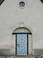
 Ruhlsdorf (Teltow) Dorfkirche Eingangsportal.JPG 1,200 × 1,600; 863 KB
-
 Ruhlsdorf (Teltow) Dorfkirche Geläut.JPG 1,600 × 1,200; 867 KB
-
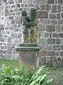 Ruhlsdorf (Teltow) Dorfkirche Grabmal Boettger.jpg 1,200 × 1,600; 1.21 MB
-
 Ruhlsdorf (Teltow) Dorfkirche Ostgiebel.JPG 1,200 × 1,600; 1.21 MB
-
 Ruhlsdorf (Teltow) Dorfkirche Panoramablick vom Kirchturm.jpg 3,663 × 1,092; 451 KB
-
 Ruhlsdorf (Teltow) Dorfkirche Turm.JPG 1,200 × 1,600; 692 KB
-
 Ruhlsdorf (Teltow) Dorfkirche.JPG 1,600 × 1,200; 1.19 MB
-
 Ruhlsdorf - Dorfkirche - geo.hlipp.de - 35329.jpg 480 × 640; 157 KB
-
 Ruhlsdorf Dorfkirche.jpg 1,920 × 2,560; 727 KB
-
 Teltow Dorfkirche lub 2023-05-10 img01 Ruhlsdorf.jpg 4,032 × 3,024; 7.43 MB
-
 Teltow Dorfkirche lub 2023-05-10 img02 Ruhlsdorf.jpg 3,024 × 4,032; 10.02 MB
-
 Teltow Dorfkirche lub 2023-05-10 img03 Ruhlsdorf.jpg 3,024 × 4,032; 6.18 MB
_2018_N.jpg)
_2018_Nordportal.jpg)
_2018_Vermauertes_Nordportal.jpg)
_2018_Westportal.jpg)
_Dorfkirche_Eingang_zur_Patronatsloge.JPG)
_Dorfkirche_Eingangsportal.JPG)
_Dorfkirche_Gel%C3%A4ut.JPG)
_Dorfkirche_Grabmal_Boettger.jpg)
_Dorfkirche_Ostgiebel.JPG)
_Dorfkirche_Turm.JPG)
_Dorfkirche.JPG)


_Dorfkirche_Panoramablick_vom_Kirchturm.jpg)