Category:Dorfkirche Rosenhagen
Jump to navigation
Jump to search
| Object location | | View all coordinates using: OpenStreetMap |
|---|
 | |||||
| Upload media | |||||
| Instance of | |||||
|---|---|---|---|---|---|
| Location | Rosenhagen, Perleberg, Prignitz District, Brandenburg, Germany | ||||
| Heritage designation | |||||
 | |||||
This is the category of the Brandenburger Baudenkmal (cultural heritage monument) with the ID 09160436 (Wikidata)
|
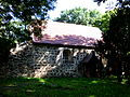
English: Church in Rosenhagen, Perleberg municipality, Prignitz district, Brandenburg state, Germany
Français : Église de Rosenhagen, ville de Perleberg, arrondissement Prignitz, état fédéral de Brandebourg, Allemagne
Media in category "Dorfkirche Rosenhagen"
The following 19 files are in this category, out of 19 total.
-
 Kirche rosenhagen 1.JPG 3,000 × 4,000; 4.14 MB
-
 Kirche rosenhagen 3.JPG 3,000 × 4,000; 4.27 MB
-
 Kirche rosenhagen 4.JPG 4,000 × 3,000; 4.46 MB
-
 Kirche rosenhagen 5.JPG 4,000 × 3,000; 4.46 MB
-
 Kirche rosenhagen 6.JPG 3,000 × 4,000; 3.91 MB
-
 Kirche rosenhagen 7.JPG 4,000 × 3,000; 4.45 MB
-
 Kirche rosenhagen 8.JPG 4,000 × 3,000; 4.31 MB
-
 Kirche rosenhagen 9.JPG 3,000 × 4,000; 3.96 MB
-
 Rosenhagen446Kirche v S.JPG 4,000 × 3,000; 4.73 MB
-
 Rosenhagen447Kirche Westportal.JPG 3,000 × 4,000; 4.63 MB
-
 Rosenhagen448Kirche Westgiebel v SW.JPG 3,000 × 4,000; 4.67 MB
-
 Rosenhagen449Kirche Südseite v SW.JPG 4,000 × 3,000; 4.93 MB
-
 Rosenhagen450Kirchenschiff Nordseite.JPG 2,000 × 1,500; 2.65 MB
-
 Rosenhagen452Kirche v N.JPG 4,000 × 3,000; 5.13 MB
-
 Rosenhagen453nördliche Kirchenfenster.JPG 2,000 × 1,500; 2.41 MB
-
 Rosenhagen454Chorgiebel v ONO.jpg 3,000 × 4,000; 5.03 MB
-
 Rosenhagen455Chorgiebel v O.JPG 3,000 × 4,000; 5.02 MB
-
 Rosenhagen456Kirche v SO.JPG 4,000 × 3,000; 4.76 MB
-
 Rosenhagen457Kirche nah v SO.JPG 4,000 × 3,000; 4.58 MB


